Warm, windy day ahead before cold front sweeps through
Seasonal temperatures return to end the workweek
Go Deeper.
Create an account or log in to save stories.
Like this?
Thanks for liking this story! We have added it to a list of your favorite stories.


Gusty winds and mild temperatures are in place for Wednesday, but a cold front will arrive with spotty precipitation. Seasonal temperatures return to close out the workweek, before a muggy, mild and stormy pattern sets up for the weekend.
Warm, breezy Wednesday
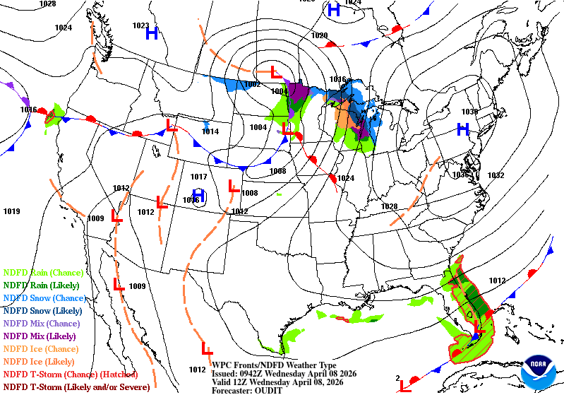
Winds will be the biggest factor in Wednesday’s forecast. An approaching cold front from the Dakotas will bring warmer, southerly winds ahead of it, before shifting to northerly winds and slightly cooler temperatures by Wednesday afternoon.
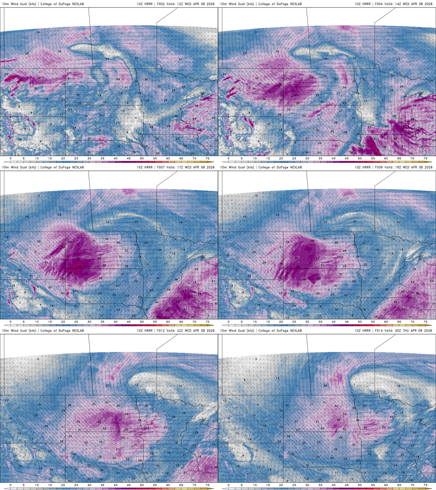
A wind advisory goes into effect from 10 a.m. to 4 p.m. Wednesday for southeastern Minnesota, where wind gusts over 45 mph are expected.

Aside from the wind, Wednesday brings a couple of chances for light rain and a wintry mix. Early Wednesday morning, light snow and some freezing rain are possible across northwest and northeast Minnesota.
Turn Up Your Support
MPR News helps you turn down the noise and build shared understanding. Turn up your support for this public resource and keep trusted journalism accessible to all.
A second round of precipitation may develop as a cold front moves east through western and central Minnesota. Most areas will stay dry, but the best chance for any measurable rainfall will be mainly north of the I-94 corridor.
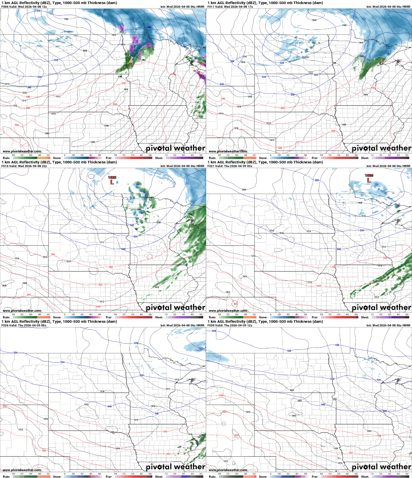
The Canadian border could see light snow accumulation of a few inches by early Thursday morning.

Wednesday will be the warmest day of the week, with 50s and 60s ahead of the front. Northern Minnesota stays cooler in the 40s with limited warming before the cold front moves through.

Northerly winds behind the front will keep Thursday and Friday closer to seasonal temperatures. By Friday, high pressure will bring lighter winds and plenty of sunshine, providing a bright and pleasant end to the workweek.
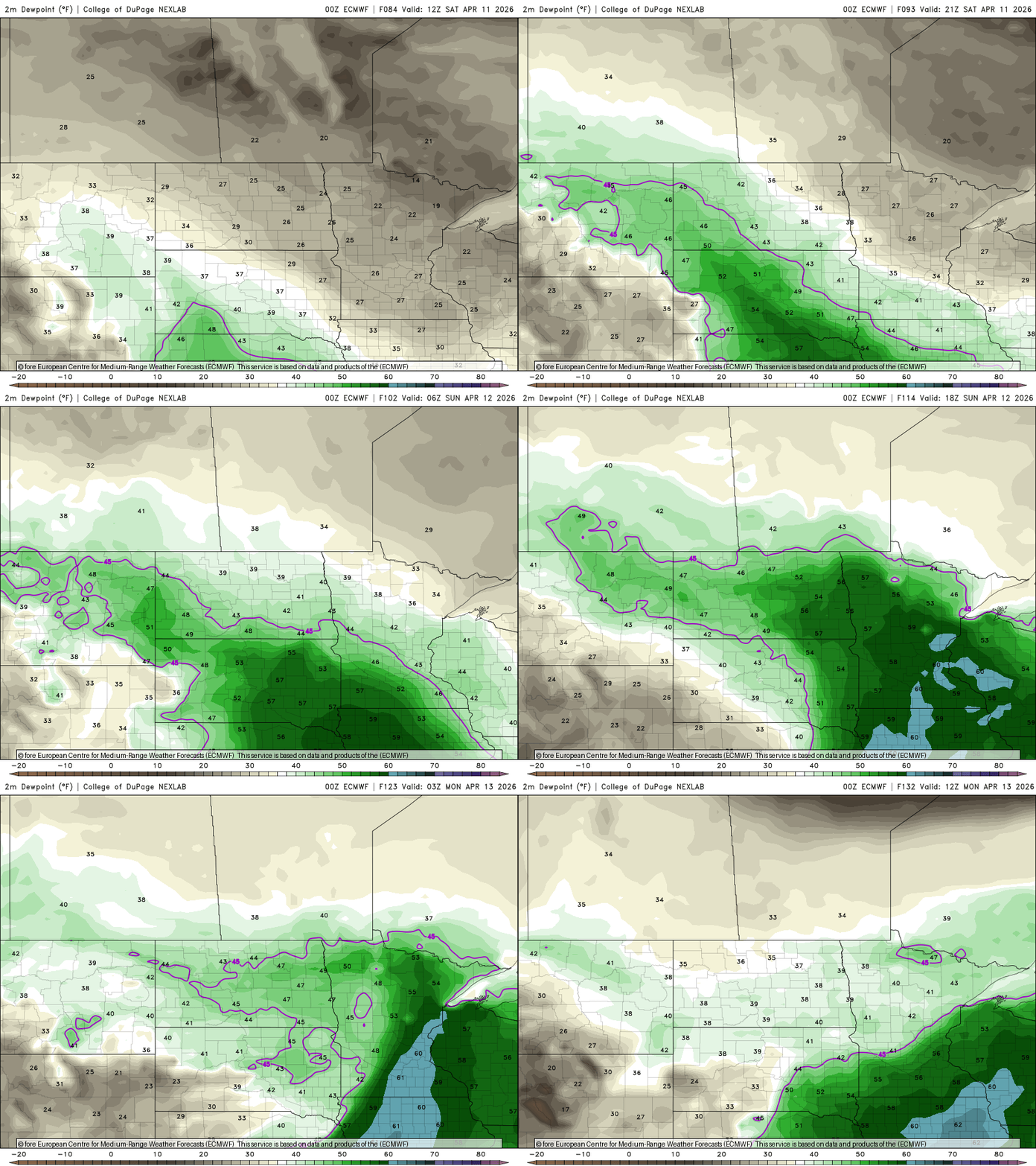
A warm, humid and stormy pattern is setting up for the weekend. Dewpoints will surge into the 60s as ample moisture streams in from the Gulf, increasing the potential for heavier and more widespread rain showers. While the exact timing is still uncertain, the first half of Saturday currently looks dry.