
Clouds, rain move in; stormy pattern ahead
Drier Sunday with summer-like warmth

Go Deeper.
Create an account or log in to save stories.
Like this?
Thanks for liking this story! We have added it to a list of your favorite stories.


Rain showers and overcast skies are expected Saturday, followed by a humid, warm and increasingly stormy pattern that could bring chances for severe weather across the state.
Scattered showers and slightly cooler temperatures
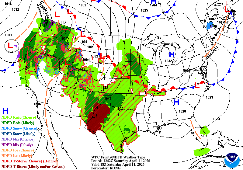
High pressure will move east into the Great Lakes as a warm front lifts north, bringing expanding rain showers into the area from the southwest on Saturday.
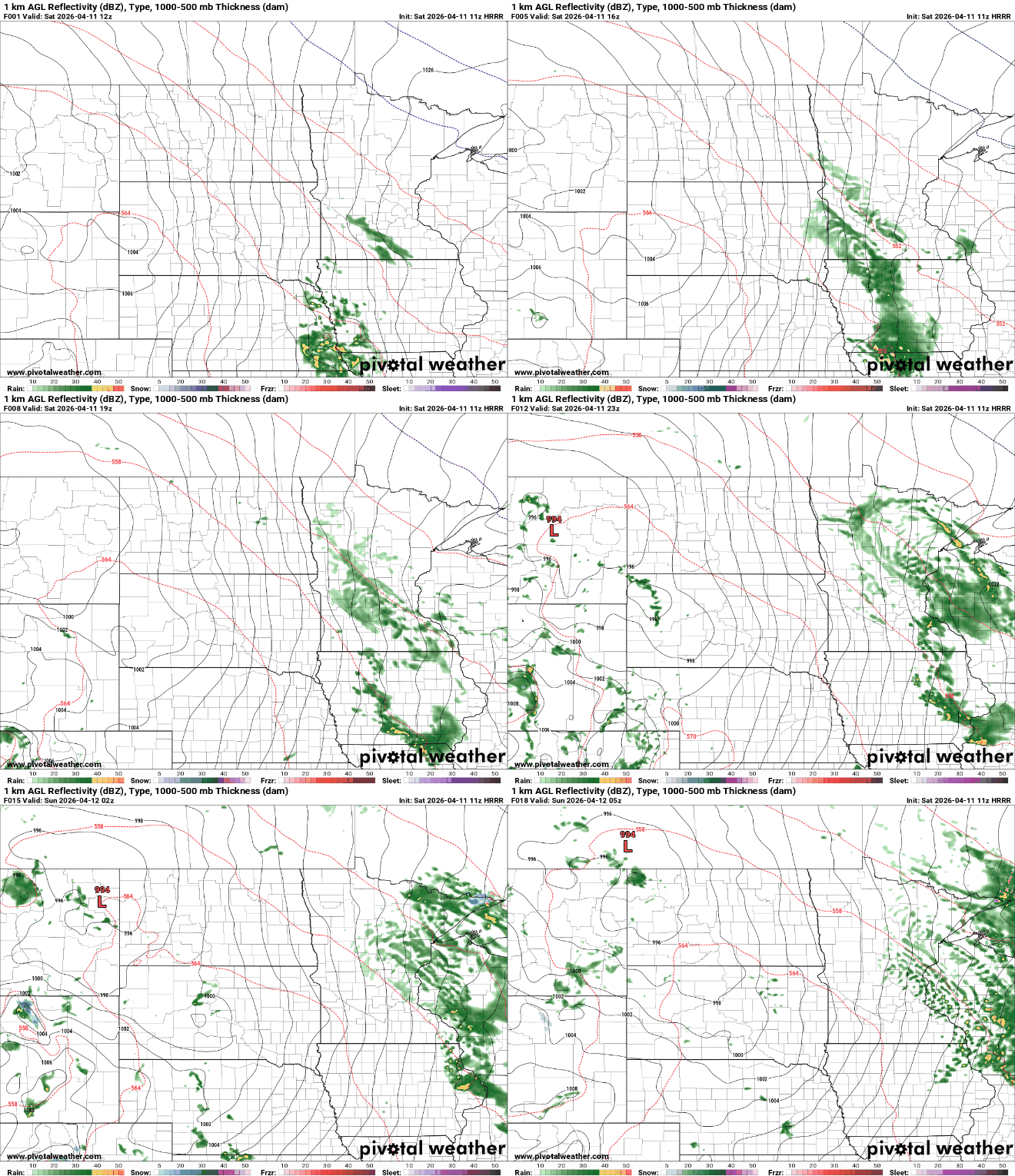
Rainfall rates will increase late in the afternoon into the early evening, with areas in eastern Minnesota and into Wisconsin receiving more than a quarter inch of rain.
Temperatures will warm to slightly below seasonal levels, reaching the upper 40s to low 50s across the state.
Turn Up Your Support
MPR News helps you turn down the noise and build shared understanding. Turn up your support for this public resource and keep trusted journalism accessible to all.

Rain will taper off overnight as the system moves east, but areas of drizzle and fog are likely to develop as temperatures and humidity increase.
Sunday is shaping up to be warmer, with improving conditions. Rain should end in Minnesota by early morning and exit western Wisconsin by early afternoon. Depending on how quickly skies clear, temperatures could climb into the lower 80s. If clouds linger, highs may remain in the 70s.

Dew points in the upper 50s to low 60s will surge north, bringing increasingly humid conditions to southern Minnesota from Sunday into Monday. We’ll see our first 60-degree dew point readings of the year.
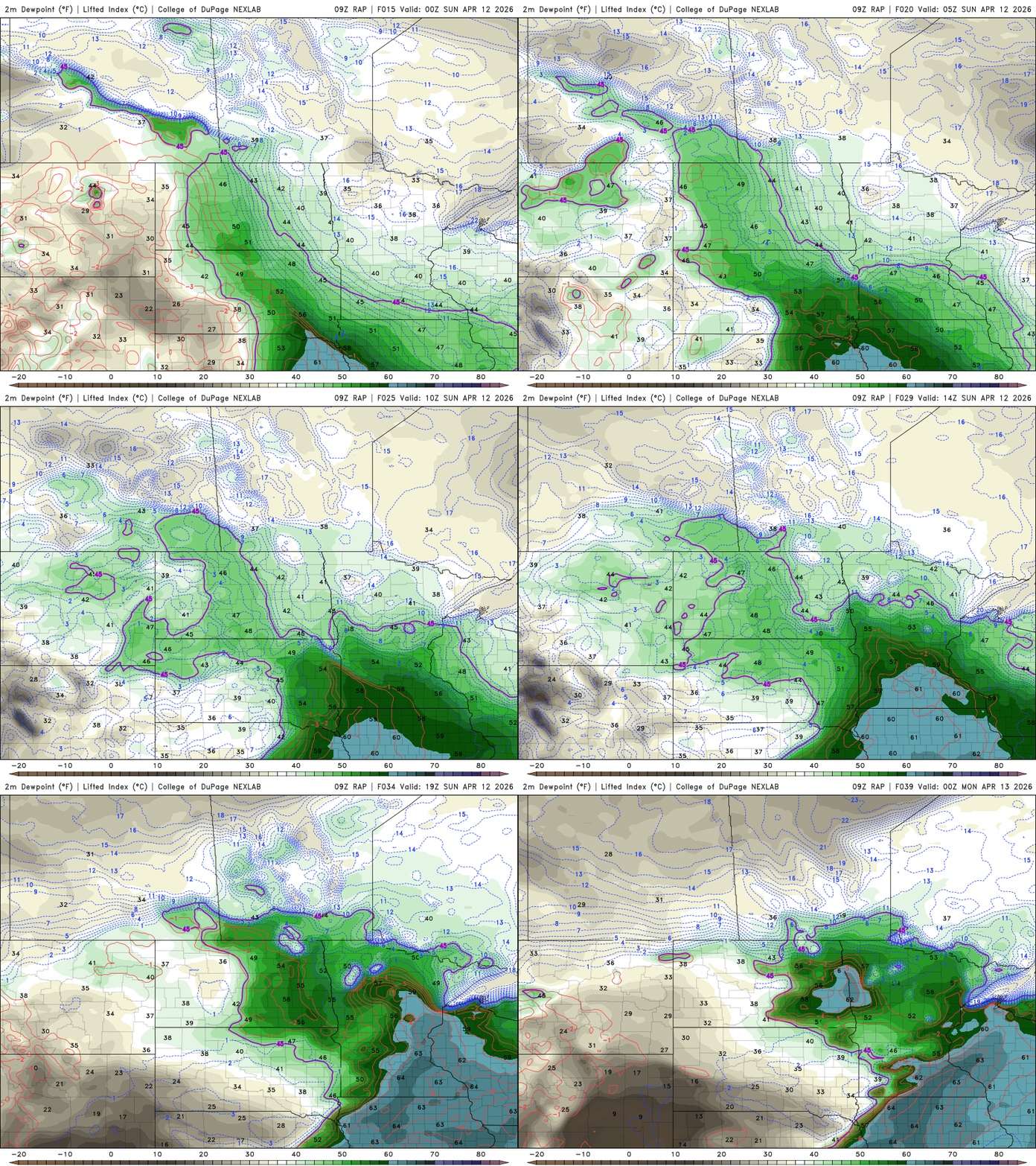
The increase in moisture will help fuel stronger thunderstorms Monday and Tuesday.
The Storm Prediction Center has issued a slight risk, or level 2 out of 5, for southern Minnesota, including the Twin Cities metro area, on Monday. All types of severe weather are possible, including large hail, damaging winds and isolated tornadoes.

Storms could develop as early as Monday afternoon into the early evening, and will be something to keep an eye on. Next week also marks the start of severe weather awareness week.
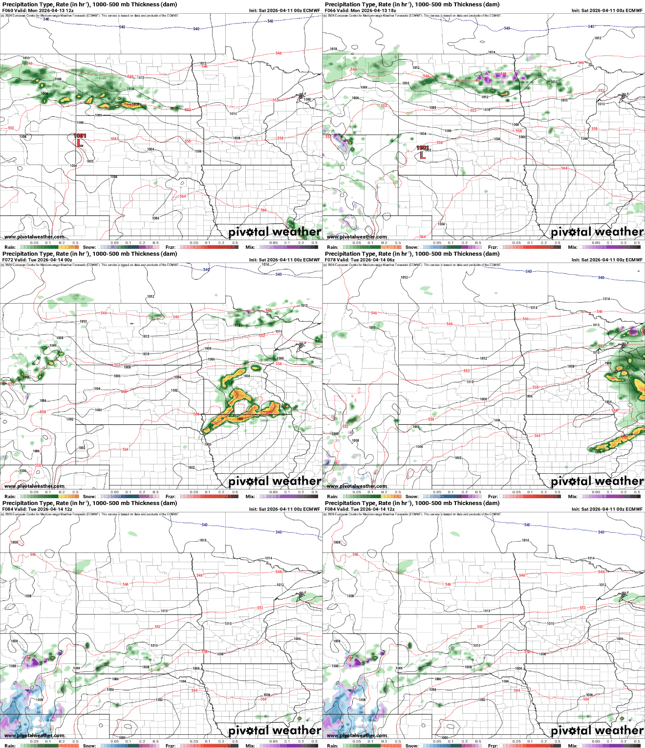
Tuesday’s forecast remains less certain, but another round of strong to severe storms is possible, especially in southern Minnesota, as a low-pressure system moves through the region.

