
Active weather week ahead: Severe storms possible Monday afternoon
Threats include very large hail, damaging winds and isolated tornadoes

Go Deeper.
Create an account or log in to save stories.
Like this?
Thanks for liking this story! We have added it to a list of your favorite stories.


The atmosphere is setting the stage for strong to severe thunderstorms Monday afternoon and evening, with the highest risk south of a line from Redwood Falls through the Twin Cities to Eau Claire, Wis.
Active weather week ahead: Severe storms possible Monday afternoon and evening
If you’re in southern Minnesota or western Wisconsin, Monday is a day to stay weather-aware. The Storm Prediction Center has highlighted an area from Redwood Falls east through the Twin Cities and Eau Claire, Wis., including areas south, with an enhanced risk (level 3 out of 5). This means the atmosphere has all the ingredients in place for what could become a volatile weather day.
Timing of the storms
Storms are expected to develop between 3 and 6 p.m. and continue into the evening hours. The most intense activity will likely occur within a 2–3 hour window after storms first form, so things could escalate quickly.
Turn Up Your Support
MPR News helps you turn down the noise and build shared understanding. Turn up your support for this public resource and keep trusted journalism accessible to all.

The main threats include large hail, potentially as big as tennis balls or even baseballs, along with damaging wind gusts and a few tornadoes.

Early storms may remain more isolated as supercells, but as the evening progresses, storms may merge into clusters and shift the primary threat toward strong winds.
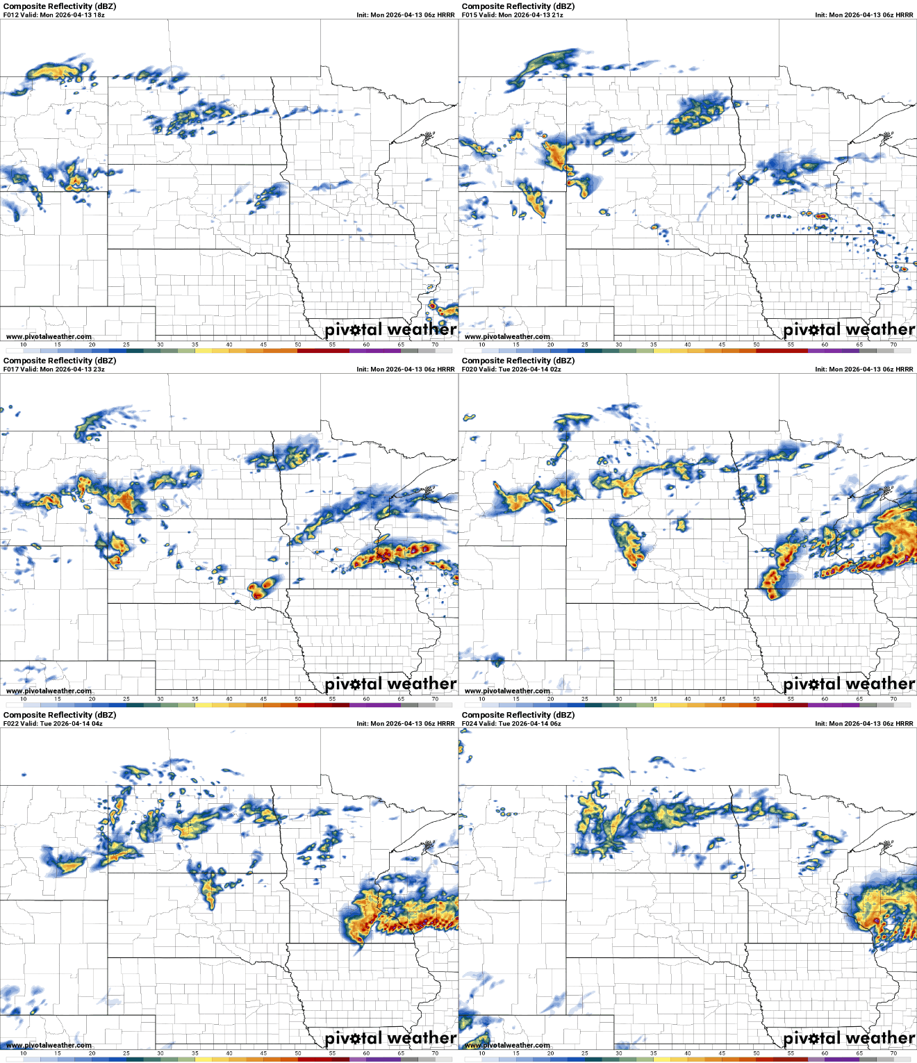
Temperatures and dew points will surge northward with the advancing warm front. Highs will climb into the mid to upper 70s across southern areas, while cooler 50s and 60s linger north of the boundary.

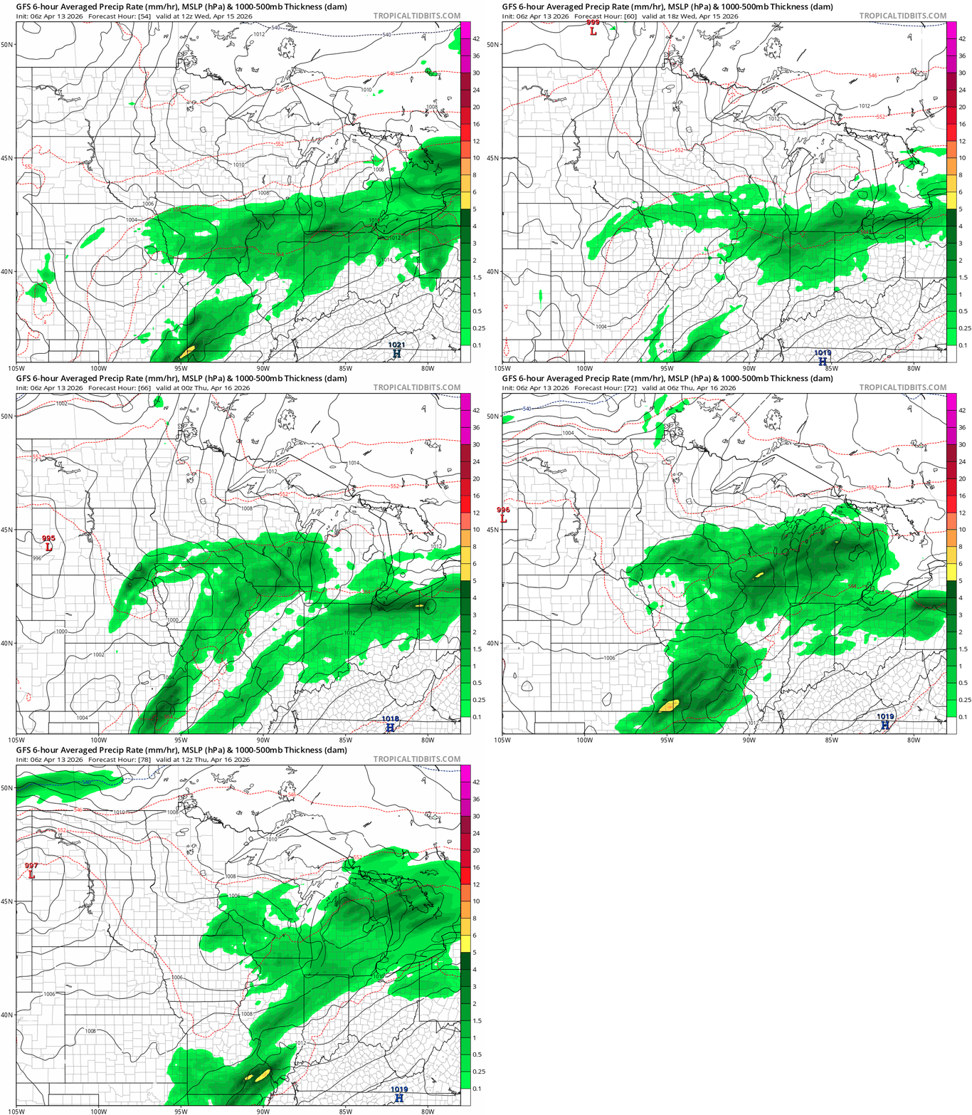
Conditions quiet down on Tuesday with dry weather expected locally while storms develop farther to the southeast. However, the break will be brief. Another system will bring chances for showers and thunderstorms back to the region Wednesday afternoon and evening, especially across southern and eastern Minnesota into Wisconsin.
Looking ahead to Friday, another round of strong to severe storms is possible. A warm and humid air mass will build ahead of a strong cold front, and thunderstorms are expected to develop during the afternoon.
Severe weather awareness week
Severe Weather Awareness Week begins Monday, and we’re starting with one of the most important topics: alerts and warnings.

It is important to know the difference between a watch and a warning when it comes to severe weather. A watch is issued when conditions are favorable for tornadoes, severe thunderstorms or flash floods. If you're in a watch area, you can continue with normal activities, but it's important to stay alert and make plans to seek shelter if necessary.
Warnings are issued when severe weather has been reported or is imminent. Warnings are issued by county and city names, so it's important to know the name of the county you live in or are visiting and the surrounding cities.
Tacos are a great way to explain the difference between a watch and a warning. A watch means we have all the ingredients ready to make tacos, while a warning means we’re eating tacos right now!


