
Above-normal temperatures Thursday with red flag warnings west
We’ll see showers and storms Friday as a cold front moves through

Go Deeper.
Create an account or log in to save stories.
Like this?
Thanks for liking this story! We have added it to a list of your favorite stories.


Temperatures will be 20 to 25 degrees above normal Thursday. A cold front will bring scattered showers Friday followed by much colder air for the weekend.
Warm Thursday with most highs in the 70s, but a cold front sweeps through Friday
Very warm air is back again Thursday. We’ll see sun for most and highs in the 70s across most of the state except the North Shore and northwestern Minnesota. Southwestern Minnesota will see low 80s. Those readings are 20 to 25 degrees warmer than normal.

Warm, dry and windy weather could create critical fire weather conditions Thursday afternoon in western Minnesota. A red flag warning is in effect there midday Thursday through the evening.
A potent cold front sweeps through Friday, dropping temperatures in western Minnesota. Our highest readings in the Twin Cities and eastern Minnesota will likely be midday before falling in the afternoon and evening hours.
Turn Up Your Support
MPR News helps you turn down the noise and build shared understanding. Turn up your support for this public resource and keep trusted journalism accessible to all.
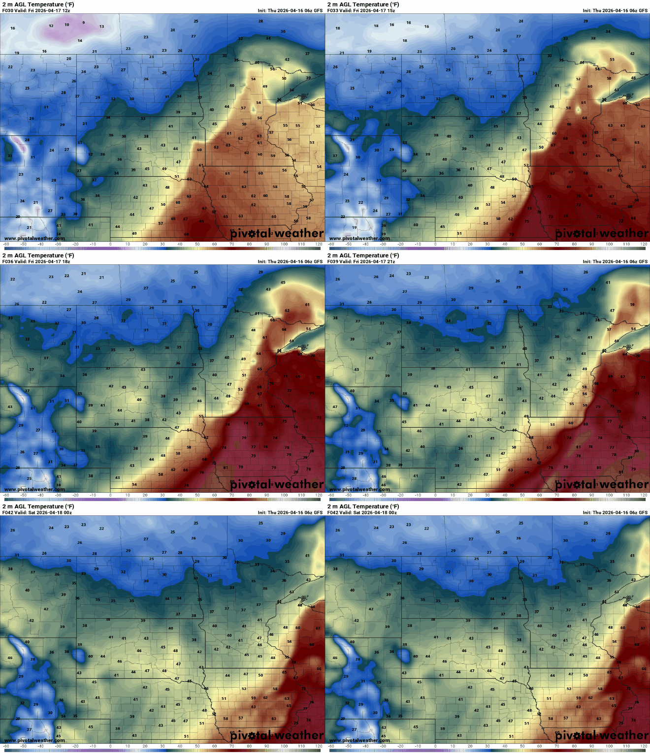
That front will also touch off scattered showers and some thunderstorms as it moves through. Northwestern Minnesota could even see a wintry mix of light freezing rain and snow showers while most will see rain showers and even some thunder in southern Minnesota midday Friday into the afternoon.
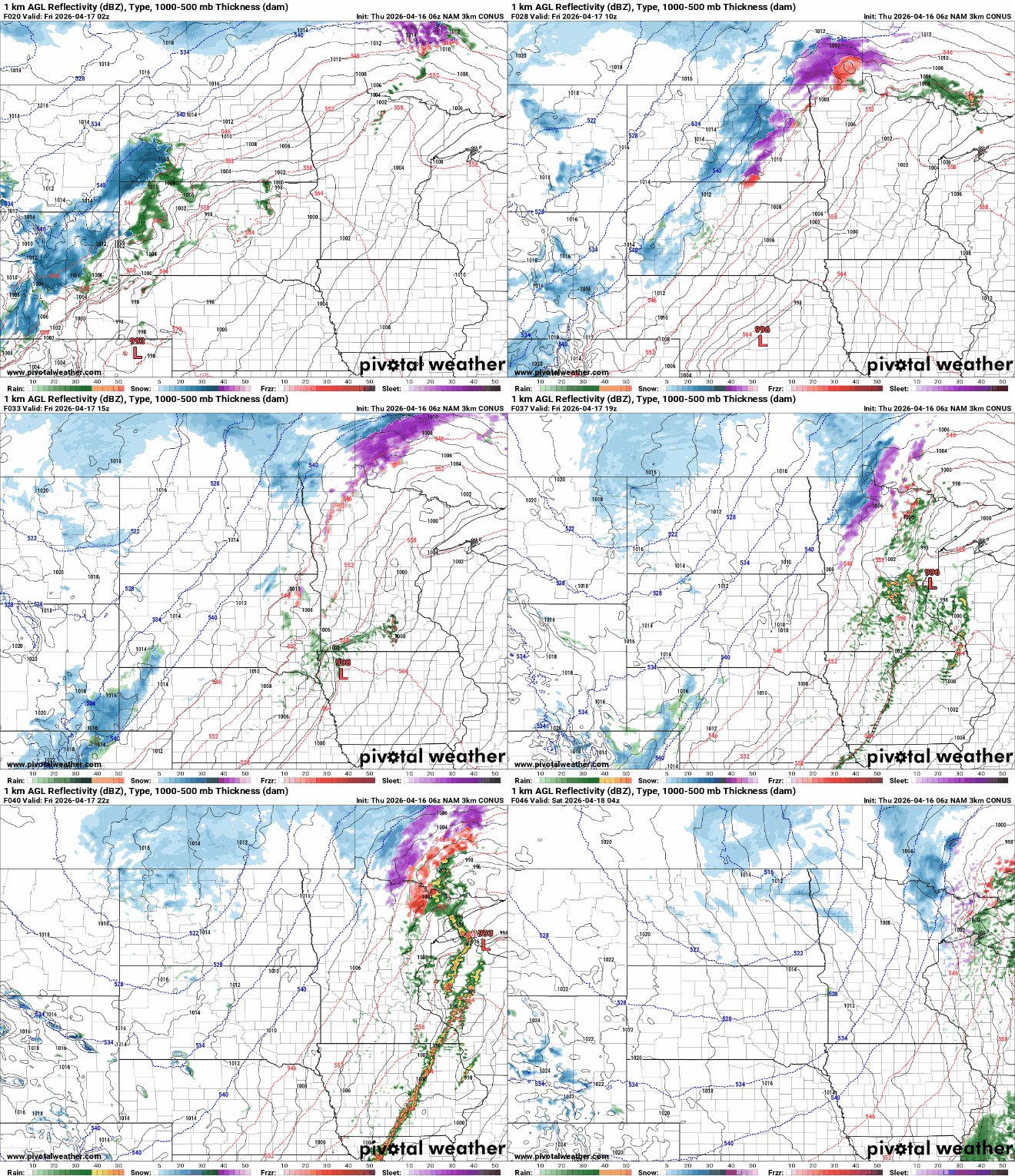
There could be strong storms with even a couple of isolated severe storms Friday midday and afternoon ahead of the cold front. There’s a slight risk (level 2 of 5) of severe storms across southeast Minnesota into western Wisconsin.

There could also be a fresh coating of snow for some in far northern Minnesota Friday into Friday night.

It’ll be quite a bit colder for the weekend, especially Saturday. Highs Saturday will be mostly in the 40s and 30s while Sunday will be slightly warmer, mostly in the 50s and 40s.

Warmer temperatures return next week with 60s and 70s in southern Minnesota. The pattern remains pretty quiet until perhaps late next week when a storm system may move into the region.

