
Chilly, breezy start to the weekend; warmer weather ahead next week
Northwest winds at 10-20 mph

Go Deeper.
Create an account or log in to save stories.
Like this?
Thanks for liking this story! We have added it to a list of your favorite stories.


A chilly air mass settles in behind Friday’s strong cold front, bringing breezy conditions and below-average temperatures through the weekend.
Chilly, breezy weekend ahead
High temperatures this weekend will struggle to climb into the 40s as a colder air mass settles across the Upper Midwest. On Saturday, highs will reach only the low 30s in northern areas, with low to mid-40s across central portions. The Twin Cities metro will top out in the mid-40s—about 10 degrees below the average high for mid-April.
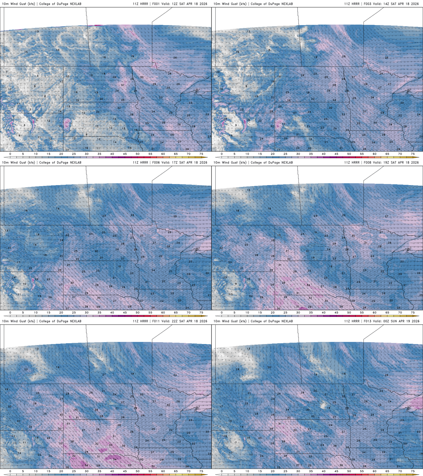
Gusty northwest winds, developing as high pressure builds in from the west, will make for breezy conditions on Saturday. Wind gusts could reach or exceed 30 mph, especially across western Minnesota.
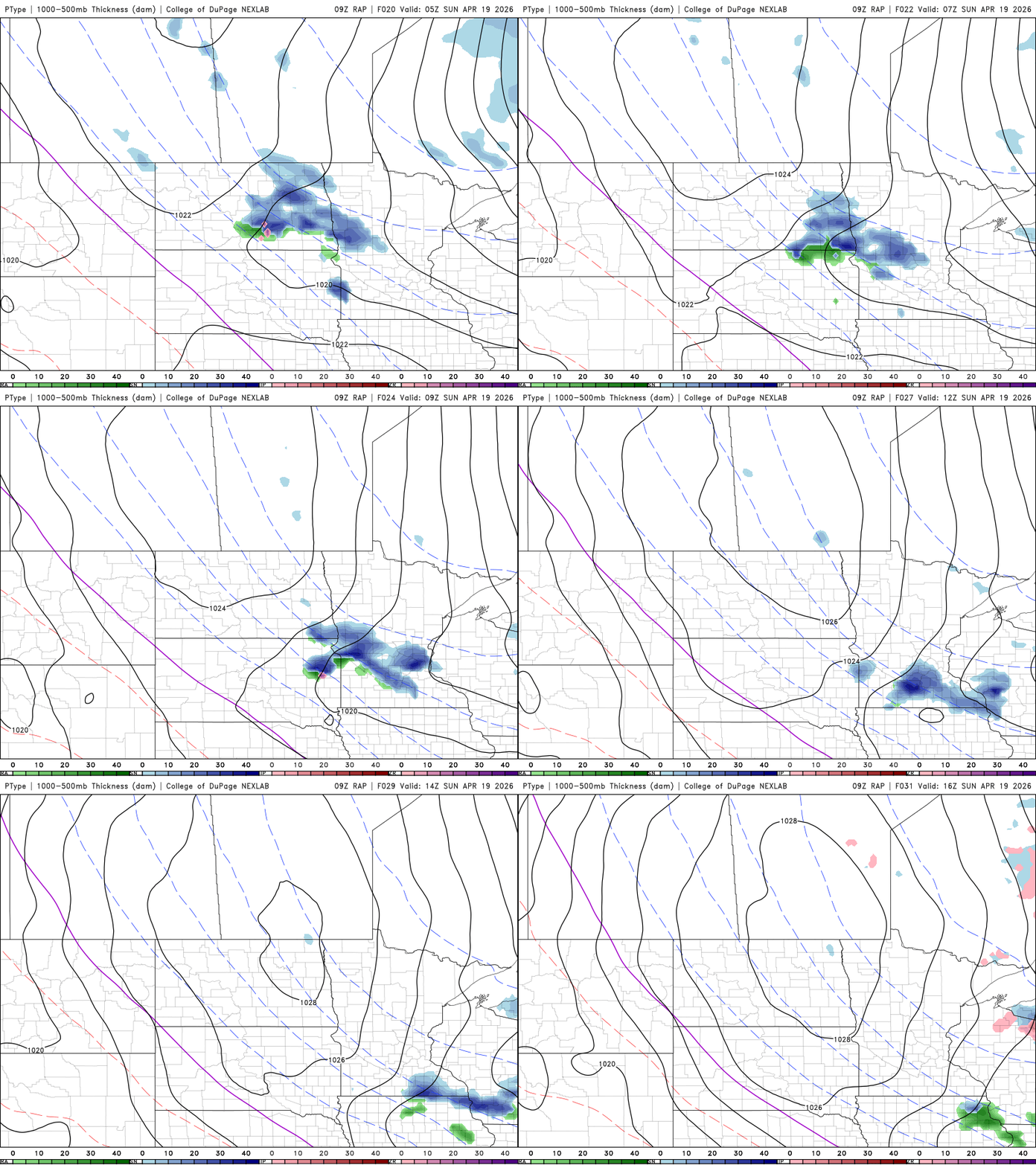
Late Saturday night into early Sunday morning, a weak disturbance could bring a few brief snow showers to central and southern areas. However, no accumulation is expected due to relatively warm ground temperatures and dry air in place.
Saturday night lows will fall below freezing statewide, with some areas dropping into the upper teens to mid-20s.

The cold air will linger into Sunday, with highs in the 30s and 40s and lighter winds compared to Saturday. After the chilly start to the weekend, a significant warm-up is on the way. Temperatures rebound into the 60s and 70s by Tuesday, along with a stretch of dry weather.
We’re also seeing continued improvement in drought conditions. The latest drought monitor update shows severe drought has been eliminated from the southwestern corner of the state, although just over half the state remains in some level of drought.

Turn Up Your Support
MPR News helps you turn down the noise and build shared understanding. Turn up your support for this public resource and keep trusted journalism accessible to all.

