
Snowflakes possible Saturday night, followed by a chilly Sunday
Big warmup ahead midweek

Go Deeper.
Create an account or log in to save stories.
Like this?
Thanks for liking this story! We have added it to a list of your favorite stories.


After a raw mid-April day, parts of Minnesota could see a quick hit of light snow before a dramatic warm-up arrives next week.
Light snow chances followed by another chilly day
High pressure moving in brought gusty winds Saturday, but those winds will ease into Saturday night as another chilly night sets in, with lows dropping below freezing statewide.

A quick-moving weather disturbance sliding southeast out of Canada could bring a brief round of light snow late Saturday night into early Sunday morning. The best chance for seeing flakes will be along and south of Interstate 94.
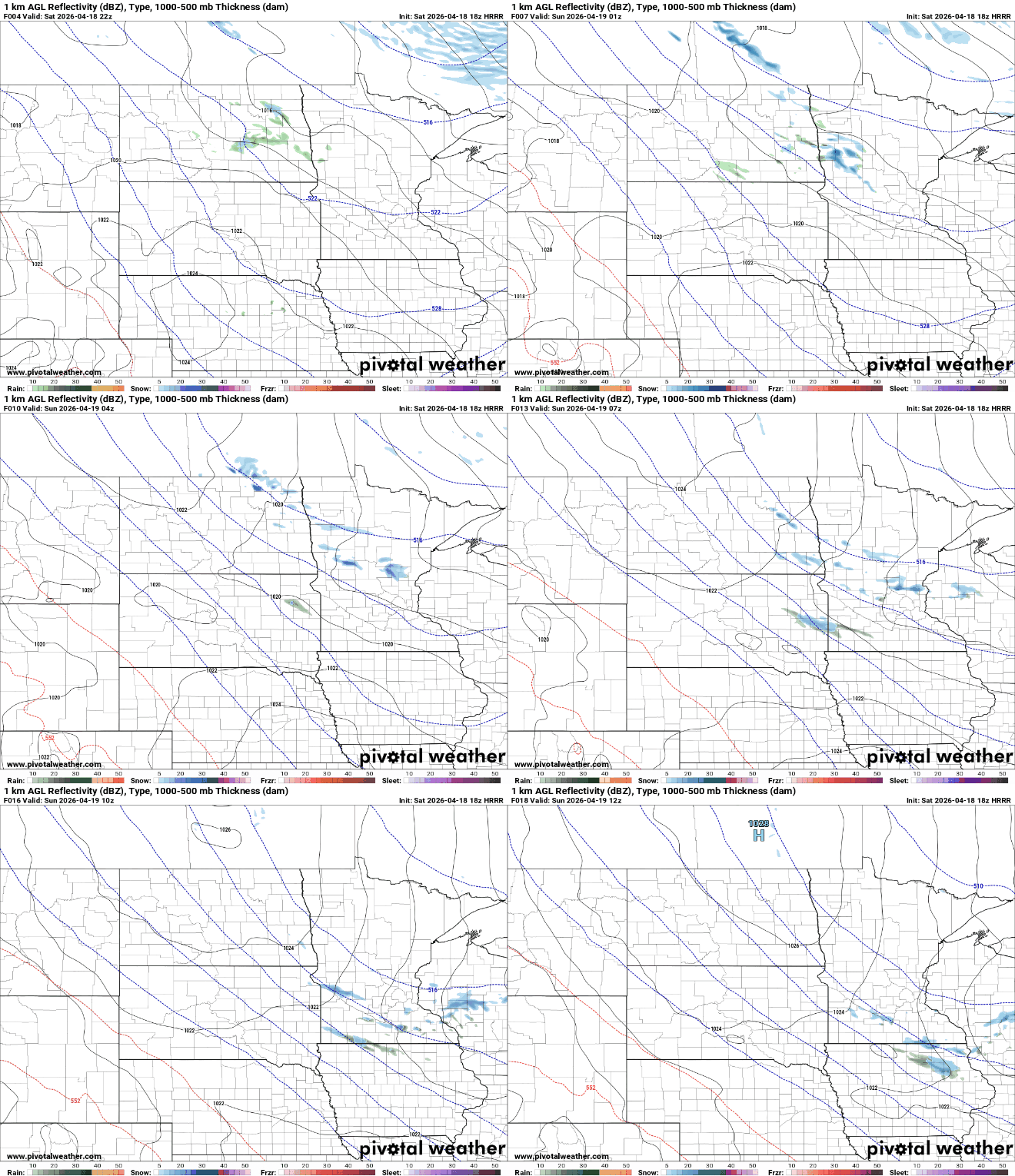
Cool conditions will stick around through Sunday, but a major shift is on the way as we head into the new workweek.

Temperatures will rebound sharply starting Monday, climbing well above seasonal averages. By Wednesday, highs are expected to range from the upper 60s in northern areas to the mid-80s across western Minnesota.

Storm chances return late in the week as the warm stretch peaks Wednesday into Thursday before a cold front moves in. That front will bring increasing cloud cover, cooler temperatures, and the next chance for rain.
Turn Up Your Support
MPR News helps you turn down the noise and build shared understanding. Turn up your support for this public resource and keep trusted journalism accessible to all.

