
Warm, windy start to week raises fire risk
Storm chances return late week

Go Deeper.
Create an account or log in to save stories.
Like this?
Thanks for liking this story! We have added it to a list of your favorite stories.


After a cold weekend, a quick surge of warmth and wind will elevate fire risk across western and central Minnesota on Monday. Summerlike temperatures arrive by midweek before storm chances return to the region later in the week.
Chilly night, fire weather concerns Monday
High pressure moving south out of Canada will bring clear skies and light winds Sunday evening.
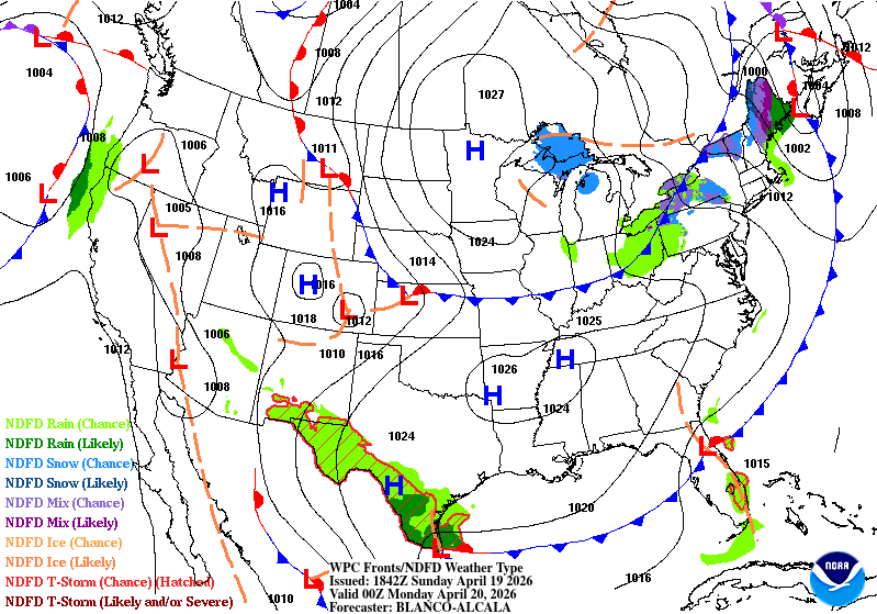
Overnight lows will drop below freezing across the state, with upper teens to low 20s expected in northern Minnesota.

Temperatures will climb 15 to 20 degrees Monday as breezy southerly winds boost highs into the upper 60s out west and the 40s and 50s in eastern Minnesota.

Dry, warm conditions will bring an elevated fire weather threat to much of western and central Minnesota on Monday. The National Weather Service has issued a fire weather watch for the region.
...FIRE WEATHER WATCH IN EFFECT FROM MONDAY MORNING THROUGH MONDAY EVENING... The National Weather Service in the Twin Cities has issued a Fire Weather Watch. * AFFECTED AREA...Much of central and western Minnesota. * TIMING...From Monday morning through Monday evening. * WINDS...South winds 10 to 20 mph with gusts up to 30 mph. * RELATIVE HUMIDITY...Around 20 percent. * IMPACTS...Any fires that develop will spread rapidly. Outdoor burning is not recommended.
Tuesday and Wednesday will feature quiet conditions with sunshine and a warming trend. Highs will reach the 60s and 70s Tuesday, with 80s returning Wednesday.
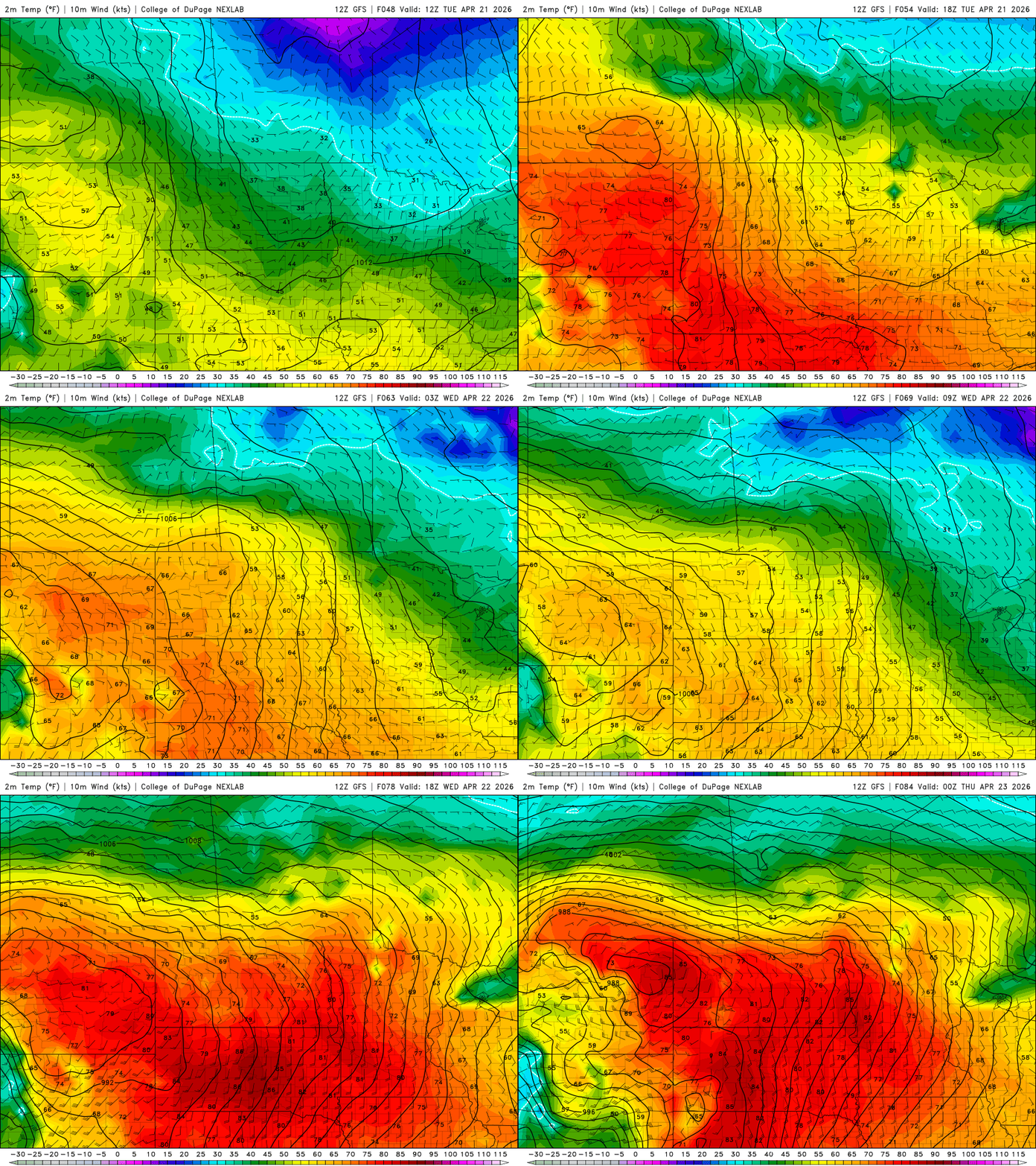
Attention then turns to Thursday, when a low pressure system is expected to track from North Dakota into northern Minnesota. Its cold front will sweep across the state, bringing the best chances for showers and thunderstorms to eastern Minnesota and western Wisconsin. Some of these storms could be strong to severe.
Turn Up Your Support
MPR News helps you turn down the noise and build shared understanding. Turn up your support for this public resource and keep trusted journalism accessible to all.

