
Critical fire danger and summerlike warmth for midweek
Storm chances return Thursday

Go Deeper.
Create an account or log in to save stories.
Like this?
Thanks for liking this story! We have added it to a list of your favorite stories.


A red flag warning is in effect across parts of Minnesota Monday night as critical fire weather conditions continue, with an unseasonably warm stretch peaking midweek before storm chances return Thursday.
Critical fire weather Monday night
A combination of dry air, warm temperatures and gusty winds is creating critical fire weather conditions across much of Minnesota. A red flag warning remains in effect until 8 p.m. for the highlighted areas below.
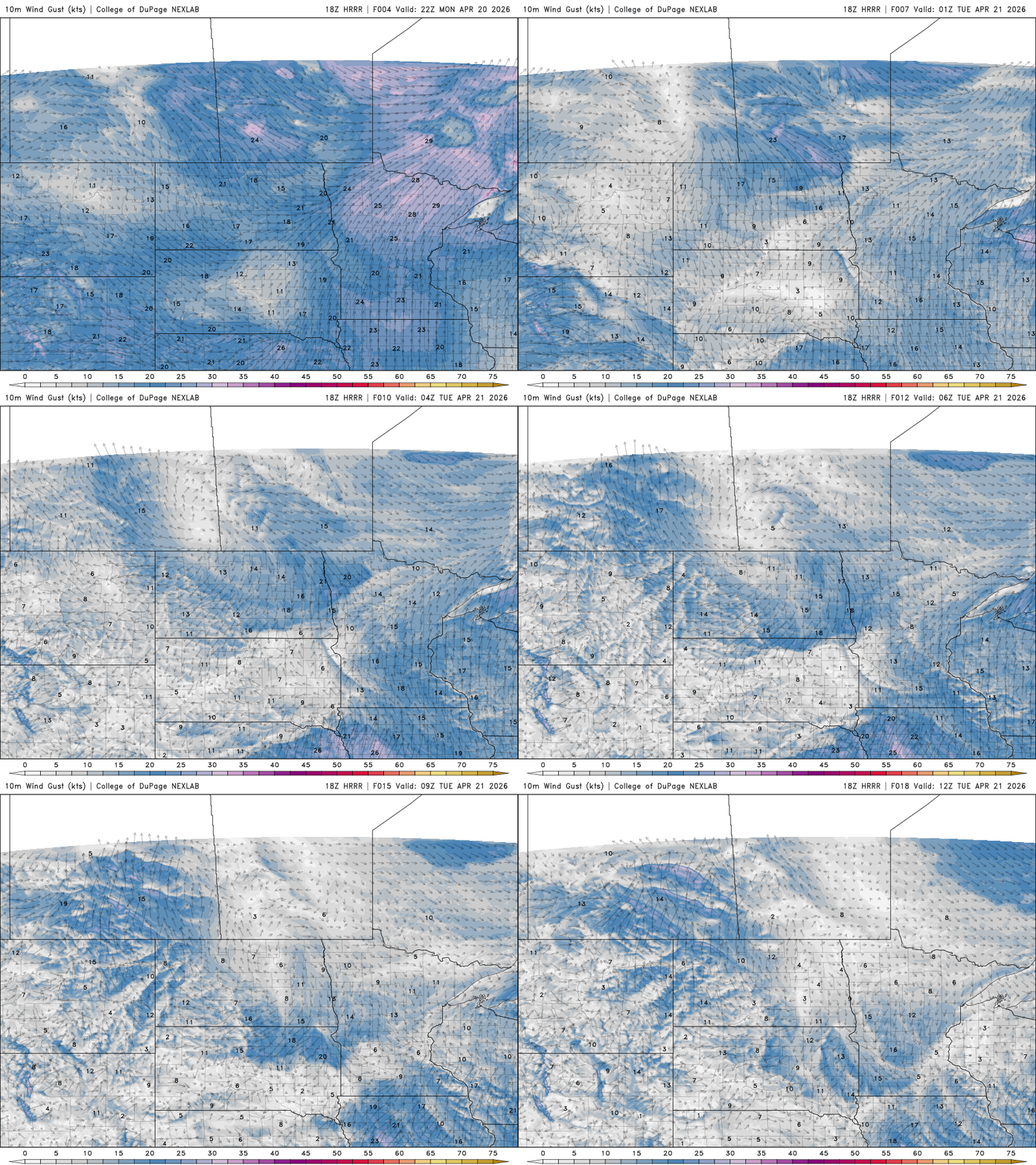
Southerly winds will gradually weaken Monday evening, dropping to 5 to 15 mph after sunset.
Overnight temperatures will fall into the low 30s across northern Minnesota, with milder low 40s to the south.
Turn Up Your Support
MPR News helps you turn down the noise and build shared understanding. Turn up your support for this public resource and keep trusted journalism accessible to all.

Tuesday will remain dry with low humidity, but lighter winds should help limit fire danger. By Wednesday, though, winds pick up again as a low-pressure system develops over the western Plains, increasing fire concerns.
A summerlike warming trend builds into Tuesday and Wednesday, with highs in the 70s Tuesday and 80s returning Wednesday — the warmest day of the week.

Relief from the dry stretch may arrive Thursday as a cold front sweeps through the region, bringing showers and thunderstorms, especially across eastern Minnesota and western Wisconsin.
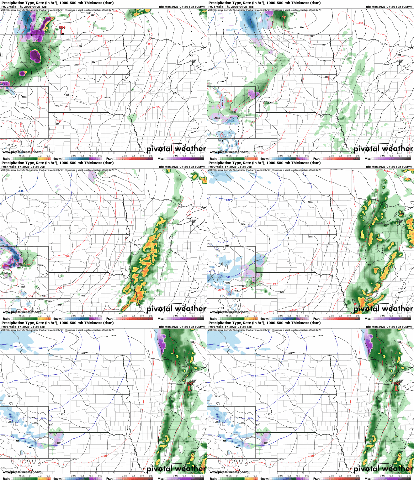
There is still some uncertainty regarding the exact timing and placement of storms, but current model data suggest the best chance for rainfall will come later Thursday into Thursday night.
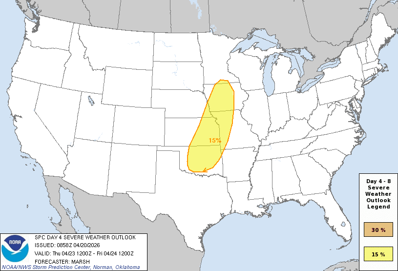
A few storms could become strong to severe, with the National Oceanic and Atmospheric Administration's Storm Prediction Center outlining a slight risk clipping southern Minnesota.
Behind the cold front Thursday, cooler and more seasonable conditions are expected to move in. Highs will drop back into the 50s by Friday and continue through the weekend as high pressure builds over the region.

