
Dry start to the weekend; rain returns late Sunday
Rainfall amounts could exceed an inch

Go Deeper.
Create an account or log in to save stories.
Like this?
Thanks for liking this story! We have added it to a list of your favorite stories.


Changes are on the way as we head into the weekend, with increasing rain chances and a wetter pattern setting up early next week. This rain is much needed, especially across western Minnesota where dry conditions have led to elevated fire risk.
Dry start to the weekend, followed by a soaking rainfall
We’re starting the weekend on a dry note, and that trend holds through Friday night with mainly clear skies and seasonably cool conditions. Low temperatures will drop into the low 30s in northern Minnesota, and upper 30s to low 40s central through southern Minnesota.
Looking ahead, the weekend starts off quiet with seasonal temperatures. Highs will generally run right around our late-April averages, with mid to upper 50s in the northern and central regions, and low 60s in the south.

A few isolated showers are possible for western and central Minnesota on Saturday, with eastern sections of the state remaining dry for the most part. A more impactful system arrives late Sunday into Monday, bringing widespread rainfall across the region.
Turn Up Your Support
MPR News helps you turn down the noise and build shared understanding. Turn up your support for this public resource and keep trusted journalism accessible to all.
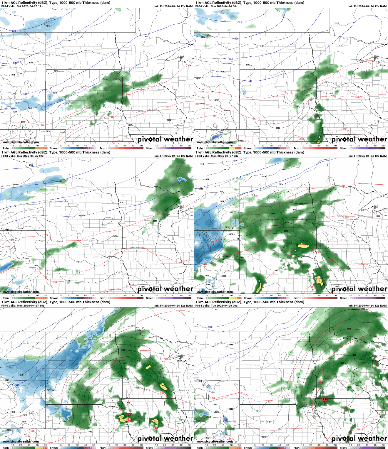
Forecast models suggest many locations could receive an inch or more of rain, which would be especially beneficial for the drier areas of western Minnesota.

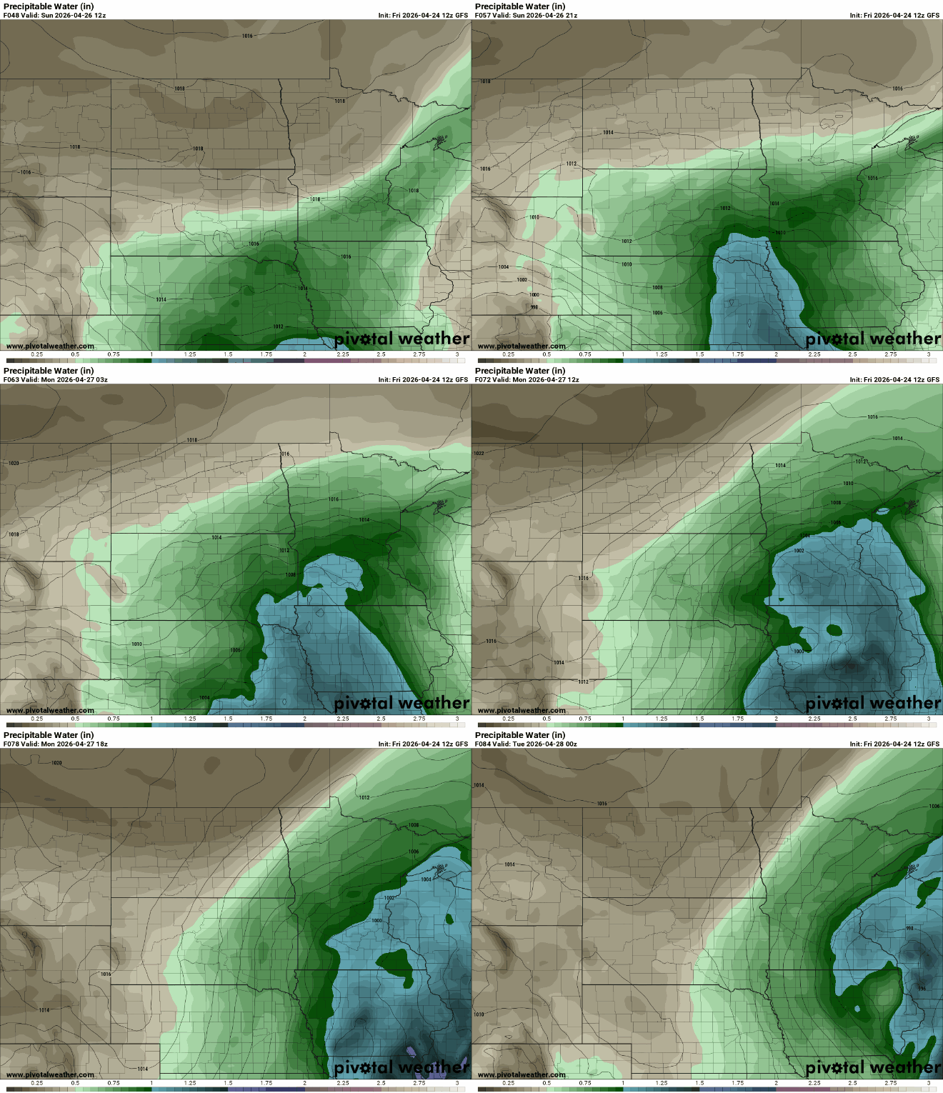
The system moving in Sunday into Monday has a lot of moisture to work with. One way we measure that is with something called precipitable water, basically, if you could squeeze all the water out of the air, like wringing out a towel, this tells you how much rain could fall. Right now, those values are over an inch, which means this system has the potential to bring a good, soaking rain.
Sunday is shaping up to be the warmest day in the forecast period despite the cloud cover and rain chances. Highs warm into the mid to upper 50s north, mid 60s to around 70 degrees for the southern half of the state.

Cooler weather sticks around into next week, with highs mostly in the upper 40s to low 60s. Overnight temperatures dropping into the low to mid-30s could bring a risk of frost or even a light freeze, especially now that plants have started to green up and grow.

