
More seasonable temperatures with more rain on the way early next week
Temperatures will remain cooler next week

Go Deeper.
Create an account or log in to save stories.
Like this?
Thanks for liking this story! We have added it to a list of your favorite stories.


It’ll be cooler Friday but actually right near-normal. Look for sunshine for most of the day. Another system brings rain late Sunday into Monday with cool temperatures lingering into next week.
Sunny and seasonable Friday but more rain by Sunday, Monday
Lingering showers are exiting the North Shore and Arrowhead Friday morning. The combination of more than 1 to 2 inches of rain over the past 24 hours there and lingering snow pack has led to a flood advisory through Saturday evening.
Many of the small rivers and streams have risen rapidly and may continue to do so Friday.

Areas around Two Harbors and Knife River saw more than 2 inches of rainfall in the past 24 hours with a widespread 1 to 2 inches for the remainder of Lake and Cook counties in northeastern Minnesota.
Turn Up Your Support
MPR News helps you turn down the noise and build shared understanding. Turn up your support for this public resource and keep trusted journalism accessible to all.

Winter is still hanging on as well up north. There are areas of 4 to 14 inches of snow cover remaining in portions of Cook County. Melting snow with rain is a combination that leads to minor flooding. The ground is still frozen for most of Lake and Cook counties as well.

As of early Friday, only the Beaver River near Beaver Bay has reached minor flood stage. River levels went up more than 3 feet over the past 24 hours there. The Knife River went up 5 feet but remains below flood stage.
The small rivers and streams along the North Shore can go up and down very rapidly and with little notice. Watch those roaring water falls from a safe distance this weekend!

Look for sunshine and cooler conditions Friday with near-normal highs in the low to mid-60s in southern Minnesota and 50s north. Northern Minnesota will see a few more scattered clouds.

Saturday will see some increased cloud cover but similar temperatures in the 50s and 60s.

There will also be some light rain showers developing in parts of western and central Minnesota Saturday. Most of eastern Minnesota should remain dry most of the day.
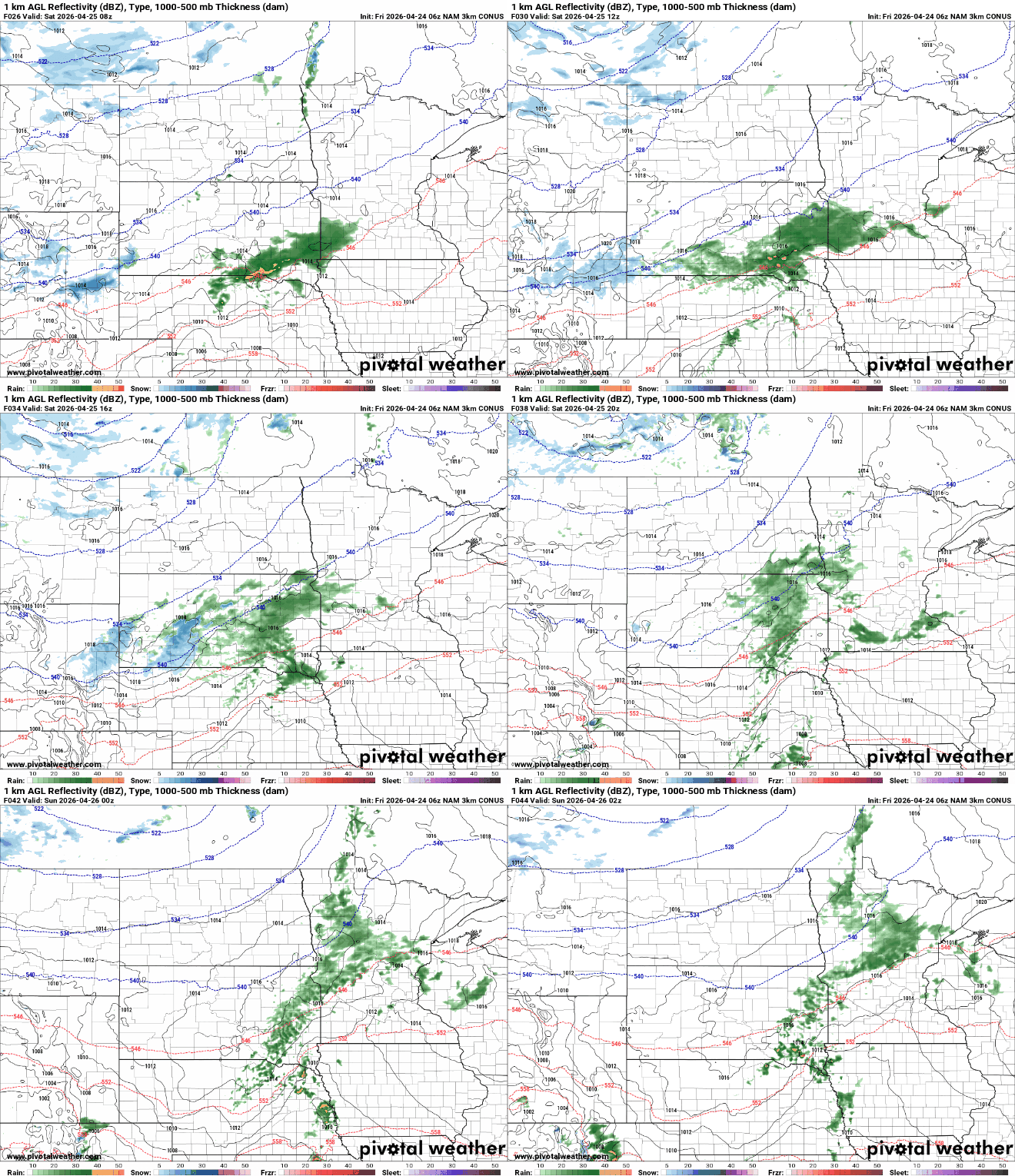
Another potent upper-level low out of the Pacific will swing into the Rockies over the weekend and send a series of disturbances our direction late Sunday into Monday. This will touch off rain showers and garden variety thunderstorms in the early part of the week.
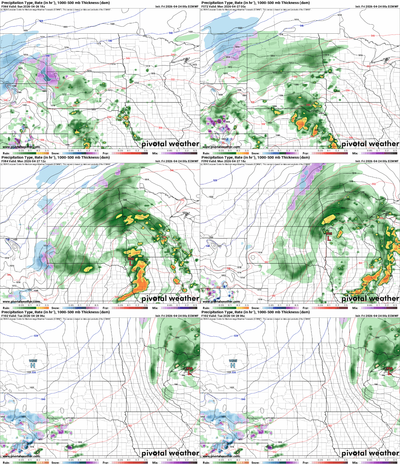
We could see some decent rainfall amounts in the 1 to 2 inch range across portions of central, southern, and eastern Minnesota into Wisconsin through Monday night. Here’s forecast rainfall output for Sunday into Tuesday from NOAA’s Weather Prediction Center:

Behind it, temperatures will be a bit cooler yet and slightly below normal with highs mostly in the 50s and 40s for midweek next week, a far cry from the 80s and 90s we saw Wednesday but much closer to normal.

