
Showers chances Saturday, widespread rain late Sunday into Monday
Seasonal temperatures this weekend, followed by a cooldown
Go Deeper.
Create an account or log in to save stories.
Like this?
Thanks for liking this story! We have added it to a list of your favorite stories.


Periods of rain will affect much of western and central Minnesota Saturday, with more widespread and steady rainfall expected late Sunday through Monday.
Rain chances for the weekend
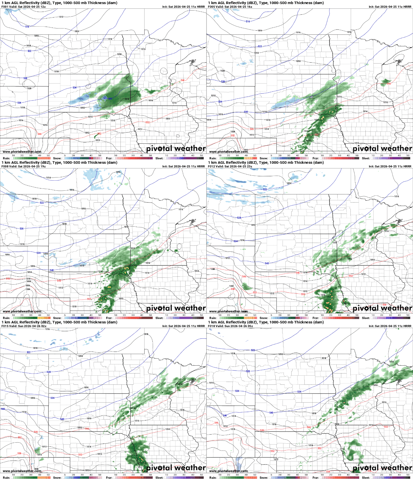
Rain will likely come in multiple rounds for our Saturday, with the main concentration for the western and central portions of the state.
Rainfall totals are expected to remain relatively light, generally ranging from a few hundredths to around a quarter inch, with the highest amounts focused in western Minnesota, where the rain is especially needed after a relatively dry past week.

Rain chances will increase again Saturday night, shifting toward central Minnesota, where an additional quarter inch of rainfall is possible.
Turn Up Your Support
MPR News helps you turn down the noise and build shared understanding. Turn up your support for this public resource and keep trusted journalism accessible to all.
Seasonal temperatures will settle in Saturday, with mid to upper 50s across the north and low 60s in the south. Skies will remain mostly cloudy, though northern areas may see more breaks and occasional sunshine.

A more significant system is set to arrive late Sunday into Monday. Following a brief break Sunday morning, a low-pressure system moving through the Central Plains will bring widespread rainfall to the region. Total rainfall amounts of one to two inches are expected through early Tuesday.

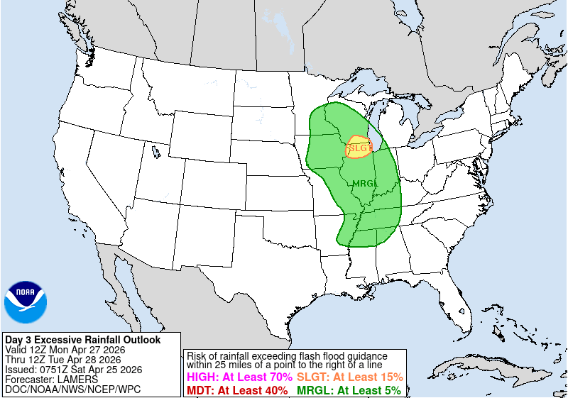
Eastern and southern Minnesota and Wisconsin may see heavier pockets of rain, with a marginal risk for excessive rainfall.
Temperatures will trend a bit warmer Sunday, with highs spanning the 50s north, 60s central, and 70s south.

Behind this system, cooler air will settle into the region for much of the upcoming week. Highs from Tuesday onward will remain in the low to mid-50s. Overnight lows will be the primary concern, as temperatures may drop low enough to bring a risk of frost or freezing conditions through Friday morning.

