
Rain and thunder Monday followed by a cool midweek
Warmer temperatures return by the end of the week
Go Deeper.
Create an account or log in to save stories.
Like this?
Thanks for liking this story! We have added it to a list of your favorite stories.


We’ll have scattered showers and thunderstorms through Monday night. Some sun should appear Tuesday.
Temperatures will be slightly cooler than normal the rest of the week with mostly 50s in southern Minnesota and 40s north Tuesday through Thursday.
Wet, windy Monday followed by cooler weather
It’s been a wet overnight and early Monday so far. Many areas in western Minnesota have seen an inch or more of rainfall so far through 7 a.m. Monday.

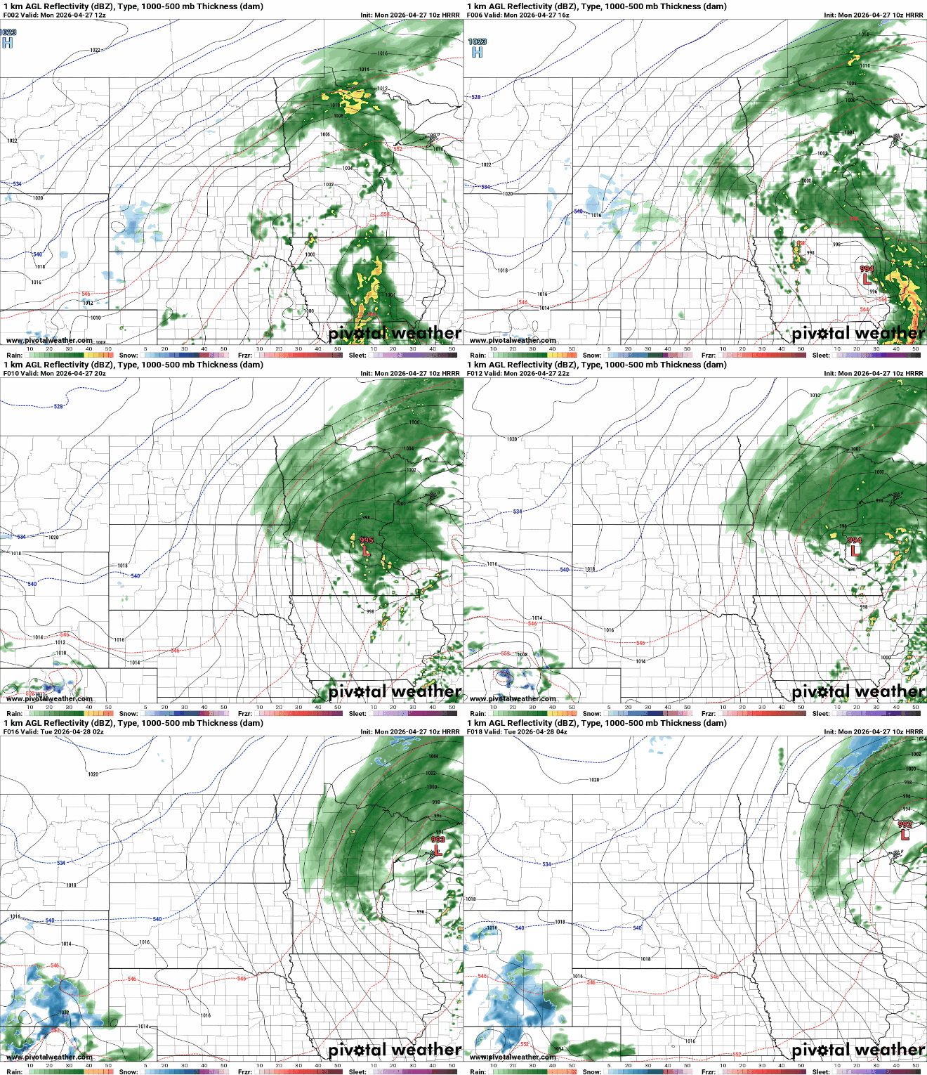
On-and-off scattered showers and some thunderstorms can be expected Monday into Monday night for much of the state.
Turn Up Your Support
MPR News helps you turn down the noise and build shared understanding. Turn up your support for this public resource and keep trusted journalism accessible to all.
The low-pressure center with this latest storm system will pass right through central Minnesota and the Twin Cities midday. It will be fairly windy from the southeast, becoming northwest at 10 to 30 mph.
We’ll see Monday afternoon highs reach the 60s in southern Minnesota between rain bands.
There’s a slight risk (level 2 of 5) for severe storms in the far southeastern corner of the state with a broader marginal (level 1 of 5) risk across southeastern Minnesota. A couple of isolated storms could produce some large hail briefly or high wind gusts.

Flood watch for parts of NE Minnesota
Many areas in western Minnesota have seen up to 1 inch of rainfall. The heaviest additional rainfall Monday will fall across central and northeastern Minnesota, where more than an inch could fall.

There’s a flood watch posted for potions of northeastern Minnesota later Monday morning through early Tuesday.

Many rivers along the North Shore saw rapid increases in river levels Thursday night and could see levels go up again with more significant rainfall combined with some melting snow pack.
Here’s the Knife River near Two Harbors as an example:

The Knife River went up about 5 feet in just eight hours Thursday night, then fell back quickly by Sunday to Thursday levels again.

