
Rainy overnight continuing into Monday
Temps will be cooler midweek before warming back up
Go Deeper.
Create an account or log in to save stories.
Like this?
Thanks for liking this story! We have added it to a list of your favorite stories.


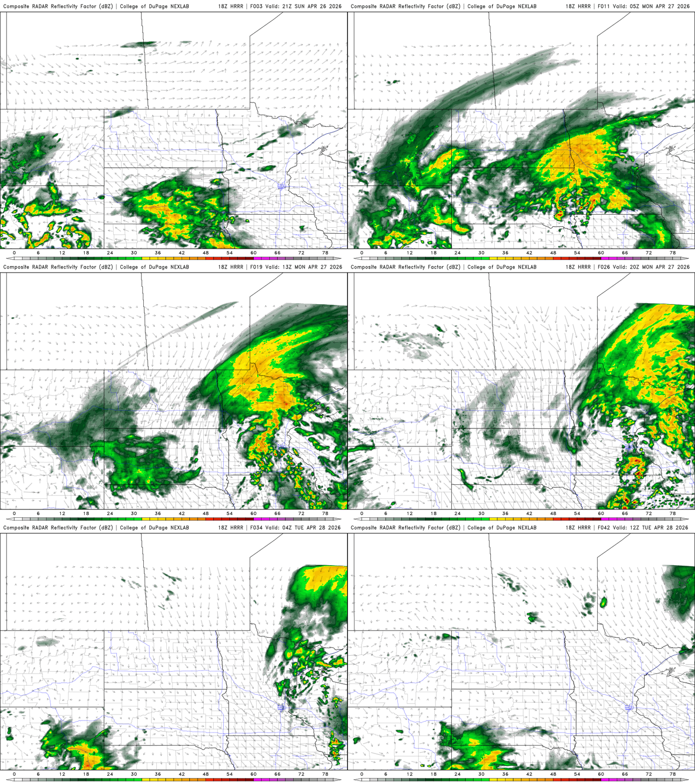
A potent system will deliver soaking rains to much of the state tonight into Monday and Monday night. Quieter and cooler conditions follow for midweek.
Storm system brings rain, thunder tonight into Monday night
Areas of scattered shower and thunderstorms will lift northeast through the evening and overnight hours. Look for waves of occasional showers and thunderstorms tonight into Monday and Monday night.
A broad area of 1 to 2 inches of rain with locally higher amounts is likely across a large swath of southwest, central and northeast Minnesota through early Tuesday.

There’s a flood watch for parts of northeast Minnesota again where heavy rain fell Thursday night and snow continues to melt in some places. With more significant rain on the way, river levels could rise again.
Turn Up Your Support
MPR News helps you turn down the noise and build shared understanding. Turn up your support for this public resource and keep trusted journalism accessible to all.

Temps overnight will drop into the 50s and 40s with 30s in far northern Minnesota.

We’ll have enough of a break in the rain Monday for temps to warm into the 60s in southern Minnesota for a time. Temperatures will be colder north.

There is a slight risk (level 2 of 5) for severe storms Monday in southeast Minnesota with a marginal risk (level 1 of 5) through the Twin Cities.

The rest of the week will be a little cooler than normal with highs Tuesday through Thursday mostly in the 50s for southern Minnesota and 40s north. Sunshine should break out some for Tuesday and Wednesday and temperatures will be warmer by the weekend with 70s possible again for at least southern Minnesota by Sunday.

