
Cool temperatures continue through Friday
A few showers will be possible Wednesday afternoon

Go Deeper.
Create an account or log in to save stories.
Like this?
Thanks for liking this story! We have added it to a list of your favorite stories.


The cooler-than-normal temperatures continue through the end of the week. An upper-level disturbance will touch off a few showers Wednesday.
Cool temperatures and some minor disturbances
It’ll be another cooler-than-normal day Wednesday. Temperatures are starting out chilly, in the 30s for most, early Wednesday morning. Afternoon highs will again be in the 40s and 50s, about 4 to 12 degrees cooler than normal.

An upper-level disturbance will allow for clouds to fill in midday Wednesday and Wednesday afternoon and produce a few very spotty showers in southern Minnesota. In northern Minnesota, they’ll contend with some flurries and a few snow showers.
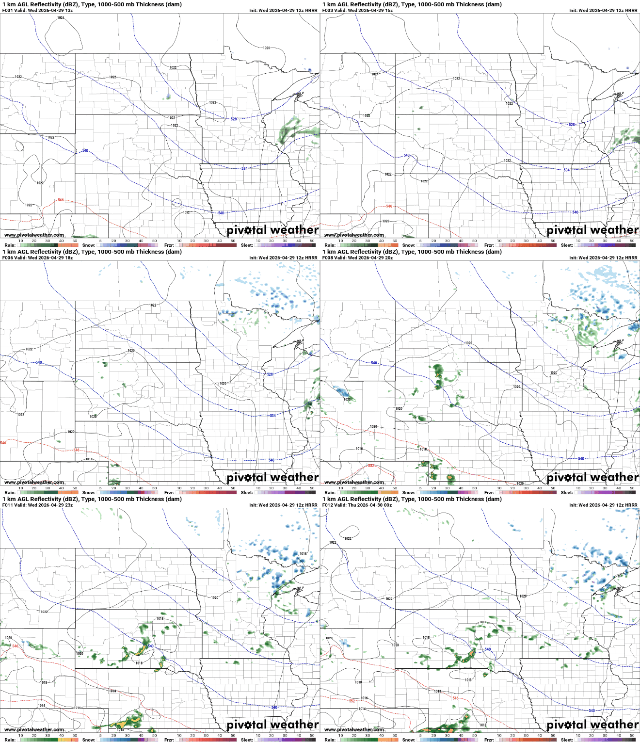
It’s not impossible to even see a little brief, slushy snowfall accumulation Wednesday in parts of northeastern Minnesota. There could be some decent, quick bursts of snow that could overcome warm soil temperatures.
Turn Up Your Support
MPR News helps you turn down the noise and build shared understanding. Turn up your support for this public resource and keep trusted journalism accessible to all.

A flood advisory continues for Lake and Cook counties in northeastern Minnesota Wednesday as rivers swell from recent rains and snow melt.

A flood warning is posted through Monday for the South Kawishiwi River Ely. It’s gone up about a foot since Thursday and is forecast to go up another half foot to about 6.9 feet by Friday. At a 7-foot stage, several Boundary Waters Canoe Area Wilderness campsites are submerged.

Clouds will clear out pretty quickly after dark, allowing for a cold overnight into Thursday. Many areas will see some patchy frost as lows fall again into the 30s. Northern Minnesota will see subfreezing overnight lows.

Anywhere outside the immediate Twin Cities could see at least patchy frost Wednesday night. If you have any delicate plants out, I would bring them inside or cover them up the next couple of nights to be on the safe side.
Thursday and Friday will continue to be cool with highs again mostly in the 40s and 50s.
We’re still on tap for a warming trend this weekend as highs return to the 60s for southern Minnesota.

A couple more upper-level disturbances could touch off a few showers Sunday and Monday.

