
Weekend warm-up with spotty rain, then cooler again
Cooler temperatures return by Tuesday

Go Deeper.
Create an account or log in to save stories.
Like this?
Thanks for liking this story! We have added it to a list of your favorite stories.


Warmer temperatures are expected for the weekend ahead, with just isolated rain shower chances developing by Saturday afternoon and early evening. A cooldown returns behind a frontal system for Tuesday and Wednesday.
Pleasant weekend with sunshine and spotty showers
Temperatures will climb into the 60s for both Saturday and Sunday as warmer air begins to move into the region. Highs in the upper 50s to mid-60s across the state before spotty rain chances return.

Sunshine early Saturday will give way to increasing clouds as a weak disturbance approaches. This system will bring the first of two rain chances, with scattered showers developing across northwestern Minnesota by early afternoon before drifting southeast into late Saturday afternoon and early evening. Rainfall is expected to be spotty and light, nothing that should ruin weekend plans.
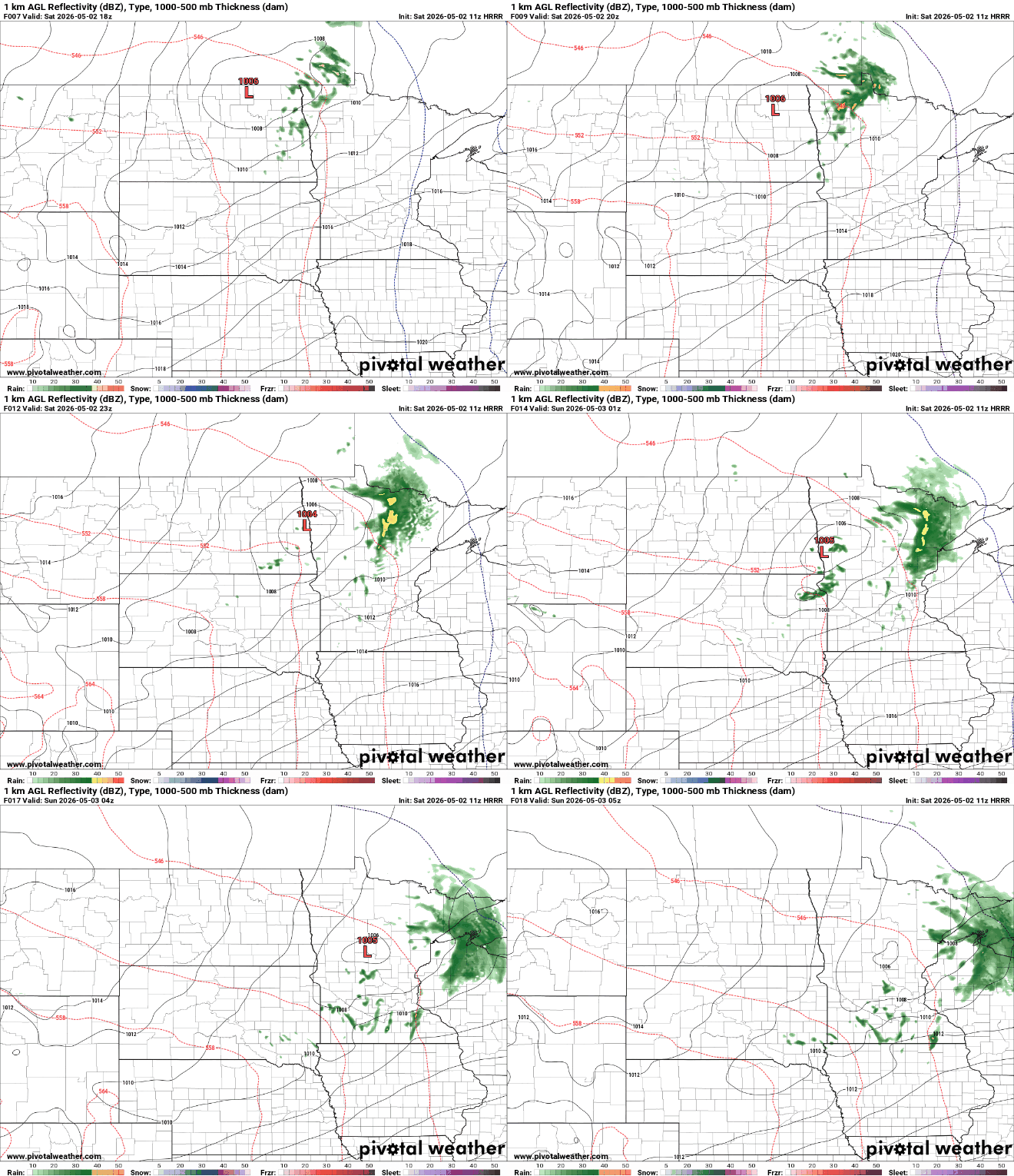
Sunday looks mainly dry with partly to mostly sunny skies and another mild day in the low to mid-60s, with pockets of mid-50s for northeastern Minnesota.

The warming trend peaks Monday ahead of an approaching cold front. Southern areas could reach the low 70s, while northwestern Minnesota stays closer to 40 degrees. A second chance for scattered showers arrives Monday afternoon, but like the weekend system, rainfall amounts look light.

Behind the cold front, a noticeable cooldown settles in from Tuesday through midweek. High temperatures will fall back into the upper 40s to mid 50s, while overnight lows dip toward and even below freezing. This will bring another round of frost and possible freezes each night through at least Wednesday night.
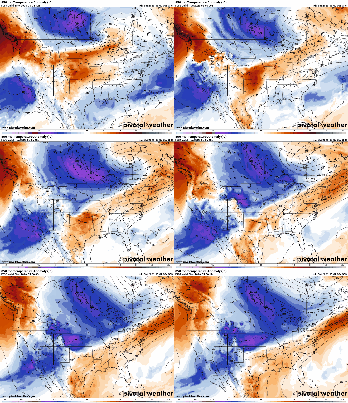
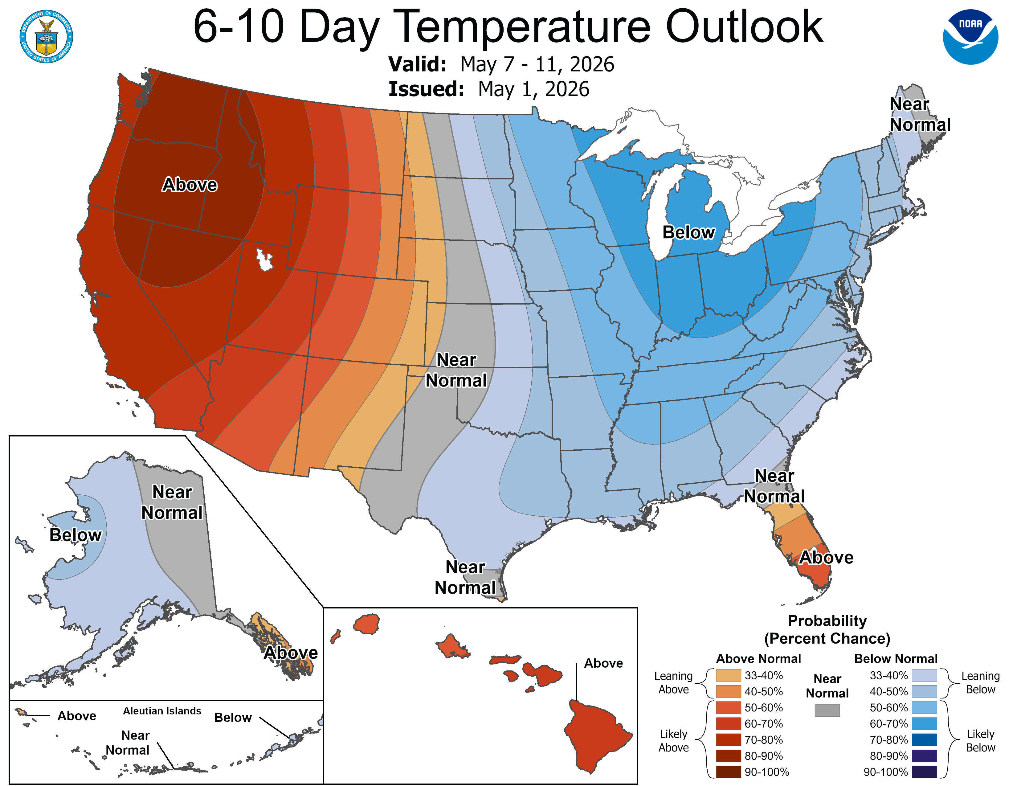
Looking ahead, temperatures may begin to moderate later next week, but no significant warm up is expected anytime soon. The overall pattern remains on the cooler side, with limited chances for widespread precipitation as we move deeper into May.
Turn Up Your Support
MPR News helps you turn down the noise and build shared understanding. Turn up your support for this public resource and keep trusted journalism accessible to all.

