
Breezy and dry, then a quick cooldown before a weekend warmup
Elevated fire risk for western Minnesota

Go Deeper.
Create an account or log in to save stories.
Like this?
Thanks for liking this story! We have added it to a list of your favorite stories.


A mix of sunshine, breezy winds and dry air will shape the weather across the region for Sunday, bringing an elevated fire risk, especially in western Minnesota.
Sunny with an elevated fire risk
A bright and pleasant Sunday is in store with high temperatures climbing into the low to mid-60s to near 70 degrees, with mid-50s for the northeastern portions.

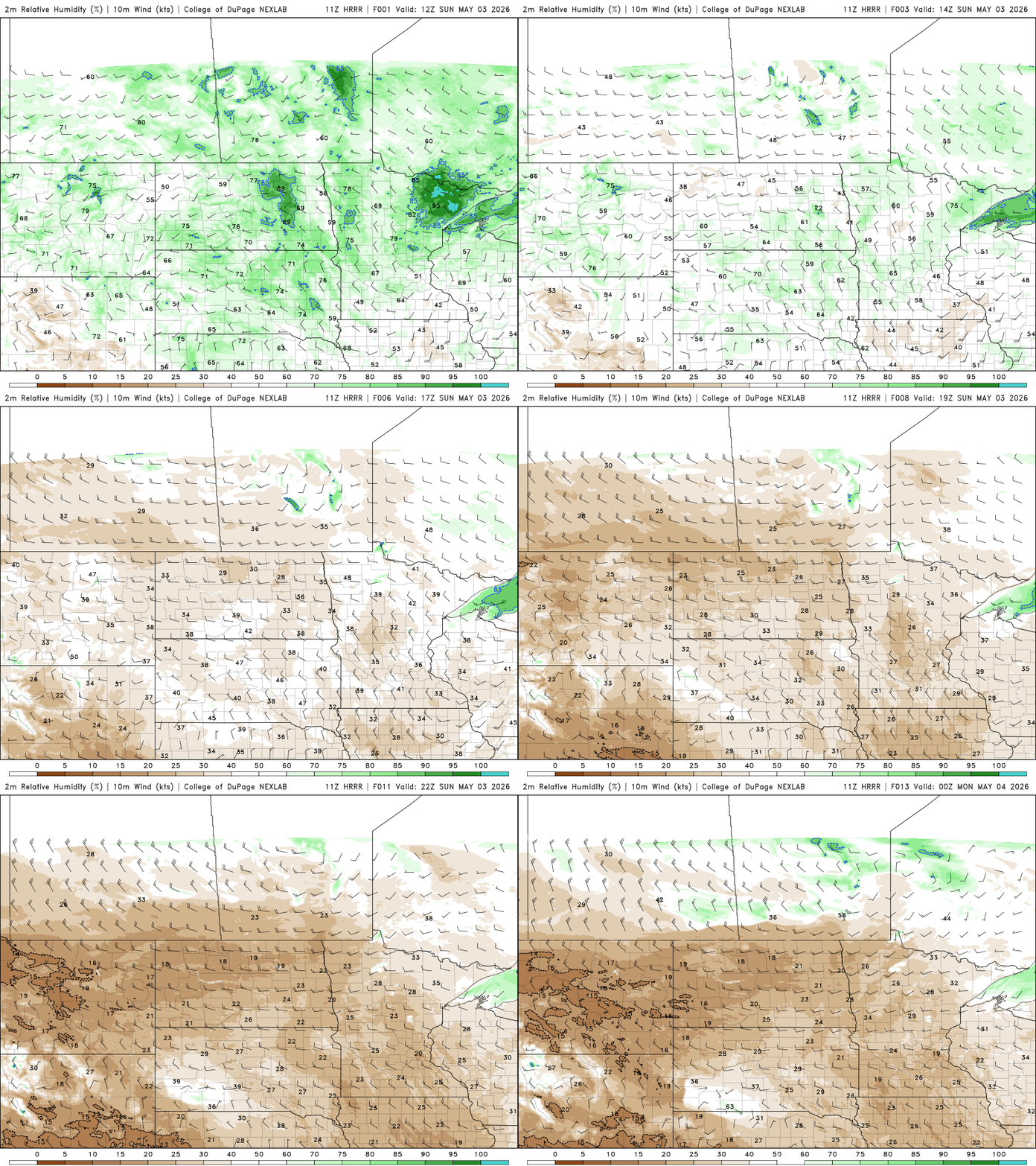
Behind a weak cold front, much drier air is moving in with relative humidity expected to drop below 30 percent. Combined with gusty northwest winds around 20 mph — higher at times in western Minnesota — this will lead to elevated fire weather conditions.
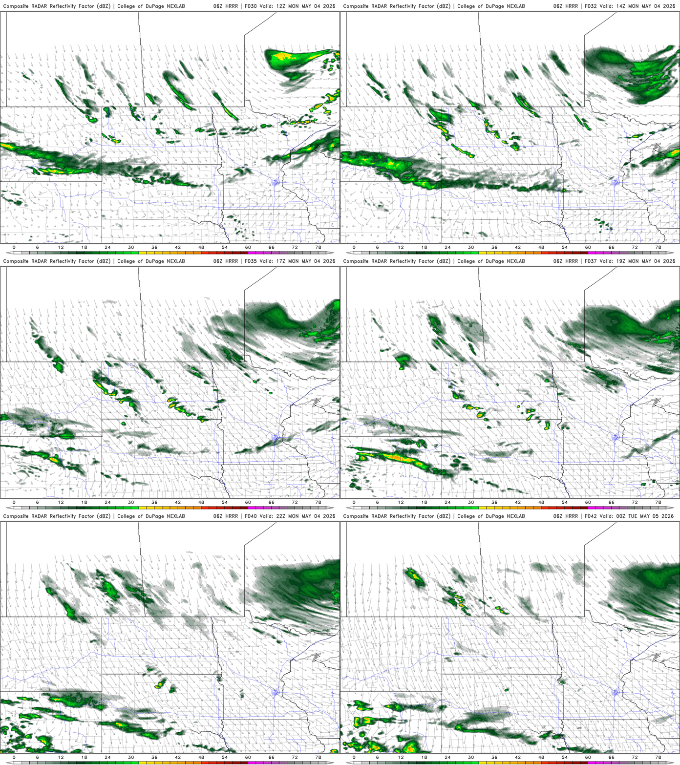
A stronger cold front will sweep through Monday, bringing gusty winds and a chance for scattered showers, though rainfall totals should remain light, generally under a tenth of an inch.
A noticeable temperature gradient will set up across the state ahead of the front, with mid- to upper 40s in northwestern areas and highs reaching the 70s in the southeast.

Cooler air settles in behind the front, bringing below-normal temperatures through the middle of the week. Highs on Tuesday and Wednesday will only reach the low 40s to mid-50s, while overnight lows will drop sharply with frost or even a freeze possible, especially Tuesday and Wednesday nights.
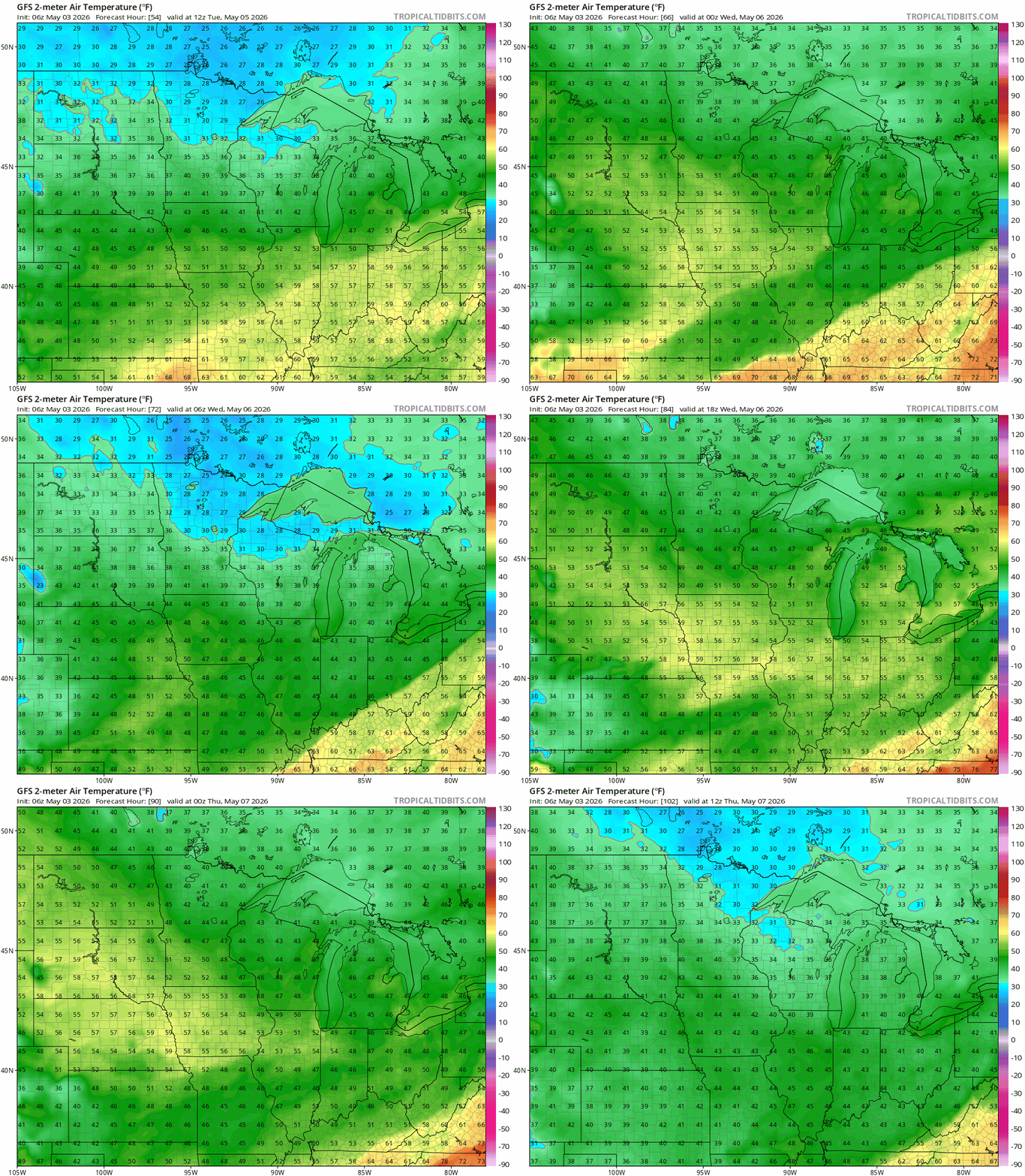
The chill will not last long. By late week, temperatures will gradually rebound as the colder air mass shifts east, with readings by next weekend returning to levels similar to what we are experiencing now. Rain chances after Monday remain slim, with only minor opportunities for light precipitation as weak systems pass through.
Turn Up Your Support
MPR News helps you turn down the noise and build shared understanding. Turn up your support for this public resource and keep trusted journalism accessible to all.

