
Passing showers early Saturday and a slightly cooler weekend
Temperatures continue their upward trend next week

Go Deeper.
Create an account or log in to save stories.
Like this?
Thanks for liking this story! We have added it to a list of your favorite stories.


A disturbance and cool front will touch off a few showers late Friday night into early Saturday followed by slightly cooler air for the weekend. Warmer temperatures are still on track next week.
A few showers and slightly cooler weekend temps
It’s been a beautiful Friday with temps topping out in the low 70s. Unfortunately it’s also pretty dry with relative humidity values of 15 to 25 percent and winds gusting to 25 to 35 mph in parts of central and western Minnesota.
A red flag warning is posted for some areas there until 8 p.m. Friday. Any fires that start could spread rapidly in these conditions.

A quickly moving upper-level disturbance and cool front will sweep across Minnesota overnight into early Saturday. It will touch off a few spotty and mostly light rain showers and pull down some slightly cooler air for Saturday and Sunday.
Turn Up Your Support
MPR News helps you turn down the noise and build shared understanding. Turn up your support for this public resource and keep trusted journalism accessible to all.
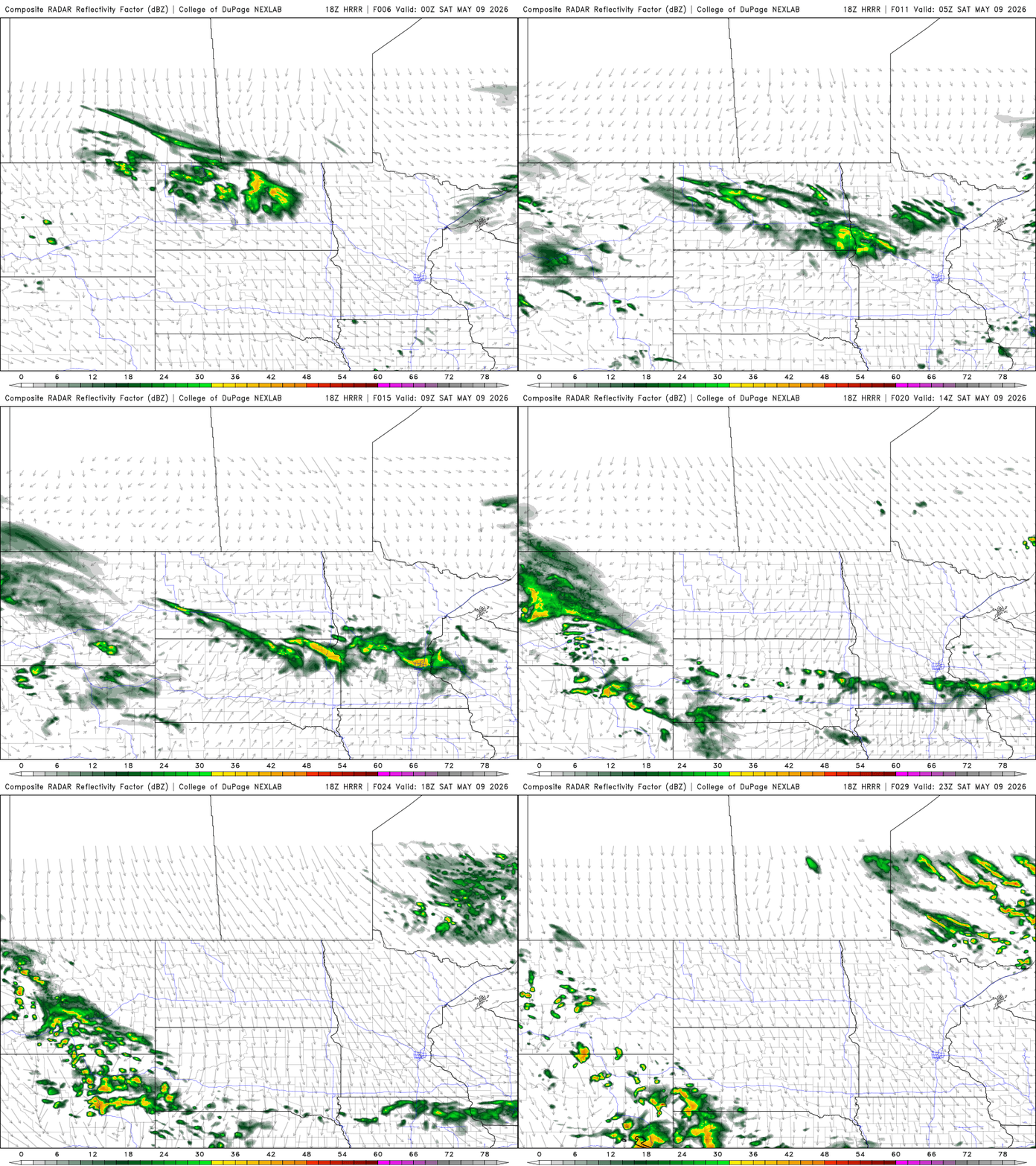
It’ll be relatively mild overnight with temperatures dipping into the 40s and 30s under partly cloudy skies.

It will be fairly breezy Saturday behind the cool front. We’ll have winds through the day at 10 to 20 mph from the northwest with gusts of 20 to 30 mph.
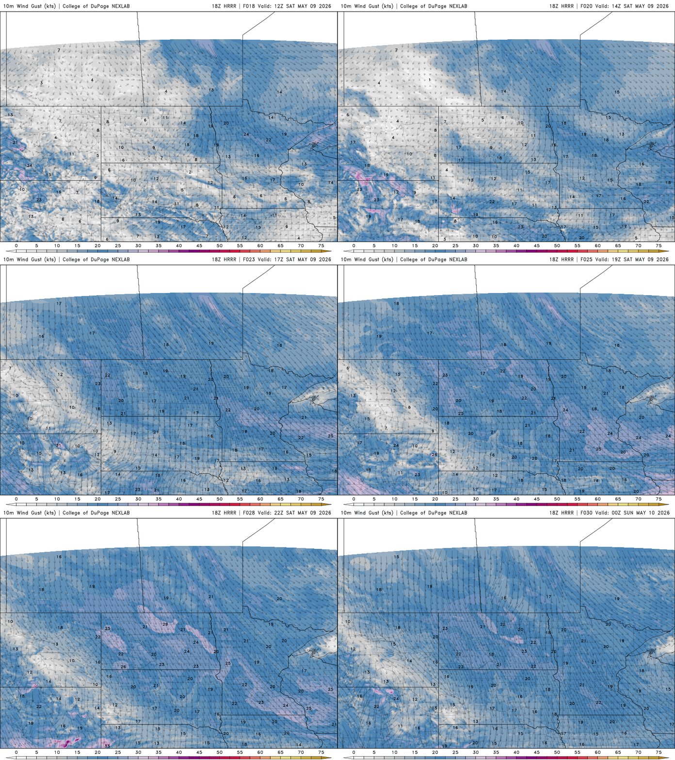
Highs Saturday will be a little cooler but close to seasonable in the low to mid-60s in southern Minnesota with mostly 50s north.
There will some upper 40s in far northern Minnesota if you’re headed to some of our northern most lakes for the fishing opener. We’ll have quite a bit of sun in southern Minnesota with more cloud cover north.

Sunday will be a few degrees cooler with partly cloudy skies for Mother’s Day. Highs Sunday will range from the mid-60s in southwest Minnesota to the upper 40s in northeastern Minnesota and right near 60 degrees for the Twin Cities.

The next chance of any moisture comes in the form of some scattered showers late Monday night into Tuesday. It doesn’t look to yield a lot of rainfall, however.

We’re still on track for pretty warm weather late next week. We should be back into the 70s by Thursday and many forecast models have us in the 80s by Friday or next weekend.


