
Warm weather persists with increasing thunder chances by late week
Temperatures will shift to be mostly above normal
Go Deeper.
Create an account or log in to save stories.
Like this?
Thanks for liking this story! We have added it to a list of your favorite stories.


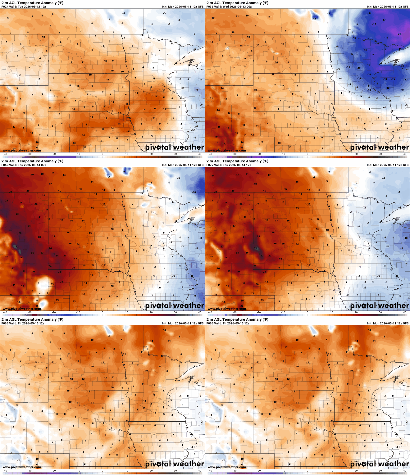
Consistently warmer weather is on tap for the rest of the week. Chances of thunder will increase by the end of the week into the weekend along with summerlike temps.
Warm temperatures continue with increasing chances of thunder by late week
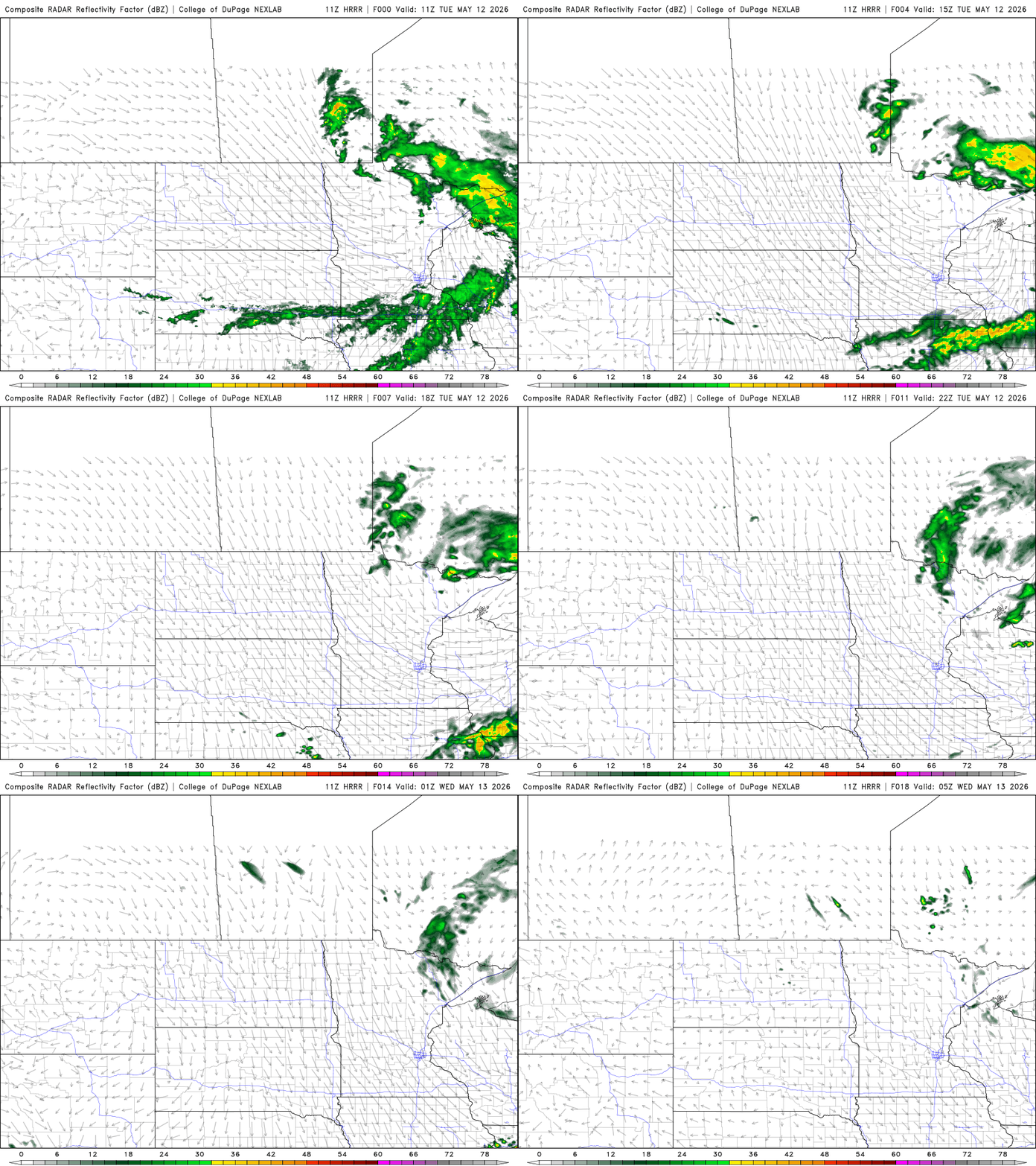
We’ll see decreasing clouds in the morning as the overnight disturbance moves out. Look for a warm Tuesday in the southern part of the state. Afternoon highs will range from the 70s south to the 50s and 40s north.

There are some lingering showers in far southern Minnesota and the Arrowhead early Tuesday. Some pop-up showers will be possible in addition to increased cloud cover in northern Minnesota Tuesday afternoon.
Another thing in the wake of Monday night’s disturbance will be gusty winds. Winds will blow at 15 to 30 mph with higher gusts forecast.
Turn Up Your Support
MPR News helps you turn down the noise and build shared understanding. Turn up your support for this public resource and keep trusted journalism accessible to all.
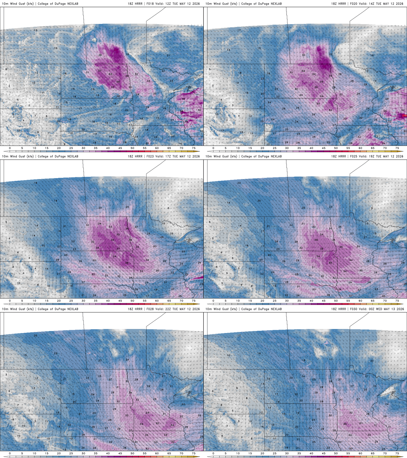
Red flag warnings are posted for western and southwestern Minnesota Tuesday afternoon due to the gusty winds and low relative humidity values. Any fires that start could spread rapidly.

Afternoon and evening relative humidity values will drop to 20 to 25 percent in western Minnesota in addition to the gusty winds.

Wednesday will again be warm for the southern part of the state with partly cloudy skies. Highs will again range from the 70s south to the 50s north.

We’re still on track for even warmer, summerlike temperatures by the end of the week and the weekend with 80s likely in southern Minnesota.

The increase in both temperature and dew points by Friday and the weekend along with an upper-level disturbance moving in will touch off at least some spotty storm chances.
The first chance will come late Thursday and then mainly Sunday and Monday with isolated activity in between, Friday and Saturday.
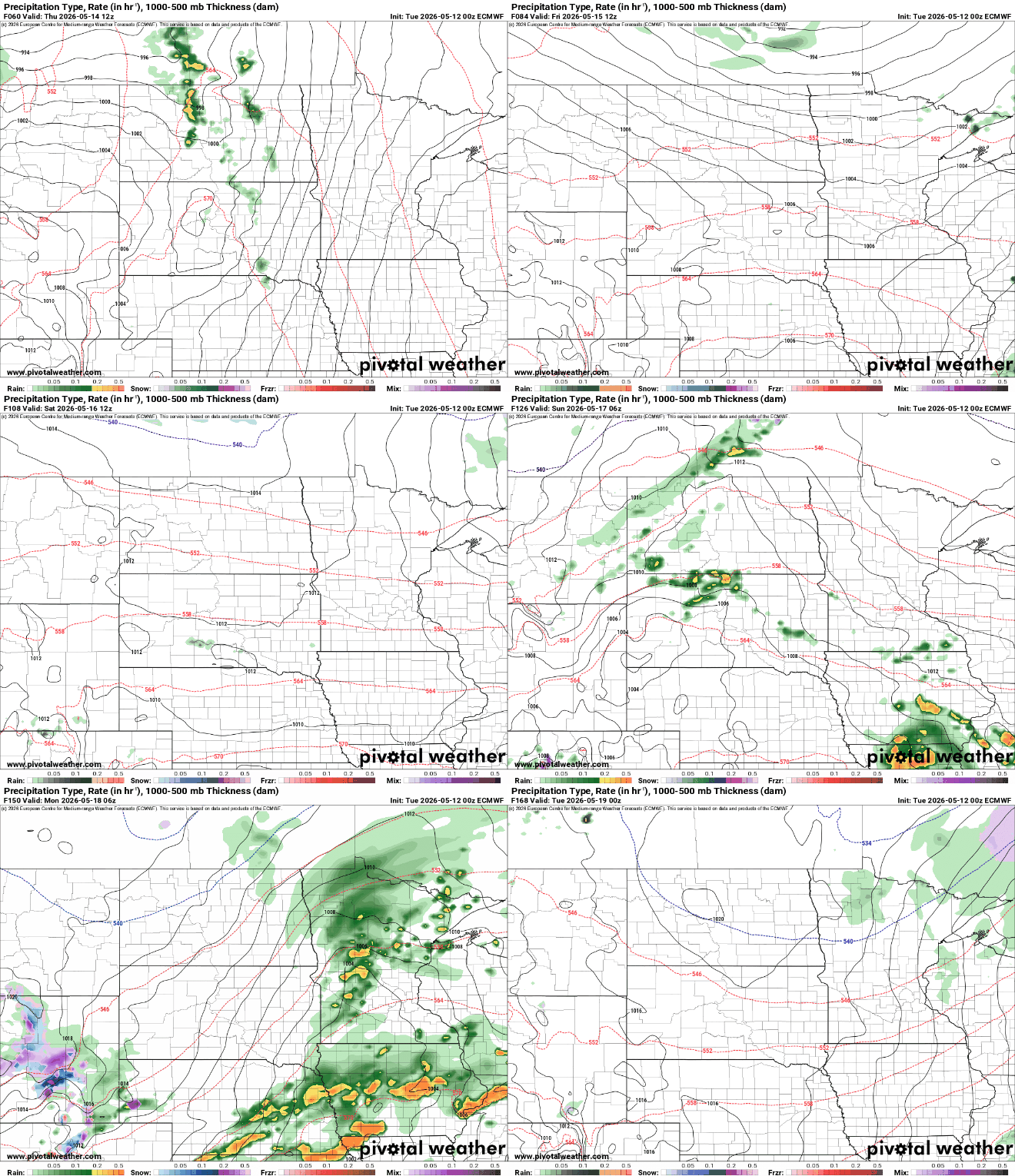
We’ll have to monitor the chance of severe storms Sunday and Monday. There’s a question as to how far north dew points of 60 or higher can reach. Those muggier dew points will be essential to produce any potential strong or severe storms.
The National Oceanic and Atmospheric Administration’s National Severe Storms Laboratory’s experimental severe weather probability forecasts do bring chance of severe weather into southern Minnesota Sunday into Monday.


