
Rain chances return Thursday with fire weather threat
Stormier pattern arrives this weekend with beneficial rainfall
Go Deeper.
Create an account or log in to save stories.
Like this?
Thanks for liking this story! We have added it to a list of your favorite stories.


The Upper Midwest is heading into another stretch of dangerous fire weather conditions before a major pattern shift brings widespread rain and thunderstorm chances back to the region early next week.
Red flag conditions Thursday with a chance for showers
Wednesday was certainly a 5-star day, featuring lighter winds, temperatures in the low 70s and comfortably low humidity levels. However, that dry air will become more problematic Thursday into Friday as warmer temperatures and breezy winds return the threat of elevated fire weather conditions to the region.
Overnight lows Wednesday night will fall into the low 50s across western Minnesota, low to mid-40s across eastern sections of the state, and chilly upper 30s across the Arrowhead region. A frost advisory remains in effect for Lake and Cook Counties where patchy frost is possible by early Thursday morning.

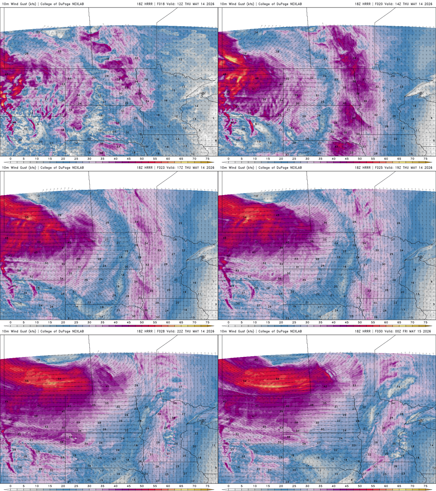
A storm system tracking through southern Canada on Thursday will tighten the pressure gradient across the northern Plains, leading to very strong southwesterly winds across western and central Minnesota. Sustained winds of 20-30 mph are expected, with gusts frequently reaching 40-50 mph. A wind advisory is in effect for northwestern and western Minnesota until 10 p.m. Thursday.
Turn Up Your Support
MPR News helps you turn down the noise and build shared understanding. Turn up your support for this public resource and keep trusted journalism accessible to all.
A red flag warning will be in effect for much of western Minnesota on Thursday as strong winds and low relative humidity values create critical fire weather conditions.

Another day of above-average temperatures is expected, with highs ranging from the lower to mid-70s across northern Minnesota, upper 70s in the Twin Cities metro and southern Minnesota and lower 80s out west.

A line of showers may develop Thursday during the late afternoon into early evening hours. A few isolated showers may also form earlier in the day along a warm front before a cold front sweeps through later Thursday evening.
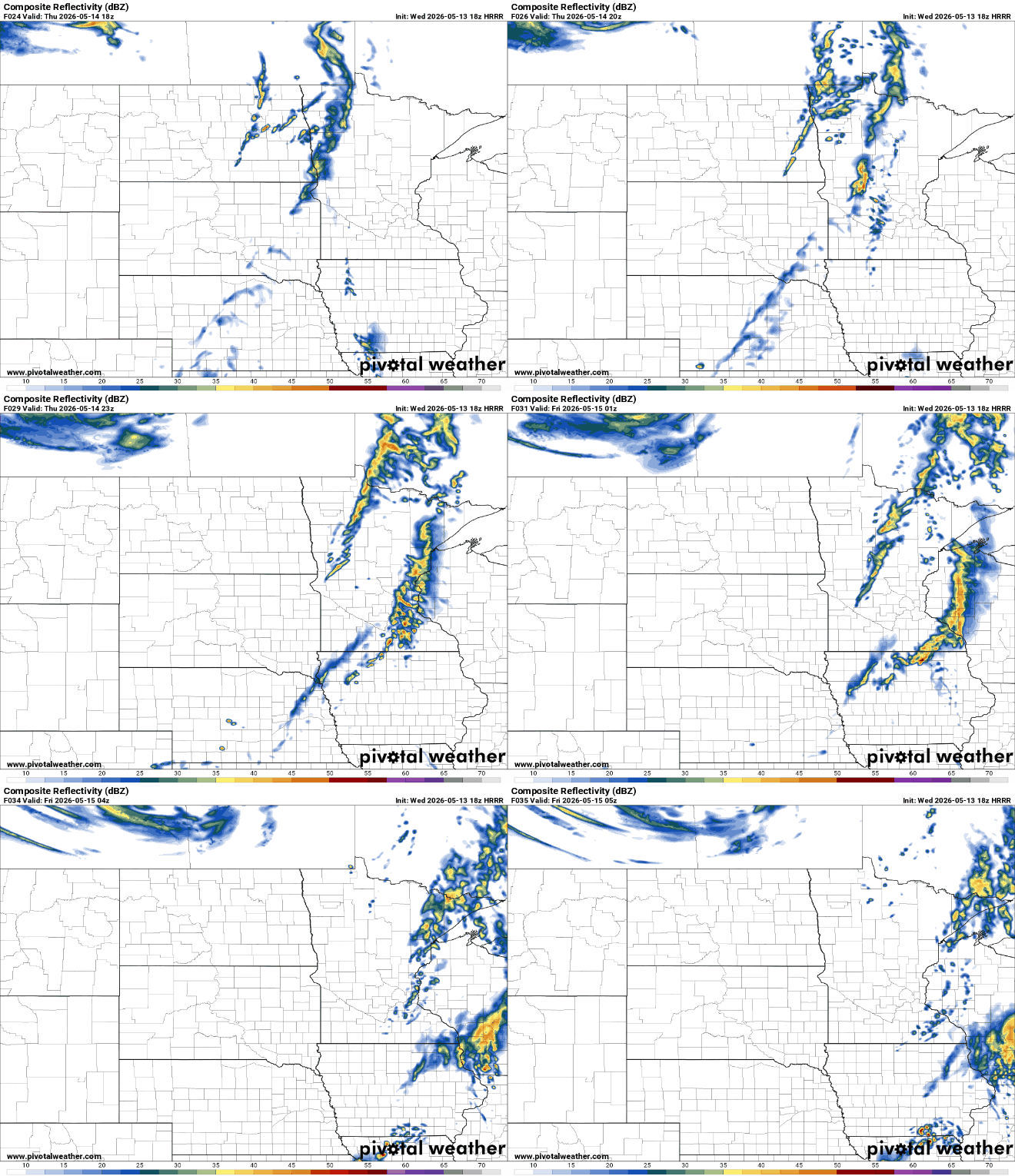
With rainfall amounts looking fairly limited, Minnesota’s newly greening landscape could certainly use additional moisture. Since May 1, much of the state has received only 10 to 25 percent of normal precipitation for the first half of May.

A surge of summerlike warmth will push temperatures well into the 70s and 80s across the region on Friday. Combined with continued breezy conditions, low humidity and an increasingly dry landscape, fire danger concerns will remain elevated. A fire weather watch has been issued for much of the state, excluding the far southeastern corner.
...FIRE WEATHER WATCH REMAINS IN EFFECT FROM FRIDAY MORNING THROUGH FRIDAY EVENING... The National Weather Service in the Twin Cities has issued a Red Flag Warning in effect from 10 AM to 7 PM CDT Thursday. * AFFECTED AREA...Portions of central, southwest, and west central Minnesota. * TIMING...For the Red Flag Warning, from 10 AM to 7 PM CDT Thursday. For the Fire Weather Watch, from Friday morning through Friday evening. * WINDS...For the Red Flag Warning south winds 20 to 30 mph with gusts up to 45 mph, and for the Fire Weather Watch west winds 15 to 25 mph with gusts up to 35 mph. * RELATIVE HUMIDITY...For the Red Flag Warning Around 25 percent, and for the Fire Weather Watch Around 15 to 20 percent. * IMPACTS...Any fires that develop will spread rapidly. Outdoor burning is not recommended.
The weather pattern then takes a dramatic turn heading into the second half of the weekend.
A much more active setup is expected to develop late Sunday into Monday, bringing multiple rounds of beneficial rainfall and thunderstorms to the Upper Midwest. Several forecast models continue to indicate a widespread swath of 1-2 inches of rain, which would provide much-needed moisture after an extended dry stretch.

Along with the rain potential, the threat for severe weather is also increasing. The Storm Prediction Center has already outlined portions of the Upper Midwest in a Slight Risk for severe thunderstorms on both Sunday and Monday.

It will be important to keep a close eye on the forecast as we head into the second half of the weekend.

