
Isolated showers and thunder before big Friday warmup
Critical fire weather conditions continue into Friday
Go Deeper.
Create an account or log in to save stories.
Like this?
Thanks for liking this story! We have added it to a list of your favorite stories.


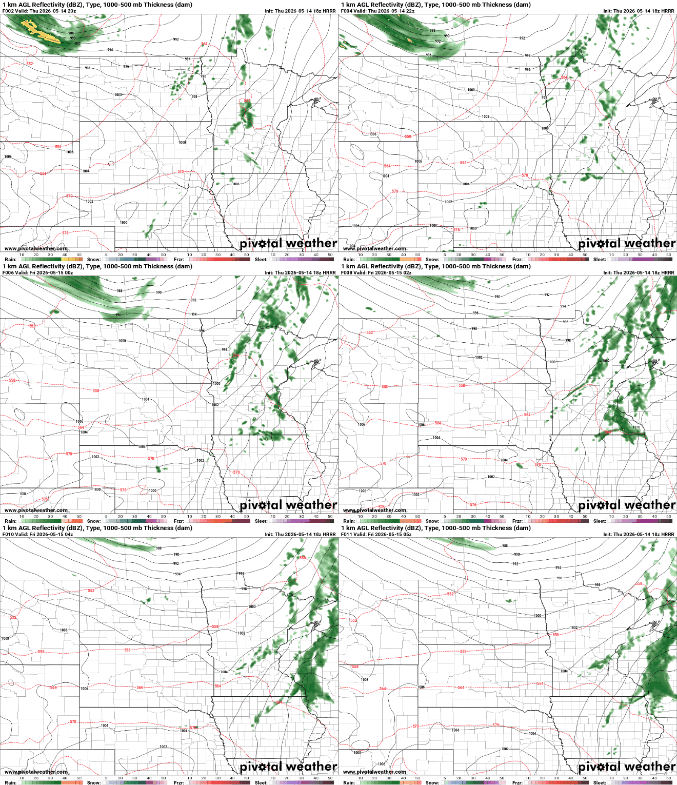
Scattered showers and a few rumbles of thunder will continue to move across the region Thursday night as a weak disturbance passes through.
Behind this activity, critical fire weather conditions are expected to develop Friday with gusty winds and very dry air leading to elevated fire danger across much of Minnesota.
Fire danger into Friday; thunderstorms move through Thursday evening
Critical fire weather conditions will continue into Friday across western, northern and central Minnesota as warm temperatures, dry air and gusty winds combine to create dangerous fire weather conditions.
A red flag warning remains in effect for much of the area, with relative humidity values expected to fall into the 10 to 20 percent range Friday afternoon.
Turn Up Your Support
MPR News helps you turn down the noise and build shared understanding. Turn up your support for this public resource and keep trusted journalism accessible to all.
Westerly winds will gust between 20 and 30 mph, with isolated gusts up to 45 to 50 mph possible across western Minnesota.

Blowing dust has also become an issue across western Minnesota Thursday due to strong southerly winds. We’ve seen some blowing dust warnings due to visibility concerns.

Visibility reductions have been reported in some areas, creating difficult travel conditions at times. While winds will shift west behind a cold front Friday and should be slightly weaker, localized blowing dust may still occur.

An air quality alert has been issued for northwestern Minnesota through 9 p.m. Friday due to coarse particle pollution from blowing dust expected to continue in the area.

With even warmer temperatures expected, our relative humidity values will dive once again into the 10 to 20-percent range. Breezy westerly winds will gusts 20 to 30 mph with some gusts up to 45 to 50 mph possible in western Minnesota.

In addition to the fire weather concerns, a broken line of showers and isolated thunderstorms will continue moving eastward across Minnesota and Wisconsin through Thursday evening.
While rainfall amounts are expected to remain light in many areas due to very dry air near the surface, some stronger wind gusts may accompany the showers.
Low temperatures drop into the 50s across the state Thursday night.

A significant warmup is expected on Friday as temperatures surge well above seasonal averages with highs reaching into the 80s and even near 90 degrees in some locations.

The second half of the weekend will bring a change in the weather pattern, introducing more Gulf moisture and increasing the chance for severe thunderstorms.
The National Oceanic and Atmospheric Administration Storm Prediction Center has issued a slight risk for severe weather across the southern half of the state on both Sunday and Monday with an enhanced risk of stronger storms Sunday in the southwestern corner of the state.

Damaging winds, large hail, heavy rainfall and a few tornadoes will all be possible if stronger storms develop. Forecast models also suggest the potential for a beneficial 1 to 3 inches of rainfall, which could help improve drought conditions across the state.
While the moderate to severe drought coverage has remained largely unchanged since last week, areas classified as abnormally dry have increased from about 30 percent to 42 percent.


