
Very warm and windy with red flag warnings Friday
Stormy pattern develops for Sunday and Monday

Go Deeper.
Create an account or log in to save stories.
Like this?
Thanks for liking this story! We have added it to a list of your favorite stories.


Very warm, dry and windy weather is leading to elevated fire weather conditions Friday. Temperatures will soar into the 80s. A stormy setup develops for Sunday and Monday.
Very warm and windy with red flag warnings Friday; stormy Sunday and Monday
We’ll have temperatures that are average for July this afternoon. Look for plenty of sunshine with highs in the 80s across southern Minnesota with 70s north.

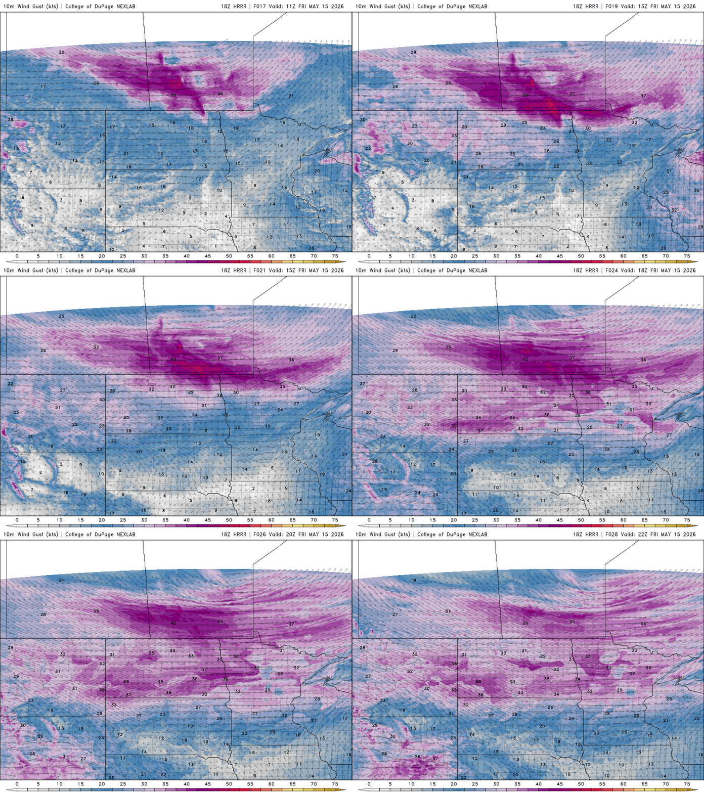
Winds will be blustery in northern Minnesota at 15 to 30 mph. Southern Minnesota winds will be a little lighter at 10 to 20 mph.
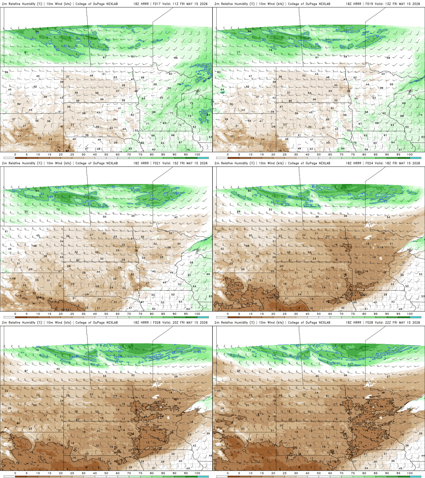
Afternoon relative humidity values will drop into the 10 to 25 percent range across the state, making for very dry conditions.
Turn Up Your Support
MPR News helps you turn down the noise and build shared understanding. Turn up your support for this public resource and keep trusted journalism accessible to all.
Red flag warnings are posted across much of central and northern Minnesota through the evening hours Friday due to those elevated fire weather concerns.
Even in the Twin Cities and southern Minnesota, fires are not advised as conditions will be dry and windy also, even if they are below red flag criteria.
The gusty winds and blowing dirt and dust are creating air quality alerts in portions of northwestern Minnesota through Friday evening.
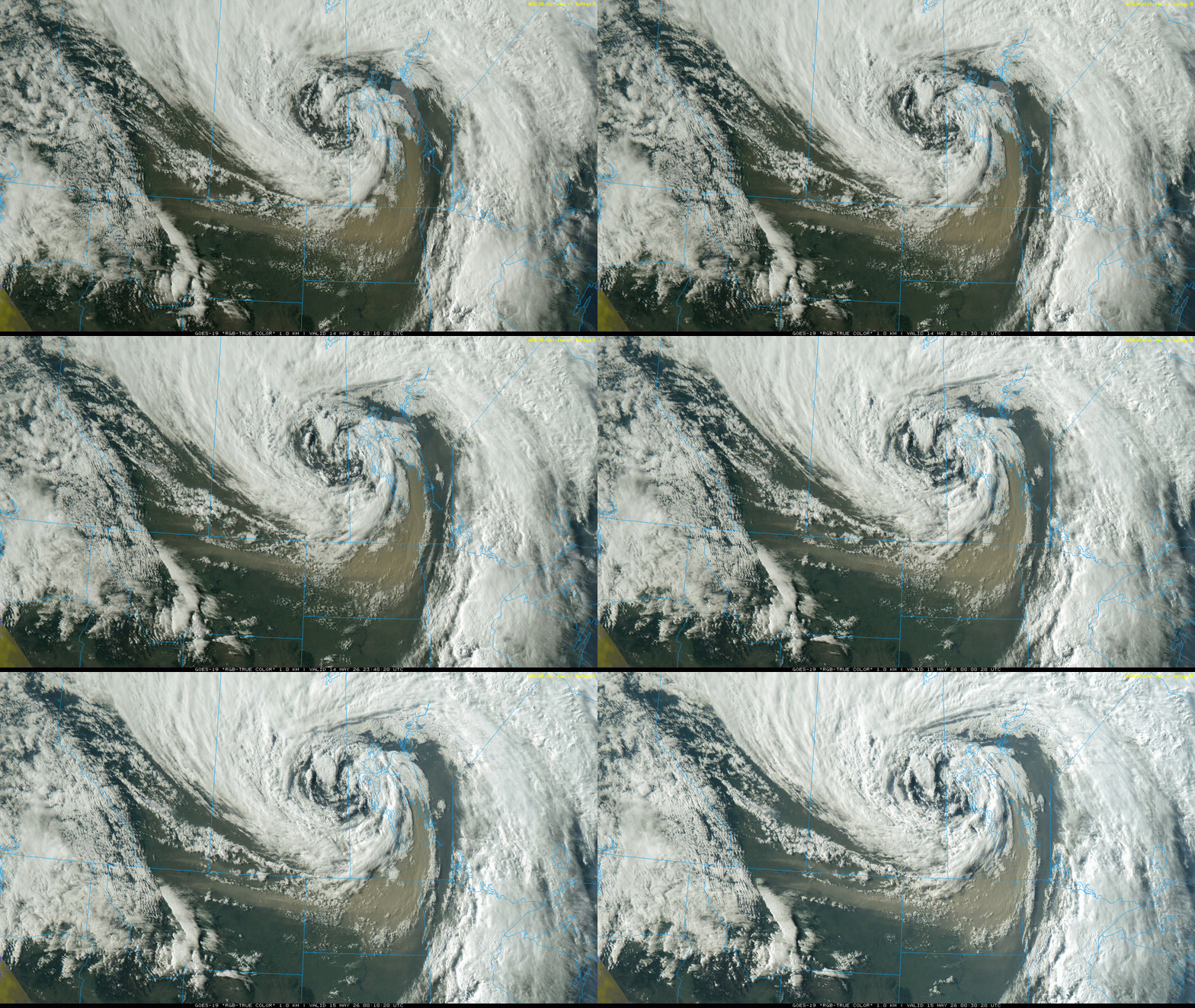
The dust is coming from north-central Montana, which is under severe drought. It blew into North Dakota and northwestern Minnesota on winds that saw gusts of 50 to 65 mph!
Here’s a visible satellite image loop from Thursday evening:
Check the latest air quality conditions, alerts and forecasts here:
That dust has dispersed and is less dense than Thursday evening in northwestern Minnesota but is still visible drifting across northeastern Minnesota and over Lake Superior.
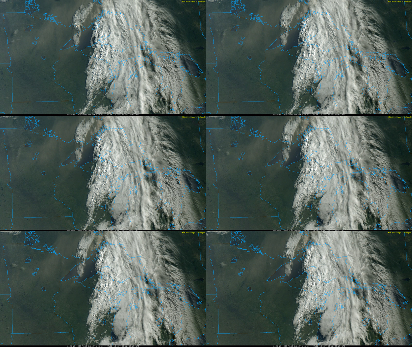
Duluth’s harbor cam shows hazy skies early Friday due to the dust in the air.

While most of Friday will be dry, some thunderstorms will develop Friday evening and overnight across far southern and southeastern Minnesota.
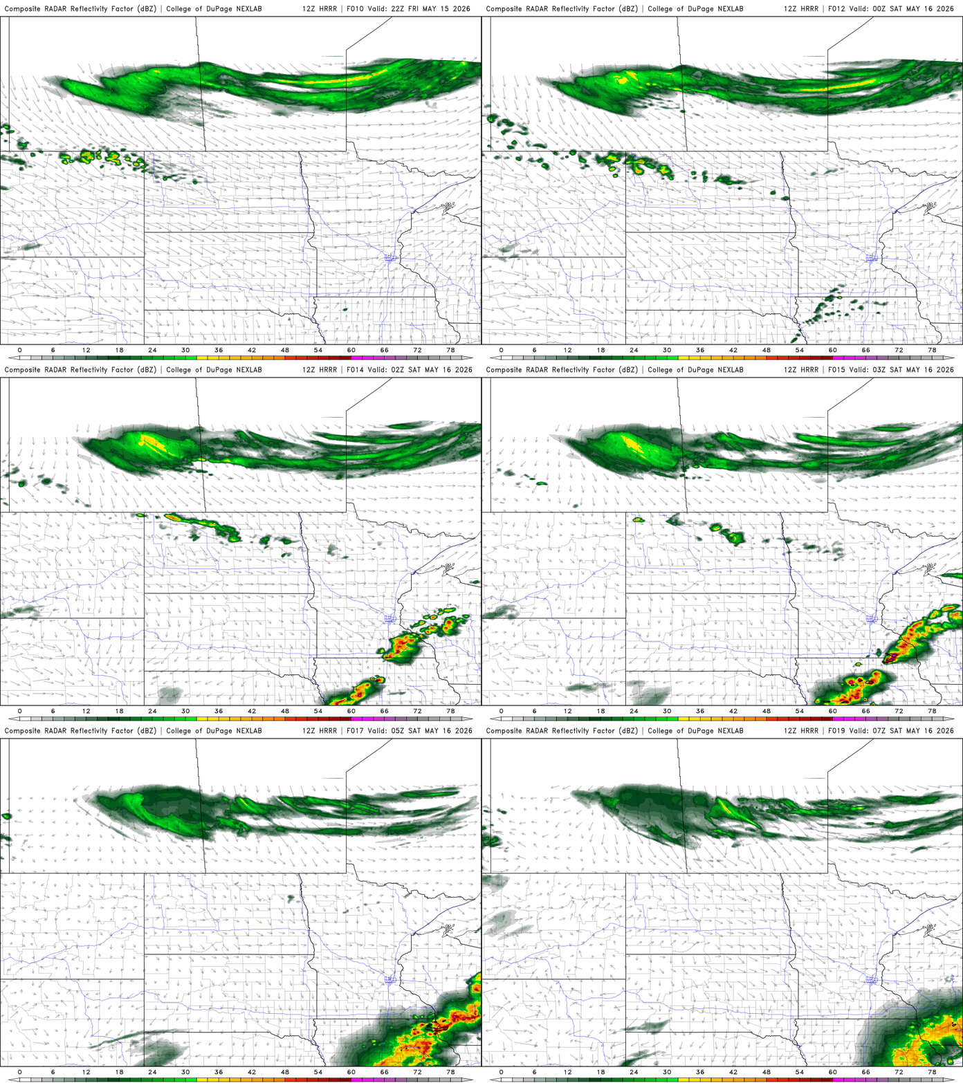
Storms that develop could produce some large hail. There’s a slight risk (level 2 of 5) for severe storms forecast for southeastern Minnesota Friday evening into Friday night.

Saturday will be very warm again but less windy with plenty of sun breaking back out. Highs will range from the low 80s south to the 70s and 60s north.

The pattern becomes much more active as several rounds of scattered showers and thunderstorms are possible starting Saturday night into Sunday through early Tuesday.
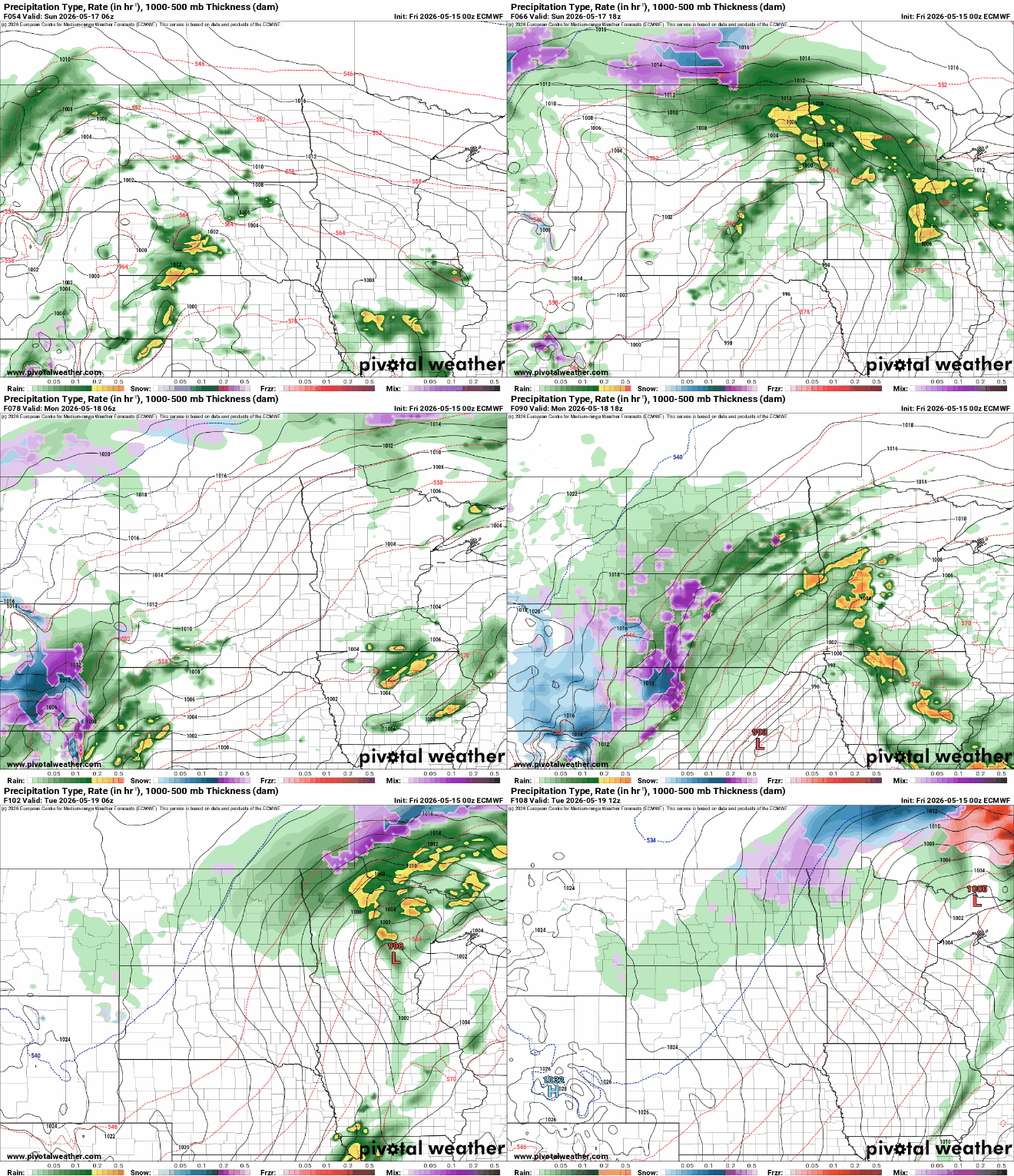
There’s a risk of severe storms especially Sunday but also Monday thanks to higher dew points and atmospheric dynamics in place to allow storms to become more organized.
The National Oceanic and Atmospheric Administration Storm Prediction Center has an enhanced risk in southwest Minnesota Sunday.

We’ll likely see a couple days of cooler weather midweek next week in the wake of the storm system. Temperatures will warm up again in time for Memorial Day Weekend.

