
Multiple rounds of strong storms expected Sunday and Monday
Cooler temperatures settle in by midweek

Go Deeper.
Create an account or log in to save stories.
Like this?
Thanks for liking this story! We have added it to a list of your favorite stories.


After a warm and dry stretch, the weather pattern is set to become much more active heading into Sunday and Monday, bringing multiple rounds of showers and thunderstorms along with the potential for severe weather across the region.
Warm, dry conditions; wet Sunday ahead
After another warm and dry day across portions of Minnesota, attention now turns to a much more active weather pattern heading into Sunday and Monday. Multiple rounds of showers and thunderstorms are expected, with severe weather looking increasingly likely Sunday evening and again Monday afternoon into Monday night.
A red flag warning remains in effect until 9 p.m. Saturday for portions of central Minnesota due to very dry conditions and gusty winds creating critical fire weather concerns.

Frosty temperatures expected across northern Minnesota have prompted the National Weather Service to issue a frost advisory for northern tier counties through 8 a.m. Sunday. Overnight lows are expected to fall into the 30s and 40s across northern and central Minnesota, while southern portions of the state hold in the 50s.
Turn Up Your Support
MPR News helps you turn down the noise and build shared understanding. Turn up your support for this public resource and keep trusted journalism accessible to all.

Thunderstorms developing across Nebraska and Iowa Saturday night are expected to move northward toward southern Minnesota by early Sunday morning. Forecast models continue to differ on exactly how widespread the morning rain and thunderstorm chances will become, but periods of showers and storms are possible across parts of the area to start the day Sunday. At this time, these early storms are not expected to become severe.
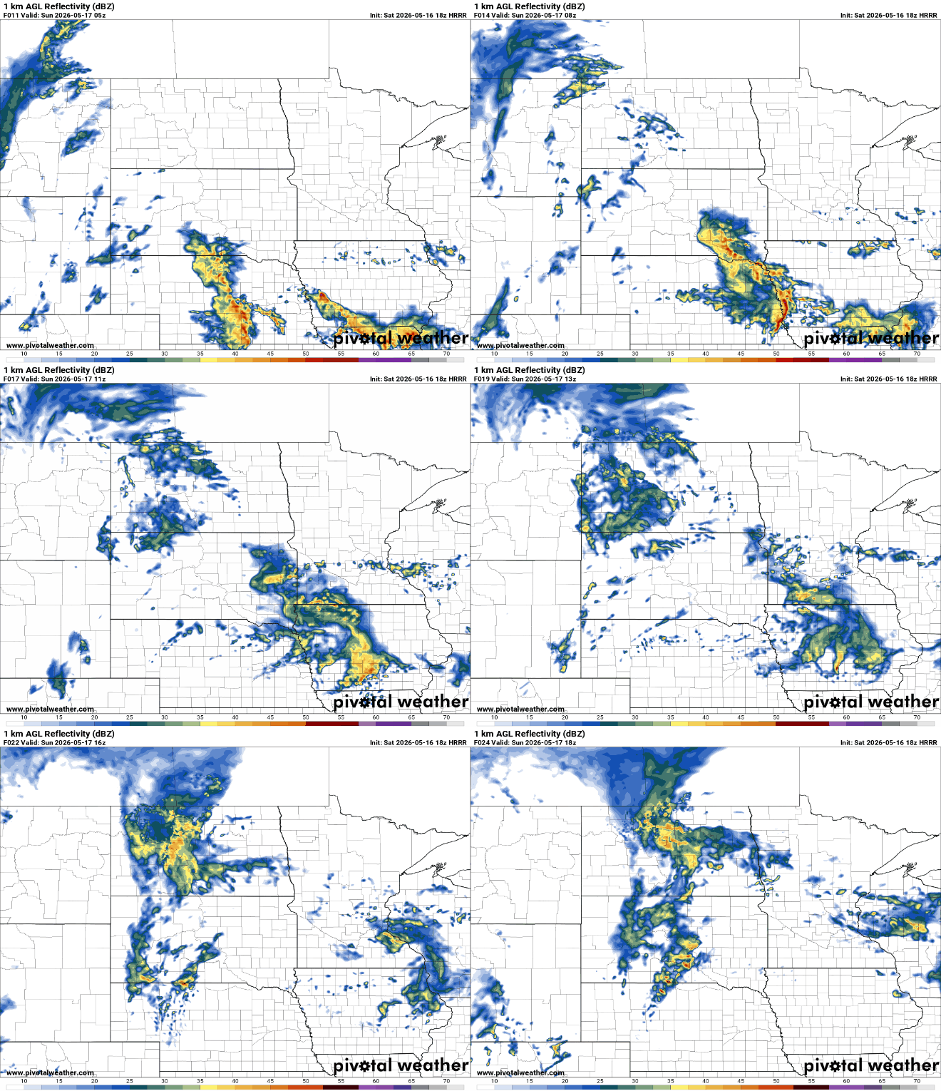
By Sunday afternoon, a warm front is expected to lift northward through the region. If enough sunshine develops behind the morning activity, the atmosphere could quickly become favorable for severe thunderstorms.
The Storm Prediction Center currently highlights much of Minnesota in a slight risk (level 2 out of 5), and an enhanced risk (level 3 out of 5) in southwestern Minnesota for severe weather Sunday.
Storms are expected to develop across portions of southeast South Dakota, eastern Nebraska, northwest Iowa, and far southwestern Minnesota late Sunday afternoon before moving east Sunday evening and overnight. All primary modes of severe weather are possible with large hail, damaging winds and isolated tornadoes.
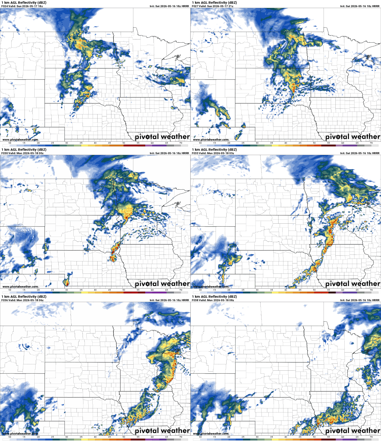
As the evening progresses, storms are expected to organize into a line while moving east reaching the Twin Cities between 10 p.m. and midnight.
Another round of thunderstorms may develop Monday afternoon and evening, especially across southern and eastern Minnesota into western Wisconsin. The Storm Prediction Center has again placed parts of the region in a slight risk (level 2 out of 5) for severe weather Monday.

Once this active stretch moves out, quieter and cooler weather is expected for the middle of next week. A much cooler air mass will settle into the region Tuesday and Wednesday, with highs struggling to reach 60 degrees in some areas.

