
More showers, storms to develop Monday followed by cooler weather
Warmer but unsettled conditions return for the weekend

Go Deeper.
Create an account or log in to save stories.
Like this?
Thanks for liking this story! We have added it to a list of your favorite stories.


We’ll see more showers and storms develop later Monday into Monday night. Cooler weather follows the system midweek. Warmer, unsettled weather returns for the holiday weekend.
More showers, storms late Monday, then a brief cooldown
Much of southern Minnesota saw some beneficial rains of 1 to 2 or more inches. Northern Minnesota saw much less or even little rainfall at all. Mapleton, south of Mankato saw a whopping 3.72 inches of rain.
Minneapolis-St. Paul International Airport received 1.14 inches of rain. Prior to Sunday night’s storm, the Twin Cities only had 4 one-hundredths of an inch of rain for the month, making it the third driest start to May.

Clouds will linger Monday and there will be quite the temperature contrast from northwest to southeast. Highs will range from near 80 in far southeastern Minnesota to the 50s far north and northwest.
Turn Up Your Support
MPR News helps you turn down the noise and build shared understanding. Turn up your support for this public resource and keep trusted journalism accessible to all.

Round two of our latest storm system will develop more showers and thunderstorms in far southern Minnesota by mid afternoon. Those showers and storms will expand north and northeast into Monday evening and overnight.
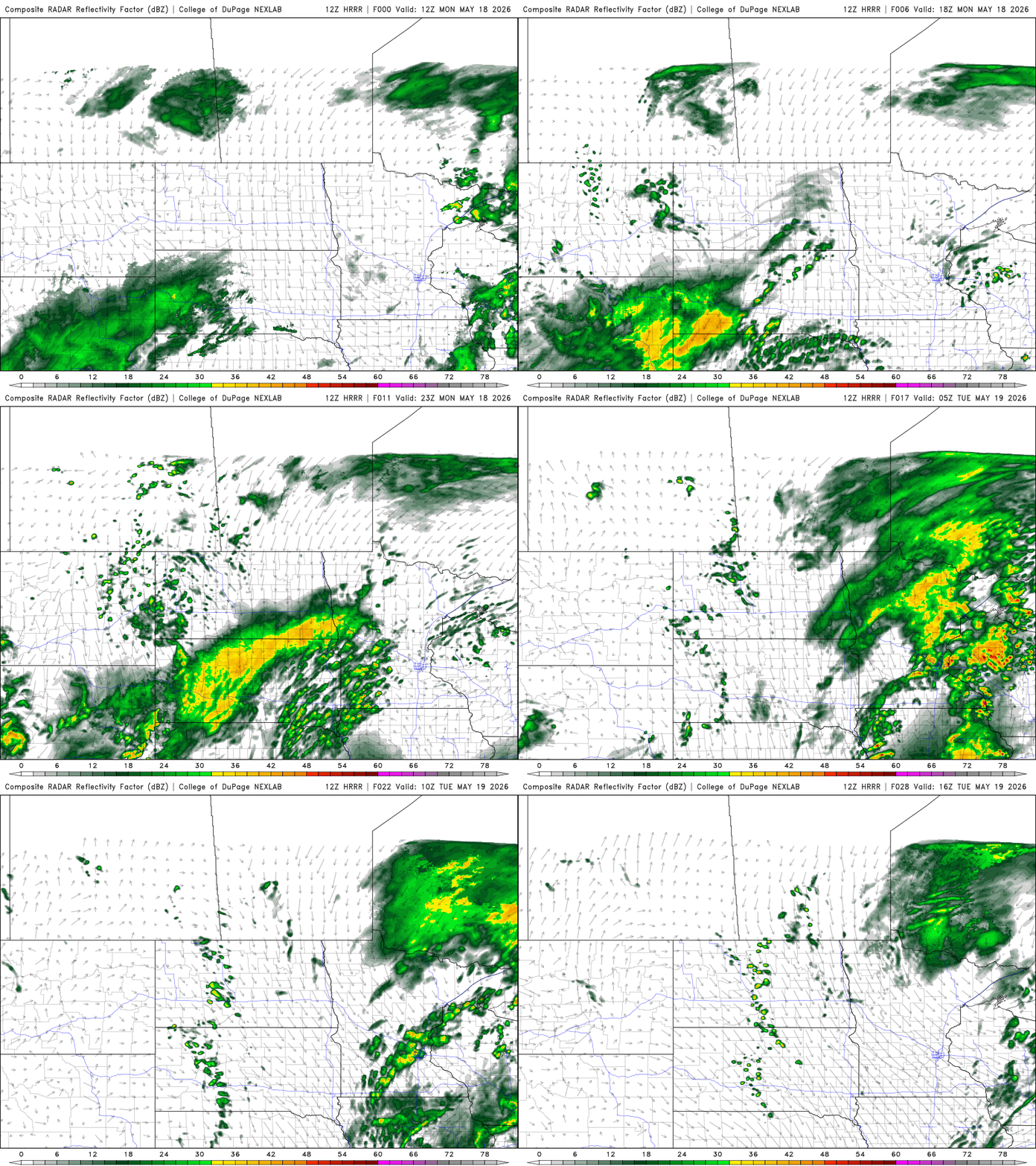
Storms that develop could be severe in southeastern Minnesota. There’s a slight risk (level 2 of 5) forecast for southeastern Minnesota Monday afternoon into Monday night.
The main threats will be large hail and damaging wind gusts in southeastern Minnesota Monday afternoon and evening.
Behind the system, cooler air will follow for midweek. Highs Tuesday will be mostly in the 50s across the state. Those readings are about 10 to 20 degrees below normal.
We’ll also see quite a bit of lingering cloud cover with some lingering showers north, especially in the morning hours.

Tuesday night will bring frosty conditions to northern Minnesota but it will be a chilly night statewide with lows ranging from the 40s southeast to near 30 degrees north.

Just in time for the holiday weekend temperatures look to warm back up into the 70s and 80s.
It will also come with some unsettled conditions, however. Some at least scattered showers and storms look likely to develop Friday and late Sunday into Sunday night with some isolated activity in between.

