
Memorial Day forecast: From unsettled to warm, sunny and gorgeous
Grilling planner looks great heading into the holiday weekend

Go Deeper.
Create an account or log in to save stories.
Like this?
Thanks for liking this story! We have added it to a list of your favorite stories.


There’s a big signal blinking in the longer range forecast, a sign of an incoming warming trend lasting well into next week.
There will be a few high clouds up in the Iron Range and North Shore for the tail end of Wednesday. We will be comfortable, with a fairly seasonable high in the lower 60s around the Twin Cities and slightly cooler farther to the north.

Some weather tools show fog developing before midnight between Lake of the Woods in northern Minnesota and Big Stone Lake in western Minnesota that could linger into Thursday morning.
Temperature-wise, we won’t be quite as cold in the Twin Cities, likely only down into the low to mid-40s. There may be some patches of frost lingering in northeastern Minnesota, but that’s not unusual even for the last few days of May.
Turn Up Your Support
MPR News helps you turn down the noise and build shared understanding. Turn up your support for this public resource and keep trusted journalism accessible to all.
Some mid-level cloud cover begins to roll into southern Minnesota from Luverne to Rochester by late Thursday morning.
We’ll drop off many of the early clouds, becoming largely sun-filled by the end of the day. Highs will move into the upper 60s by Thursday’s warmest point, likely around 4 p.m.
The high-pressure corridor begins to weaken Friday, allowing some rain showers to move in late evening. These start out in southwestern Minnesota, moving up toward St. Paul and Minneapolis after dark.
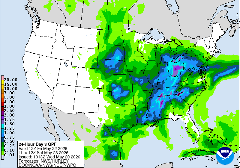
Much of the rain moves northeast by late morning on Saturday. Temperatures are still fairly standard across the state, in the mid-60s. There’s a noticeable warmup happening on Sunday. Some spots in southern Minnesota may reach 80 degrees.

We could even eclipse 80 on Memorial Day. Knock on wood, but Sunday and Monday are looking really lovely, apart from an isolated shower in the far northwestern edges of the state.
A run at the mid-80s is certainly within reason by the middle of next week, and a couple of towns could race towards an isolated 90 degrees by next Thursday!

