
Evening storm threat with a hot Memorial Day ahead
Severe thunderstorm watch in southwestern Minnesota

Go Deeper.
Create an account or log in to save stories.
Like this?
Thanks for liking this story! We have added it to a list of your favorite stories.


A slight risk for severe storms returns to parts of Minnesota Sunday night as scattered thunderstorms develop during the evening hours and track east overnight. A few storms could produce large hail and damaging winds before quieter, but much hotter, weather settles in for Memorial Day.
Stormy Sunday night
Scattered thunderstorms are expected to develop this Sunday evening across western and southwestern Minnesota before spreading eastward into central and southeastern Minnesota overnight. Some storms may also reach western Wisconsin by early Monday morning.
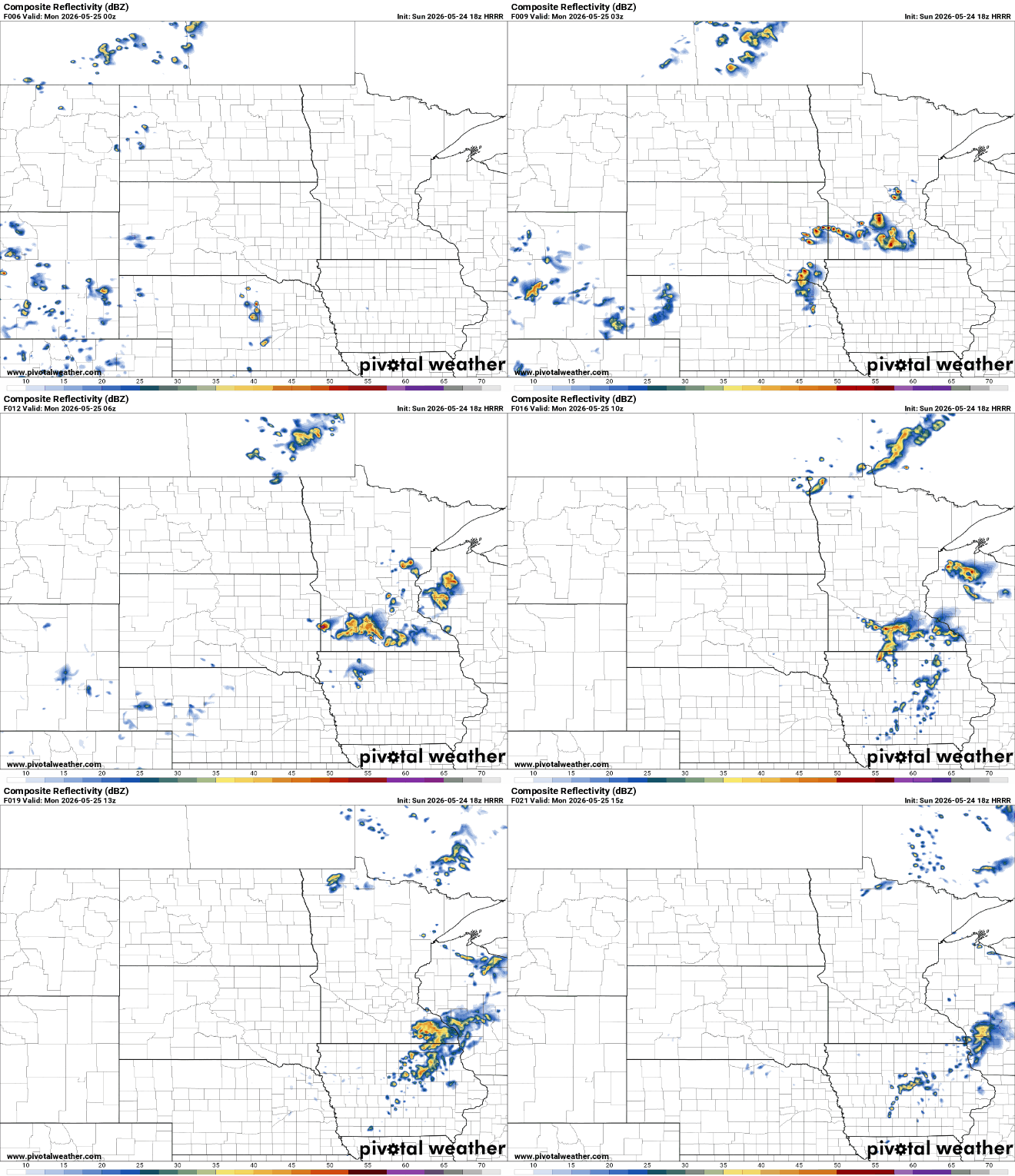
A few storms could become strong to severe, especially across southwest and west-central Minnesota. The main threats include large hail and damaging winds. The Storm Prediction Center issued a slight risk for southwestern Minnesota.
A severe thunderstorm watch is out for southwestern Minnesota until 11 p.m.
Turn Up Your Support
MPR News helps you turn down the noise and build shared understanding. Turn up your support for this public resource and keep trusted journalism accessible to all.

URGENT - IMMEDIATE BROADCAST REQUESTED Severe Thunderstorm Watch Number 243 NWS Storm Prediction Center Norman OK 455 PM CDT Sun May 24 2026 The NWS Storm Prediction Center has issued a * Severe Thunderstorm Watch for portions of Northwest Iowa Southwest Minnesota Northeast Nebraska Southeast South Dakota * Effective this Sunday afternoon and evening from 455 PM until 1100 PM CDT. * Primary threats include... Scattered large hail and isolated very large hail events to 2 inches in diameter possible Isolated damaging wind gusts to 65 mph possible SUMMARY...High-based supercells are expected from northeast Nebraska across southeast South Dakota into southwest Minnesota this evening, and storms could spread into northwest Iowa before weakening early tonight. The storms will be capable of producing large hail (1.5-2 inches in diameter) and isolated severe outflow gusts (60-65 mph). The severe thunderstorm watch area is approximately along and 65 statute miles east and west of a line from 40 miles north of Redwood Falls MN to 30 miles west southwest of Norfolk NE.
Storms develop in the early evening hours and will rapidly move east towards western Wisconsin by early Monday morning.

Mild overnight temperatures will only fall into the 50s and 60s across most of Minnesota and western Wisconsin, though cooler air across the Arrowhead region will allow lows to dip into the 40s.

By Memorial Day morning, lingering showers and storms should move out, with skies gradually clearing through the late morning hours.
The afternoon will feel much more summer-like as southerly winds increase and temperatures surge into the upper 80s.

Humidity levels will also begin to rise, with dew points climbing into the lower 60s and lasting through at least midweek.
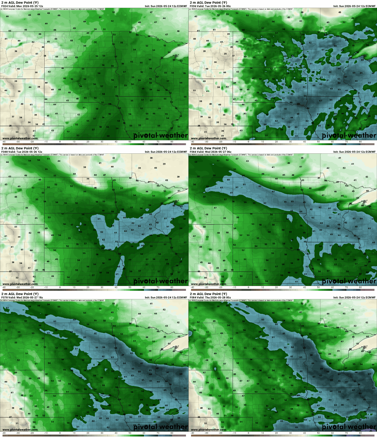
The warmest stretch of the forecast arrives Tuesday, with low 90s scattered across the maps.

After our tease of summer, we’ll see a dry, more comfortable weather pattern take hold to start meteorological summer. Expected more seasonal temperatures and dew points dropping into the 30s and 40s.

