
Spotty thunderstorms, very warm Tuesday and Wednesday
Scattered morning storms south; spotty storms for the afternoon, evening

Go Deeper.
Create an account or log in to save stories.
Like this?
Thanks for liking this story! We have added it to a list of your favorite stories.


It’ll be a very warm day Tuesday with highs in the 80s to near 90. Spotty thunder is possible Tuesday and Wednesday followed by high pressure making for dry, warm weather.
Heating up Tuesday with spotty thunder into Wednesday
We have an unsettled atmosphere Tuesday and Wednesday with higher dew points and a slow-moving frontal boundary.
Showers across southern Minnesota will continue to dwindle through midmorning Tuesday. Clouds will decrease through the morning but more spotty storms will develop late this afternoon and evening.
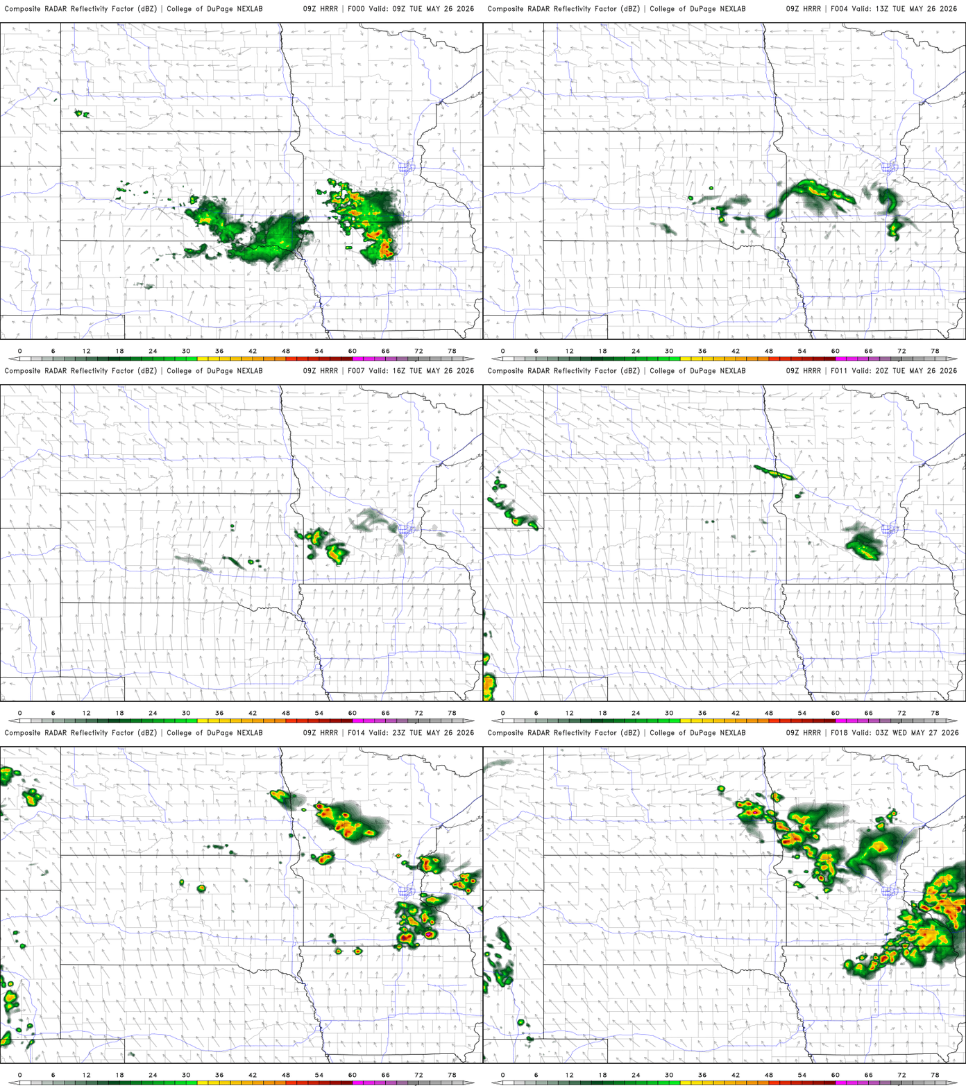
There’s a marginal risk (level 1 of 5) for severe storms Tuesday. A couple of isolated storms could produce some high wind gusts and large hail.
Turn Up Your Support
MPR News helps you turn down the noise and build shared understanding. Turn up your support for this public resource and keep trusted journalism accessible to all.
It will be very warm Tuesday with highs well into the 80s and low 90s across southern and western Minnesota Tuesday afternoon.

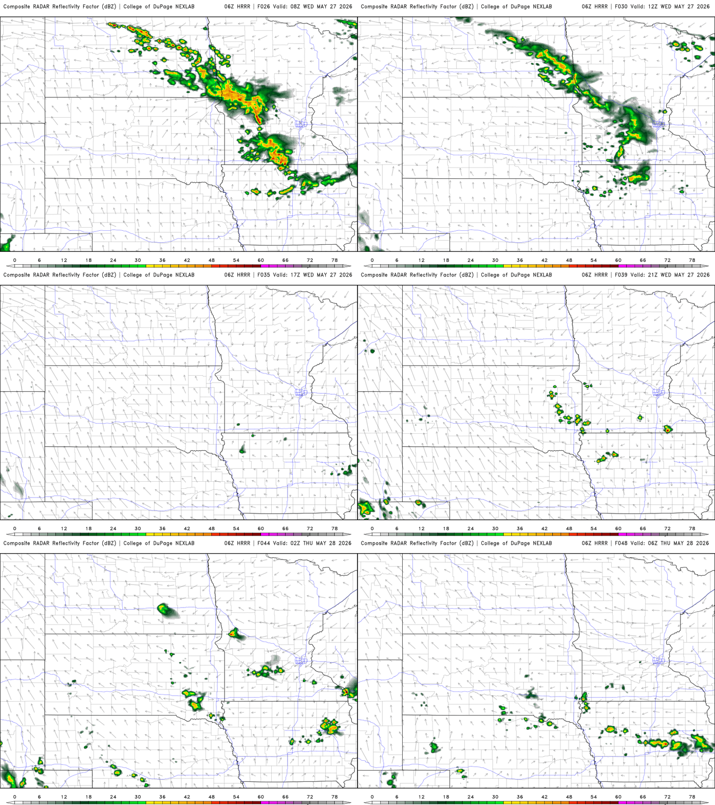
Wednesday will be another warm and somewhat unsettled day. Highs will again be in the 80s for much of central and southern Minnesota.

More isolated storms are possible early in the day Wednesday with storms redeveloping again Wednesday afternoon and evening.
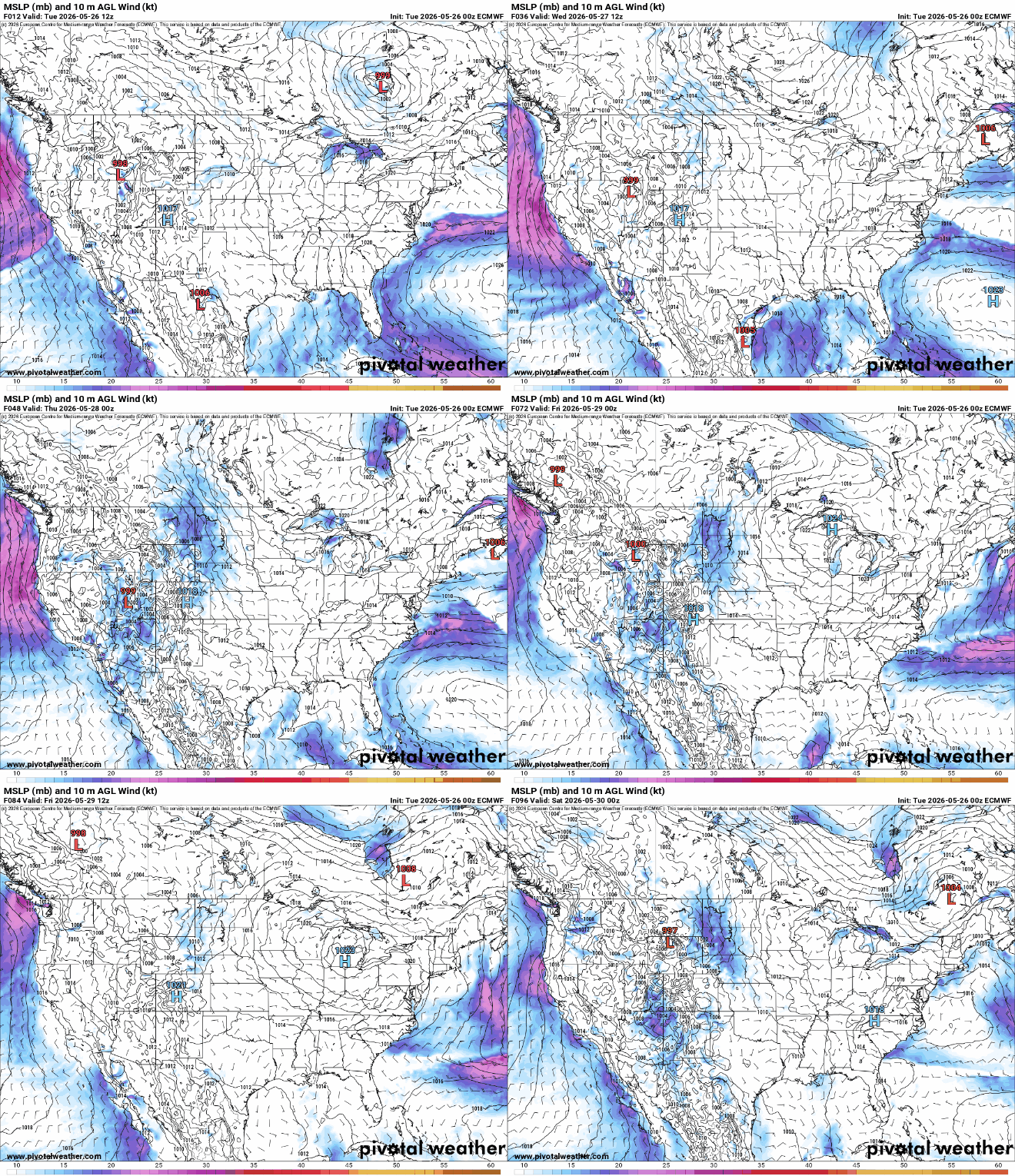
An area of high pressure will move in from Hudson Bay Wednesday night into Thursday. It will flush out the instability of Tuesday and Wednesday, giving way to several days of sunshine and just slightly cooler weather.
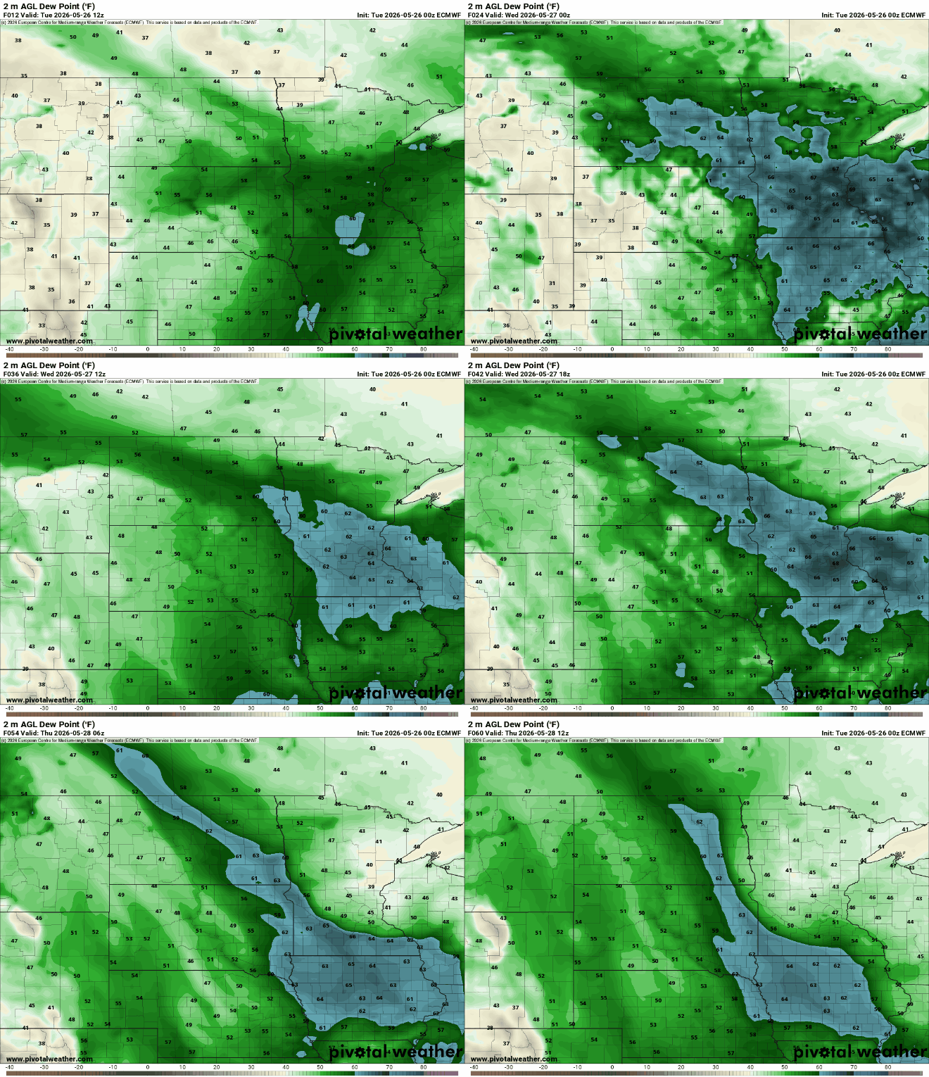
The high pressure will bring a drop in dew points that will calm down the atmosphere over Minnesota. Dew points will be in the 60s across southern Minnesota Tuesday and Wednesday but fall into the 50s and even 40s at times Thursday into the weekend.
The end of the week and last weekend of May is looking very nice. Temperatures will be slightly cooler, mostly in the low to mid 80s versus the upper 80s with upper 70s in northern Minnesota along with days of sunshine.


