
Steamy again Wednesday with isolated, spotty thunder
Sunshine, dry weather Thursday into the weekend
Go Deeper.
Create an account or log in to save stories.
Like this?
Thanks for liking this story! We have added it to a list of your favorite stories.


It’ll be another very warm, muggy day Wednesday. Isolated and spotty thunder will be possible again. High pressure brings more stable conditions Thursday into the weekend.
Another steamy day Wednesday before slightly cooler, drier air returns
We’re in for another very warm and relatively steamy day across southern Minnesota once again. Afternoon highs will be well into the 80s with some low 90s. Dew points will be in the low to mid-60s across the southern half of the state.

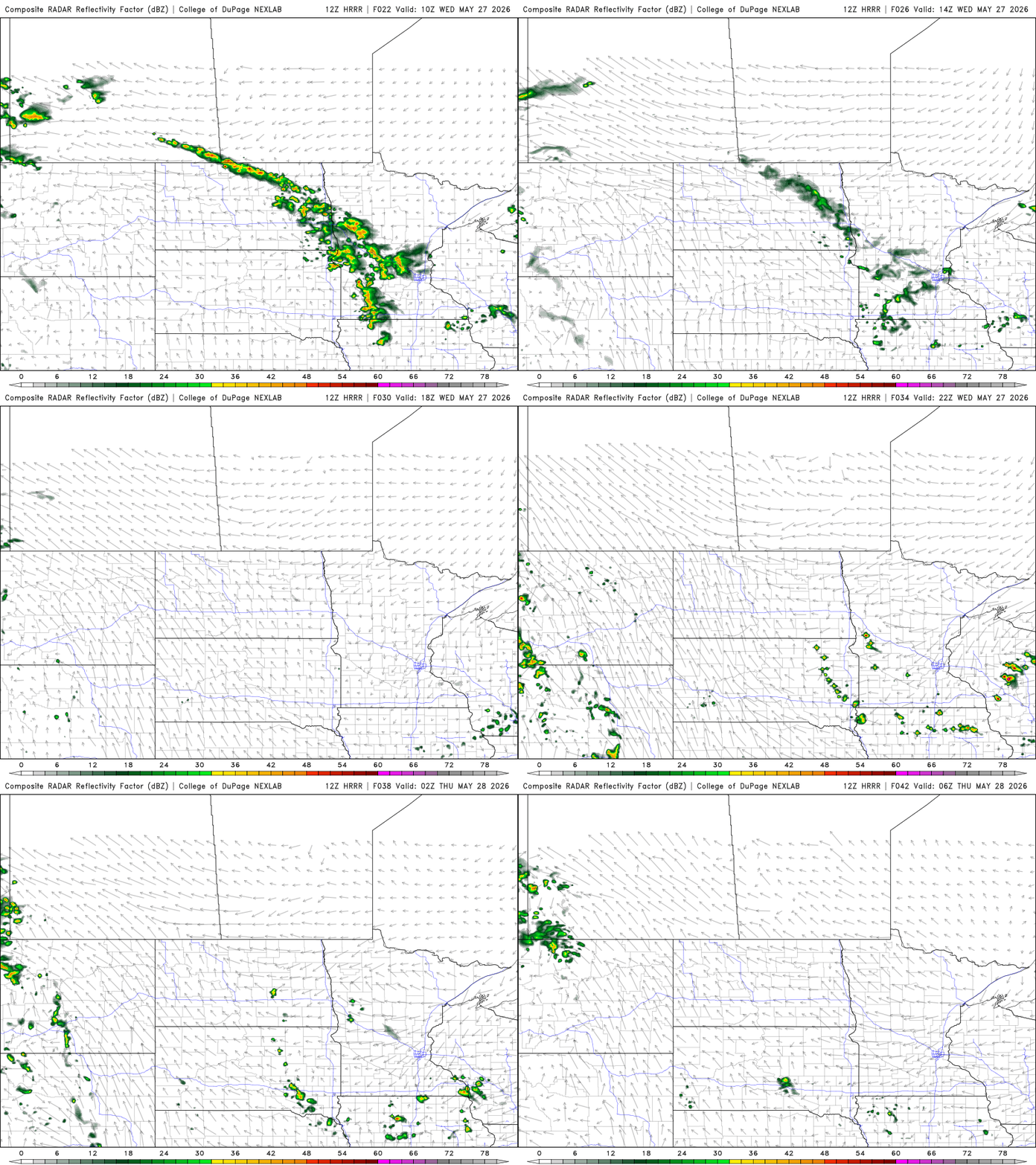
A slowly moving frontal boundary will bring a wind shift and some drier dew points Wednesday night into Thursday, but it will also be the focus for more isolated thunderstorm development Wednesday.
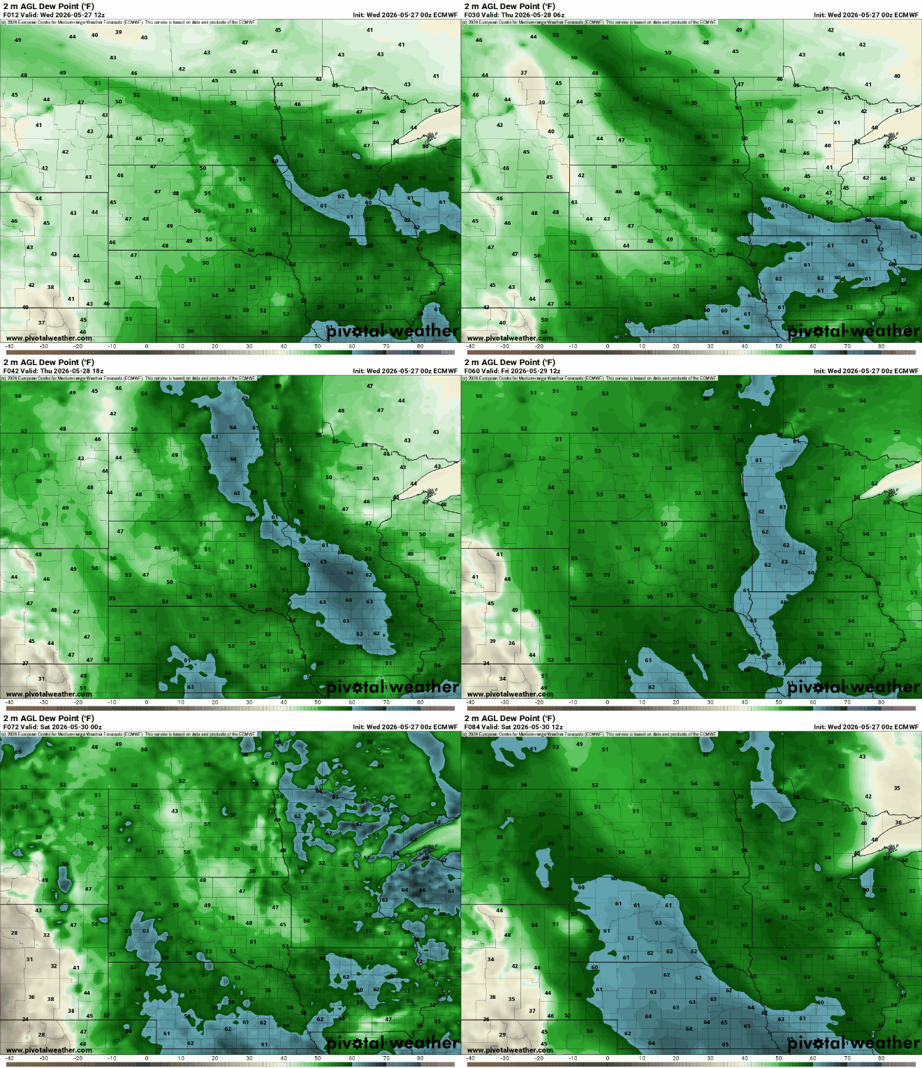
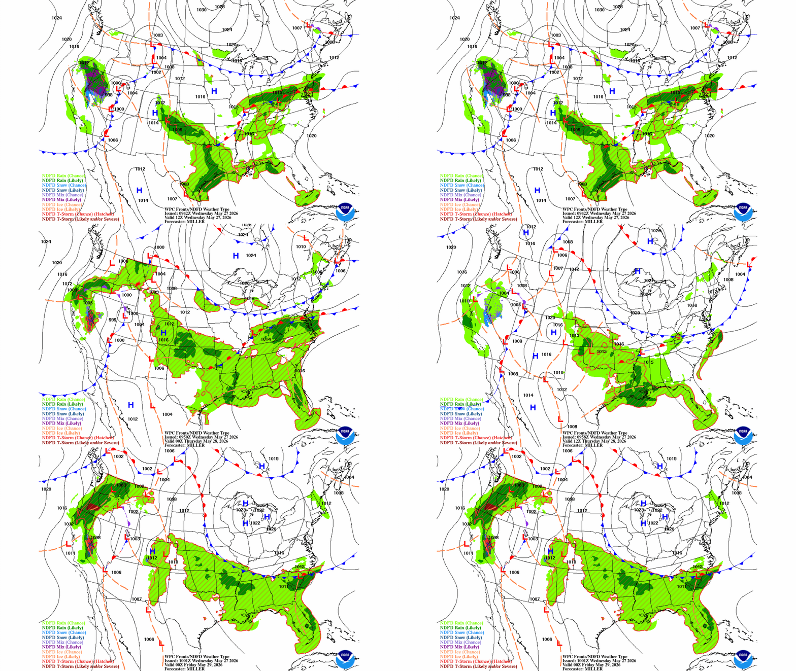
That frontal boundary — a backdoor cool front — will stall in western Minnesota Thursday creating a temperature and dew point divide from east to west.
Turn Up Your Support
MPR News helps you turn down the noise and build shared understanding. Turn up your support for this public resource and keep trusted journalism accessible to all.
Behind the front, dew points will drop for Thursday but the muggier air mass won’t go too far. Sticky dew points will push just into western Minnesota, Iowa and the Dakotas for a couple of days.
More stable high pressure builds in from Hudson Bay for Thursday into the weekend. Temperatures will be just slightly cooler and less humid but that will make for lots of sunshine and dry weather. Highs Thursday will be in the 70s north to low to mid-80s west.

The streak of dry, stable days persists into the weekend and early next week. It’ll start to get pretty dry around here as conditions are expected to remain warmer and drier than normal across much of the region the next two weeks.

Most forecast models have us wracking up rainfall deficits of 1 to 3 inches across much of Minnesota in the coming 10 days to two weeks. We need at least 1 inch of rain per week this time of year to keep up with normal.
The strongest sunshine of the year can really dry things out in a hurry.


