
Warmer-than-normal temperatures continue to dominate
Some rain, thunder chances for western Minnesota

Go Deeper.
Create an account or log in to save stories.
Like this?
Thanks for liking this story! We have added it to a list of your favorite stories.


Temperatures will average 10 to 15 degrees above normal this weekend and into next week. Some rain and thunder chances will sneak into mainly western Minnesota Friday and this weekend.
Much warmer and drier than normal; some thunder chances west
It’ll be another very warm day Friday across the state of Minnesota. Look for sunshine through high clouds with highs in the low 90s north and low 80s southwest.

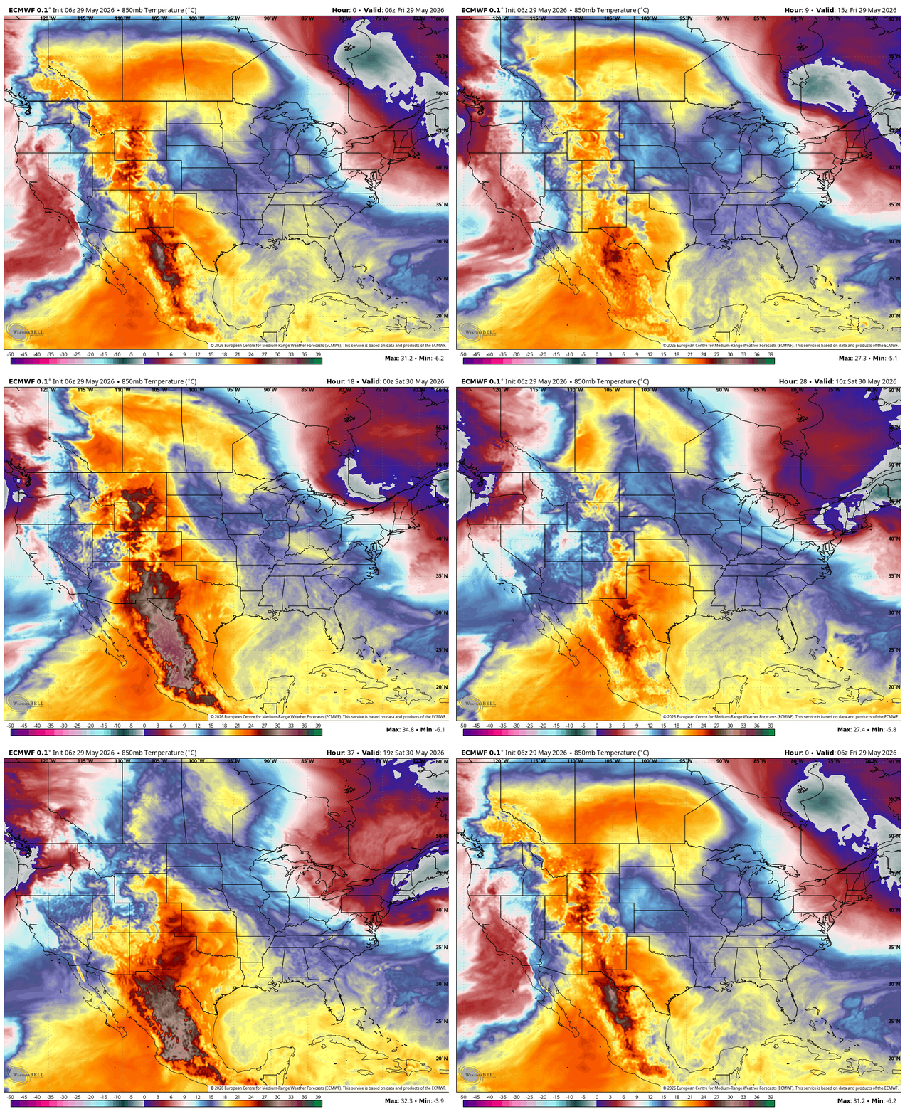
The flipped temperature profile from normal is the result of the center of the heat being pinched off in central Canada and to the west. These are forecast lower-level temperatures Friday into the weekend at about 4,000 feet above the surface:
There’s an air quality alert Friday afternoon and evening for ozone in the Twin Cities metro area, the result of a chemical reaction with pollutants, such as nitrogen oxides from auto exhaust and industrial pollutants, and strong sunshine that gets trapped in the lower atmosphere.
Turn Up Your Support
MPR News helps you turn down the noise and build shared understanding. Turn up your support for this public resource and keep trusted journalism accessible to all.
Ozone in the stratosphere is beneficial, absorbing damaging ultraviolet radiation.

Check the latest air quality conditions, alerts and forecasts here:
As the upper-level high and heat dome eases its grip some, high clouds and scattered mid-level clouds will be sneaking in from the southwest as well as higher dew points once again.
This will bring chances of spotty showers and thunder to mainly western Minnesota Friday and over the weekend.
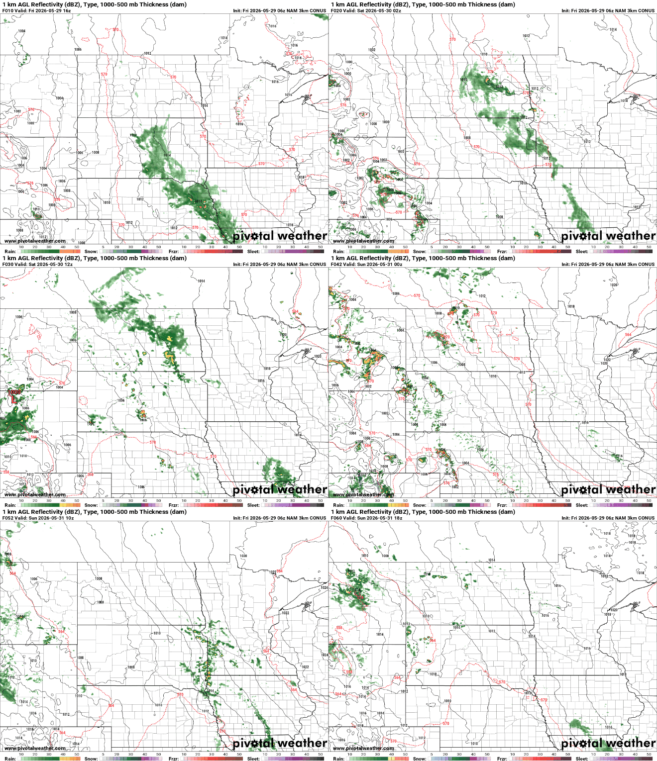
Rainfall through early Monday will be confined to just western and mostly southwest Minnesota. Some forecast models dump slightly higher amounts, but overall the average among the models is less than one-half inch and eastern Minnesota likely remains dry.

Saturday and Sunday will both continue to be very warm with highs mostly in the 80s across the state.
The cooler spots will continue to be southwestern Minnesota with the most clouds and shower chances on the southwestern edge of the receding upper level high pressure heat dome.

That western edge of the heat will allow higher dew points and the chance of some spotty showers and thunder to sneak a little bit further east early next week.
Overall, the pattern continues to be warmer and drier than normal into next week. High temperatures will remain in the 80s, which is still about 10 to 15 degrees above normal.

It’s worth a reminder that the normal high doesn’t reach 80 degrees in the Twin Cities until June 17, even if we’re impatient for those summer days.

