
Summer-like warmth holds strong through the start of meteorological summer
10-15 degree temperature anomalies expected
Go Deeper.
Create an account or log in to save stories.
Like this?
Thanks for liking this story! We have added it to a list of your favorite stories.


Little change is expected in Minnesota's weather pattern as we head into Sunday. Warm temperatures and periodic chances for showers and thunderstorms will continue, with the greatest rain chances remaining across portions of western and southern Minnesota.
Rain potential stays west with summer-like temperatures
While much of Minnesota has enjoyed a warm and mostly dry Saturday, a few pockets of unsettled showers have persisted across the western part of the state. Scattered showers and lingering cloud cover have primarily affected southwestern and western Minnesota, while areas farther east have remained largely rain-free.
Look for low temperatures to drop into the 50s Saturday night across much of the state. Cooler temperatures in the 40s are expected across northeastern Minnesota, where easterly winds off Lake Superior will continue to keep conditions cooler along the North Shore and surrounding areas.

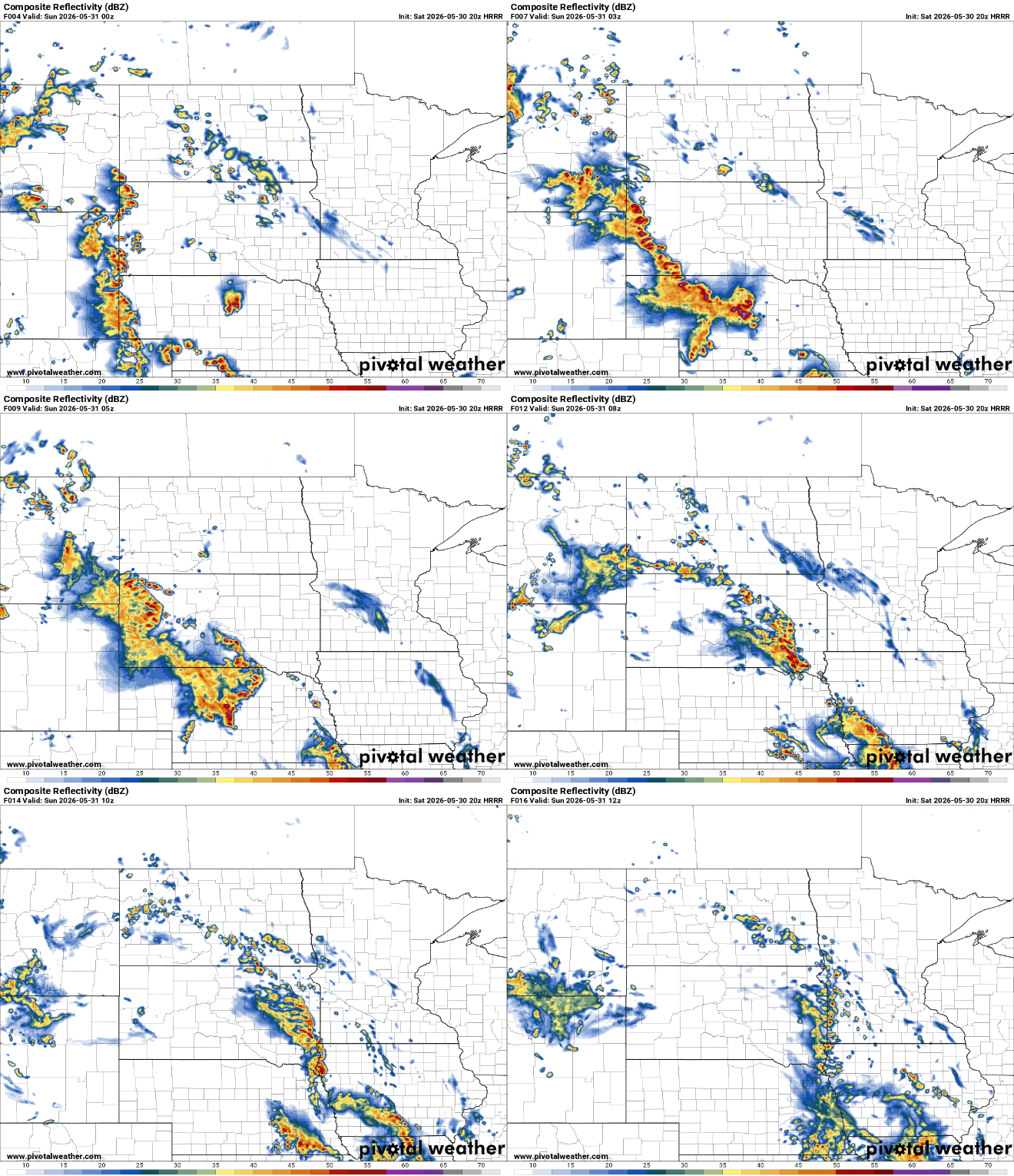
Additional chances for showers and thunderstorms will develop Saturday night into early Sunday, once again primarily affecting western and south-central Minnesota.
Turn Up Your Support
MPR News helps you turn down the noise and build shared understanding. Turn up your support for this public resource and keep trusted journalism accessible to all.
Our copy-and-paste forecast continues into Sunday, with highs climbing into the upper 70s to middle 80s statewide. Additional chances for showers and thunderstorms will once again be found across western and southern Minnesota, although the favored corridor for precipitation will nudge slightly farther east than it was on Saturday.

By Wednesday and Thursday, the large ridge of high pressure that has dominated the Upper Midwest will begin to weaken and shift eastward. As this occurs, southwesterly flow aloft will develop across the region, allowing temperatures to climb slightly while increasing the potential for more widespread showers and thunderstorms.
Looking ahead, the overall temperature pattern through early June continues to favor above-average warmth across the Upper Midwest, with forecast anomalies indicating temperatures several degrees above seasonal norms.

Our current forecast models suggests Wednesday into Thursday may provide the best chance for area-wide showers and thunderstorms during the upcoming week.

