
Storm chances increase for Wednesday and Thursday
Heavy rainfall possible

Go Deeper.
Create an account or log in to save stories.
Like this?
Thanks for liking this story! We have added it to a list of your favorite stories.


Minnesota is about to trade sunshine for storm chances as a more active weather pattern settles into the Upper Midwest.
While a few storms could become severe, the bigger story may be the opportunity for widespread, beneficial rainfall as meteorological summer gets underway.
Trading sunshine for storm chances
High pressure centered over the Great Lakes continues to provide dry, summerlike conditions across Minnesota and Wisconsin. Temperatures will remain above average, and most communities can expect pleasant weather through at least Wednesday afternoon.
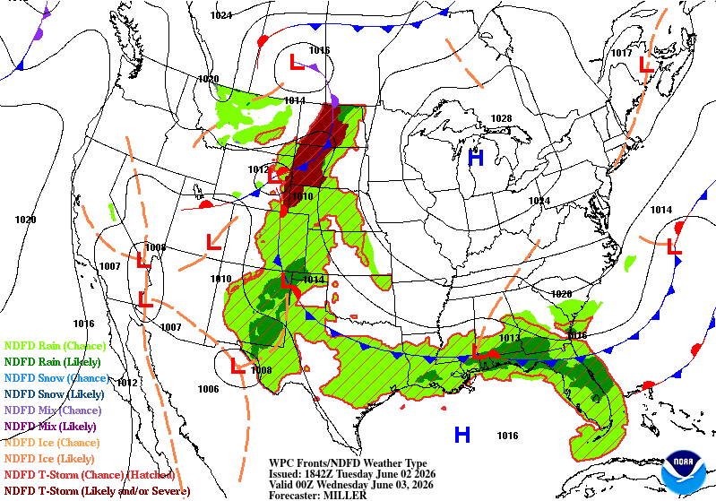
Meanwhile, a developing weather boundary over the Dakotas will gradually shift eastward toward western Minnesota later Wednesday and be the focus for thunderstorm development.
Turn Up Your Support
MPR News helps you turn down the noise and build shared understanding. Turn up your support for this public resource and keep trusted journalism accessible to all.
Thunderstorms are expected to develop across western Minnesota Wednesday afternoon and evening before gradually moving east overnight.
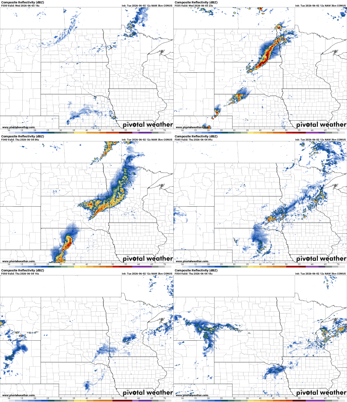
The National Oceanic and Atmospheric Administration’s Storm Prediction Center has placed areas west of Interstate 35 under a marginal risk (level 1 of 5) for severe thunderstorms.

Forecast wind shear values Wednesday evening are expected to increase into the 35 to 50 knot range across parts of Minnesota. While this doesn't suggest a widespread severe weather outbreak, it is enough to help thunderstorms organize and produce isolated large hail and damaging winds.

Thursday appears to be the most active day of the week. The entire region is currently under a marginal risk (level 1 of 5) for severe weather Thursday afternoon and evening.

Heavy rainfall a concern
One aspect of this week's storm system that bears watching is the amount of moisture available in the atmosphere. Forecast precipitable water values are expected to climb to around 1.75 inches by Thursday, which is well above average for early June in Minnesota.
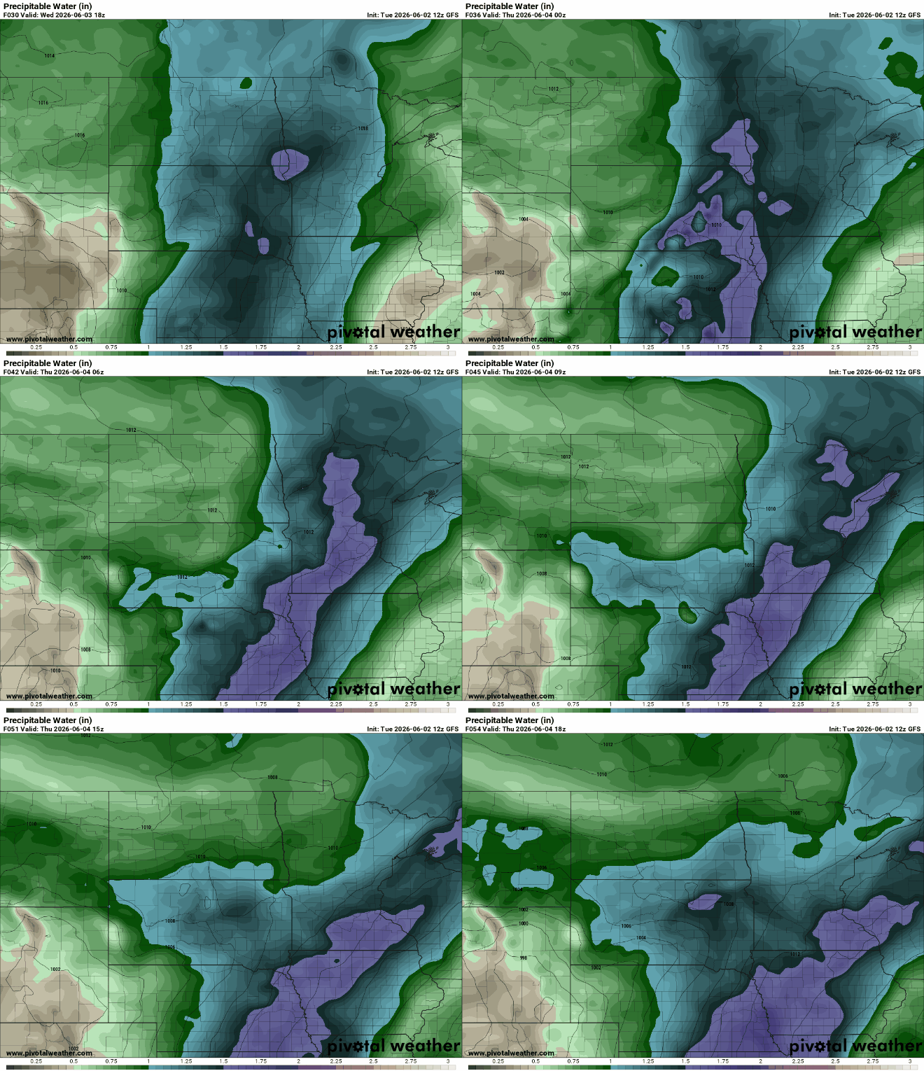
Precipitable water is a measure of how much water vapor is available for storms to work with. Higher values often mean more efficient rainfall production.
Rainfall amounts through early Saturday could range from 1 to more than 2 inches across parts of Minnesota, providing much-needed moisture for crops, lawns and gardens.
The key will be storm movement.
Fast-moving thunderstorms would help spread beneficial rainfall over a wider area, while slower-moving or repeatedly developing storms could lead to localized pockets of excessive rainfall, similar to what some communities experienced over the weekend.

Bring on the rain chances. While a few stronger storms will be possible, much of Minnesota could benefit from a widespread soaking rain as we begin meteorological summer.

