
Dry for most Wednesday ahead of increasing thunder chances
A mainly dry, warm weekend is shaping up
Go Deeper.
Create an account or log in to save stories.
Like this?
Thanks for liking this story! We have added it to a list of your favorite stories.


Most of Minnesota will remain dry Wednesday with high clouds increasing. Scattered storms move into western Minnesota Wednesday evening. Storm chances increase statewide into Thursday and Friday.
Mostly dry Wednesday; rain, thunder chances ahead
Wednesday’s another warm, dry day for most of Minnesota.
High and mid-level clouds will start to increase ahead of showers and thunderstorms to the west. Highs will be mostly in the low to mid-80s. South winds will increase at 10 to 20 mph, increasing dew points through the day.

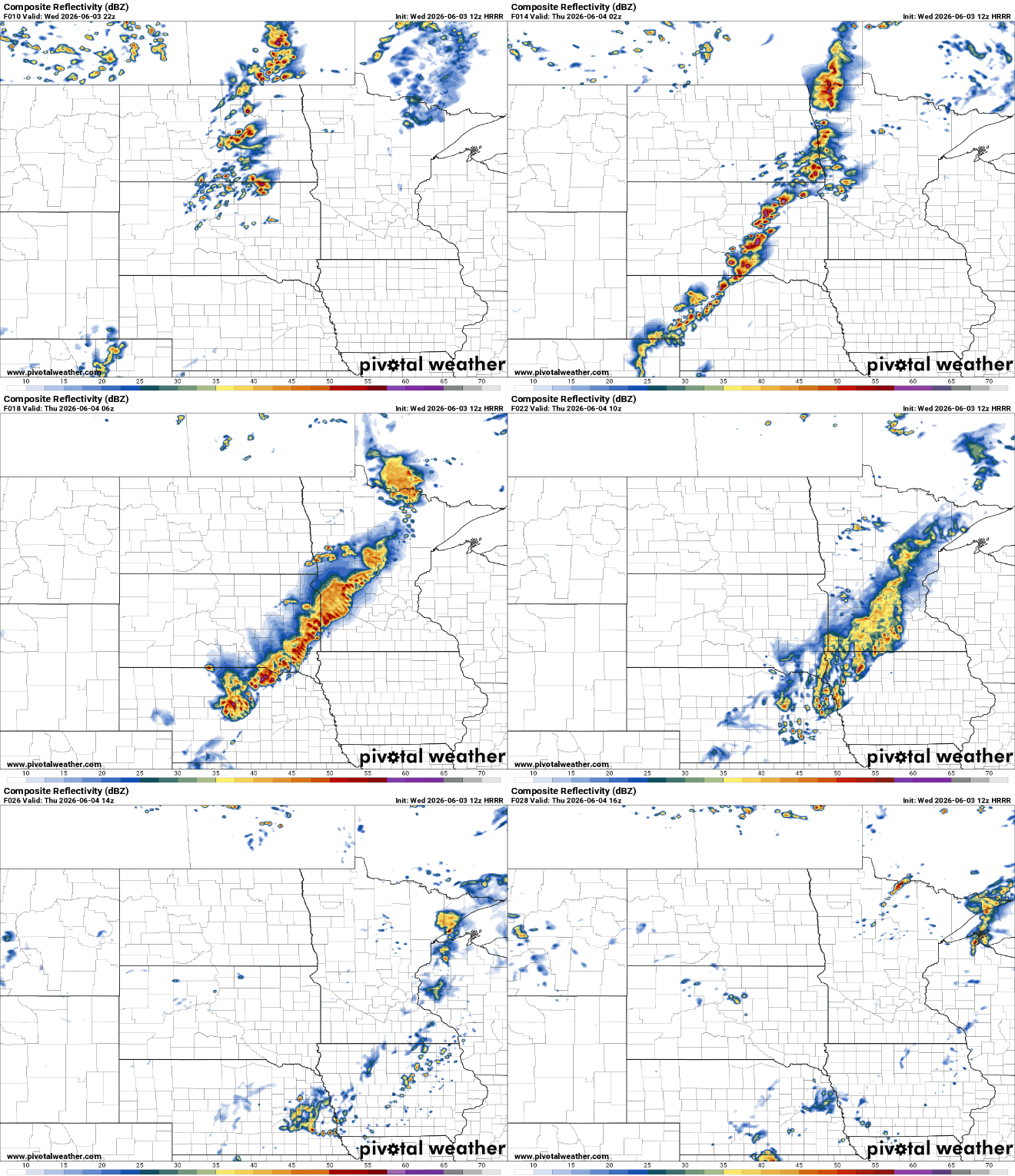
Scattered showers and thunderstorms will develop in the Dakotas Wednesday afternoon and push into far western and northwestern Minnesota into the evening and overnight.
Turn Up Your Support
MPR News helps you turn down the noise and build shared understanding. Turn up your support for this public resource and keep trusted journalism accessible to all.
Those showers and storms will mostly weaken as they track east overnight, but we should all see at least a little bit of rain.
There’s a slight risk (level 2 of 5) of severe storms in far west-central and northwestern Minnesota due to the evening timing of storms arriving there. The severe threat greatly diminishes as this line weakens and moves east into early Thursday.

We’ll see more spotty development again later in the day Thursday with additional chance of rain, thunder into Friday. None of it will be all day or all night in nature but more spotty and scattered in nature.
Thursday and Friday activity will depend upon activity prior to it, so there’s low confidence in placement and timing of activity for Thursday and Friday at this point.
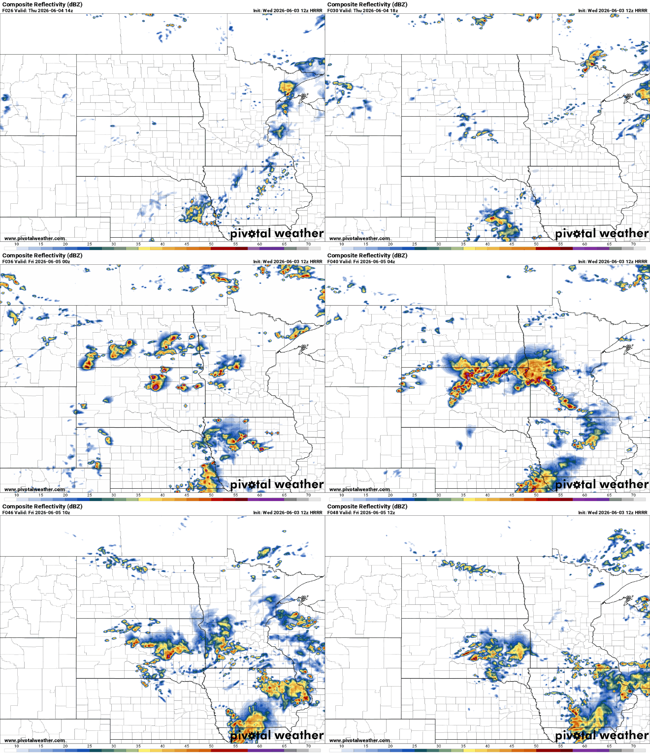
There’s another risk for potentially severe weather, mainly in western Minnesota Thursday into Thursday night.

Multiday rainfall totals will vary widely due to the nature of thunderstorms, but widespread amounts ranging from one-half inch to 1.5 inches could fall across central, southern and western Minnesota with much less rain in northeastern Minnesota.
Unfortunately, most forecast models are trending downward for total rainfall into Friday night.

The unsettled weather largely departs for the weekend. We’ll have just isolated thunder chances Saturday and Sunday with highs back in the 80s and brighter skies again.
The question for next week is where the upper-level high-pressure ridge — the heat dome — sets up.
If it’s farther east, we could see more stormy activity. If it’s more centrally located, we may be drier and hotter.
Here are two pretty different forecast model scenarios for Wednesday next week:

Stay tuned! Either way, temperatures look to trend upward next week.

