
Spotty to scattered rain, thunder chances through Friday
A mainly dry, warm weekend is shaping up
Go Deeper.
Create an account or log in to save stories.
Like this?
Thanks for liking this story! We have added it to a list of your favorite stories.


We’ll have some additional chances at spotty to scattered shower and thunderstorm development through Friday. The weekend is shaping up to be mainly dry and very warm.
More chances at rain, thunder through Friday then a mostly dry weekend
Areas mainly west saw some decent rainfall overnight Wednesday night into early Thursday.
Ivanhoe, Canby and Fergus Falls were a few places that saw more than 1 inch of rainfall. The line of storms fizzled pretty quickly as they moved east leaving most of the Twin Cities with a trace to just one-fifth of an inch.

We’ll see a mix of clouds and sun develop midday. That will help warm temperatures back up into the 70s and 80s for most, along with higher dew points Thursday, mostly in the 60s.
Turn Up Your Support
MPR News helps you turn down the noise and build shared understanding. Turn up your support for this public resource and keep trusted journalism accessible to all.

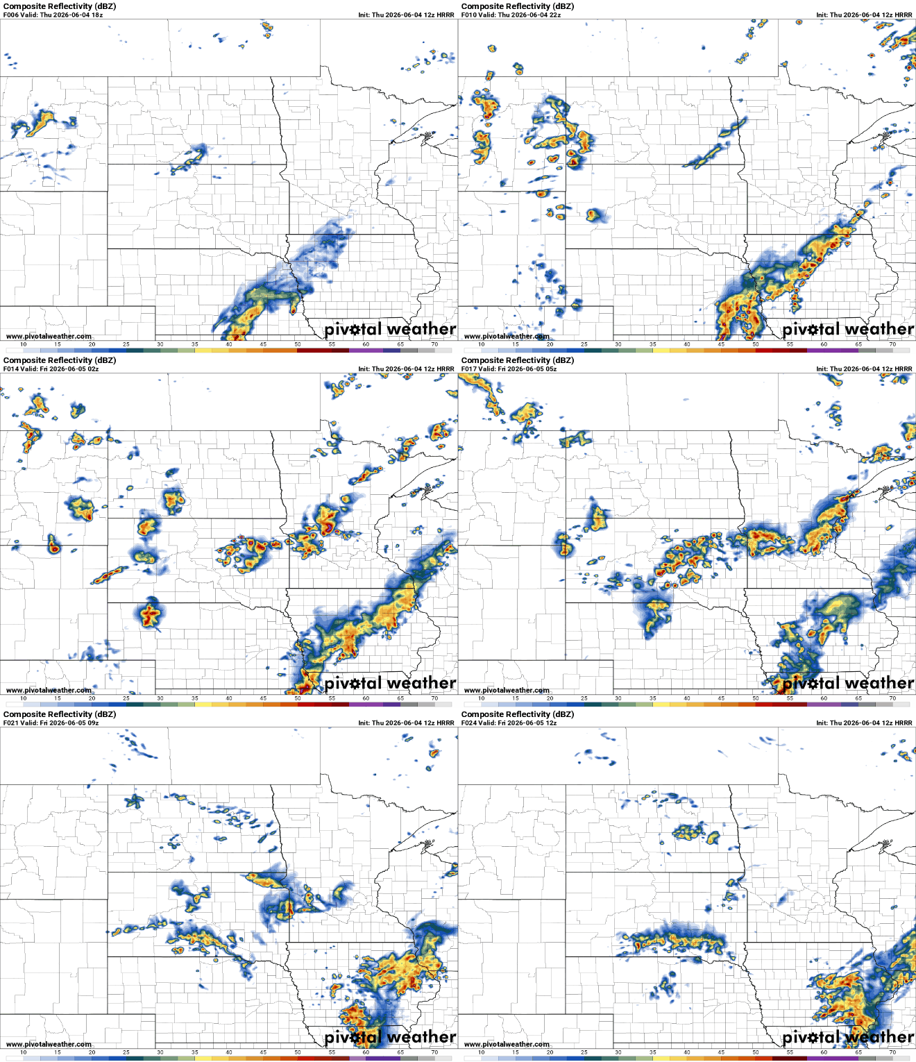
A little sunshine along with muggy dew points will help to produce more spotty thunder later Thursday afternoon and evening into the overnight.
Storms look to initiate late in the afternoon and evening in west-central or southwestern Minnesota and also north, then slowly move east.
There’s a slight risk (level 2 of 5) of severe storms in western Minnesota with a marginal risk (level 1 of 5) elsewhere across much of central, southern Minnesota into western Wisconsin.

There’s an additional risk of severe storms for southeastern Minnesota mostly Friday as well, shifting more to the southeast.

Storms on Friday look to be more spotty than Thursday’s activity. There will be statewide chances but the stronger storms look to be in southeastern Minnesota late Friday afternoon into the evening hours.
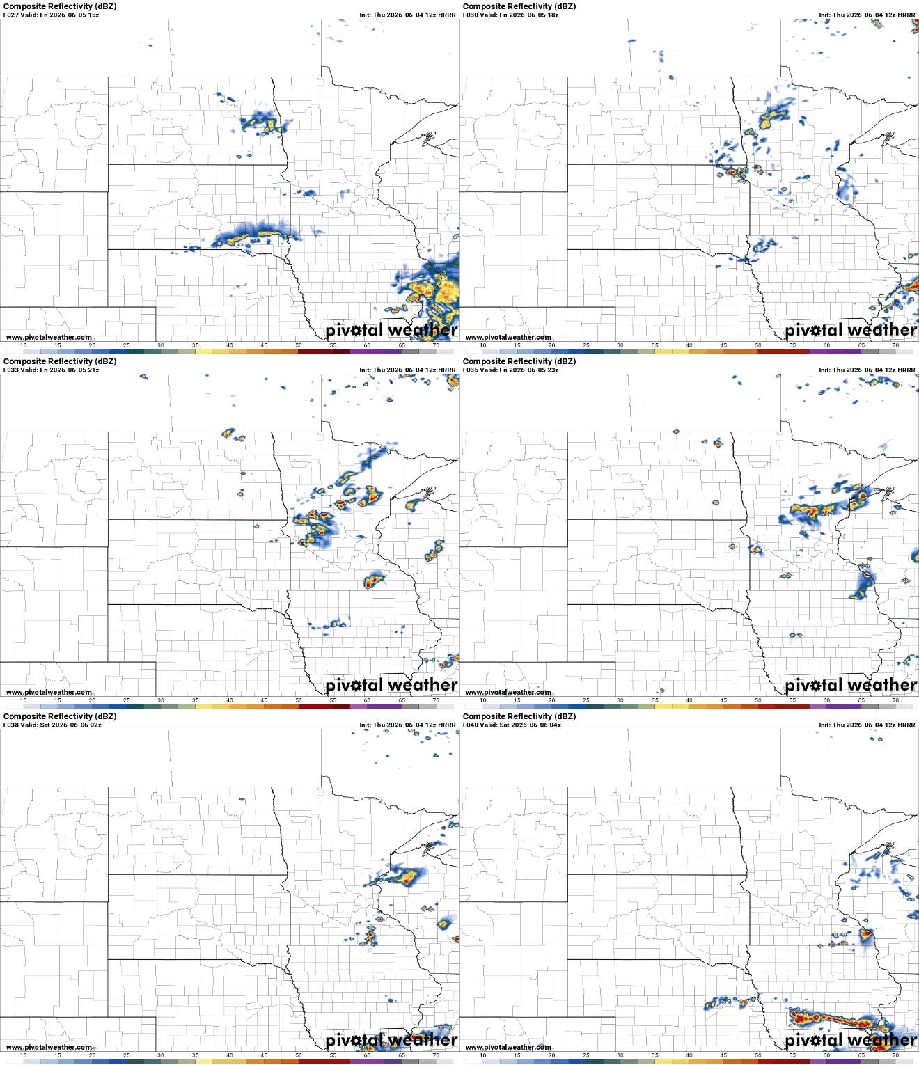
The weekend is still looking mainly dry with just isolated thunder chances and brighter skies. Highs both Saturday and Sunday will be mainly in the 80s, although some places north and west could be near 90 degrees Sunday.

Next week will likely see an upward trend in temperatures with some additional thunder chances, though confidence in the forecast for next week isn’t particularly high at this point.


