
Stormy stretch ahead: Multiple rounds of rain and thunder through midweek
Tropical-like airmass brings oppressive dew points

Go Deeper.
Create an account or log in to save stories.
Like this?
Thanks for liking this story! We have added it to a list of your favorite stories.


An air quality alert remains in effect for much of the state through Sunday evening, and multiple rounds of showers and thunderstorms are expected from late Sunday through at least Wednesday.
Quiet start to Sunday, stormy finish
A pleasant start to our Sunday as most of the day remains largely uneventful. Conditions will change quickly through the afternoon as warmer, more humid air surges northward into Minnesota.
Temperatures will climb into the 80s and low 90s while dew points rise into the mid-60s.

An air quality alert remains in effect through 11 p.m. Sunday for much of Minnesota due to elevated ground-level ozone.
Turn Up Your Support
MPR News helps you turn down the noise and build shared understanding. Turn up your support for this public resource and keep trusted journalism accessible to all.

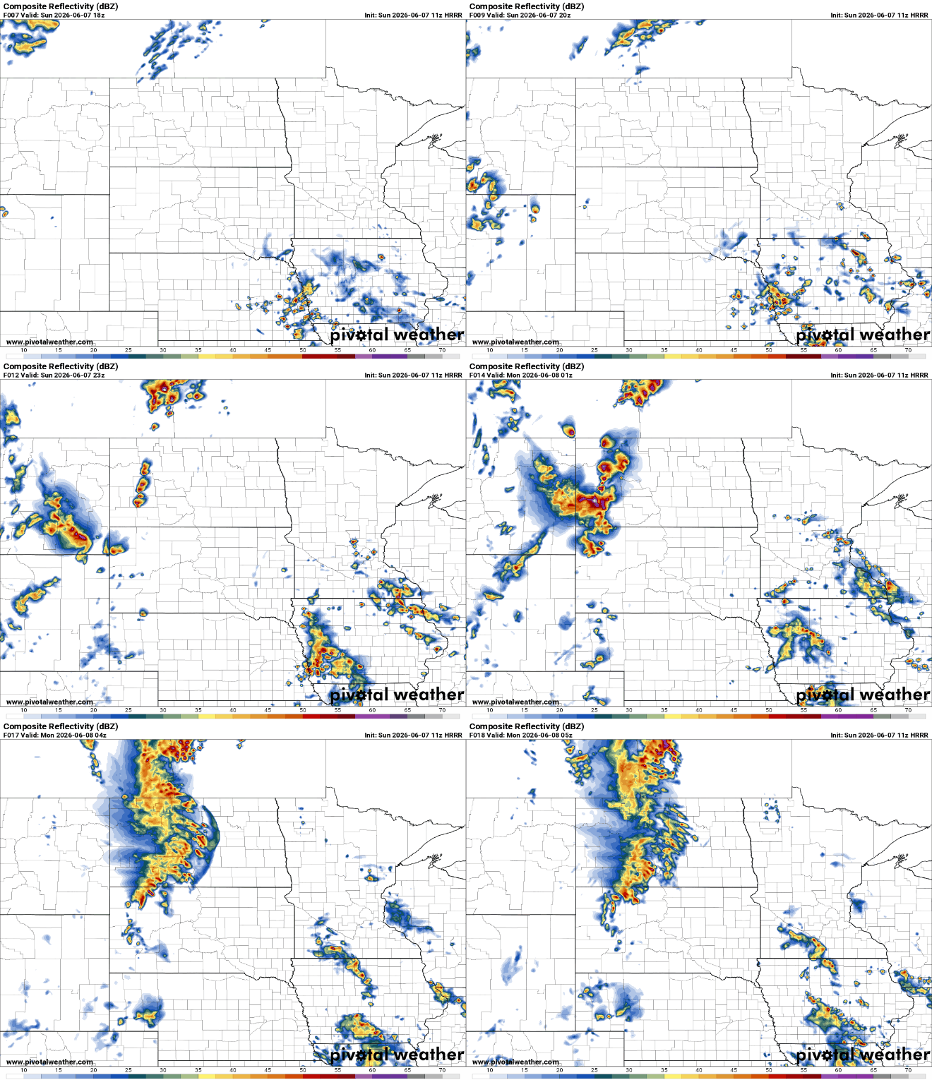
A strengthening weather system moving from the Central Plains into the Upper Midwest will help trigger showers and thunderstorms later Sunday afternoon into early Monday morning. No severe weather is expected at this time; however, these storms could produce some efficient rainfall, so heavy rain showers are expected.
The greatest concern for heavy rain extends across southern and eastern Minnesota into western Wisconsin, where multiple rounds of showers and thunderstorms may track over the same areas.
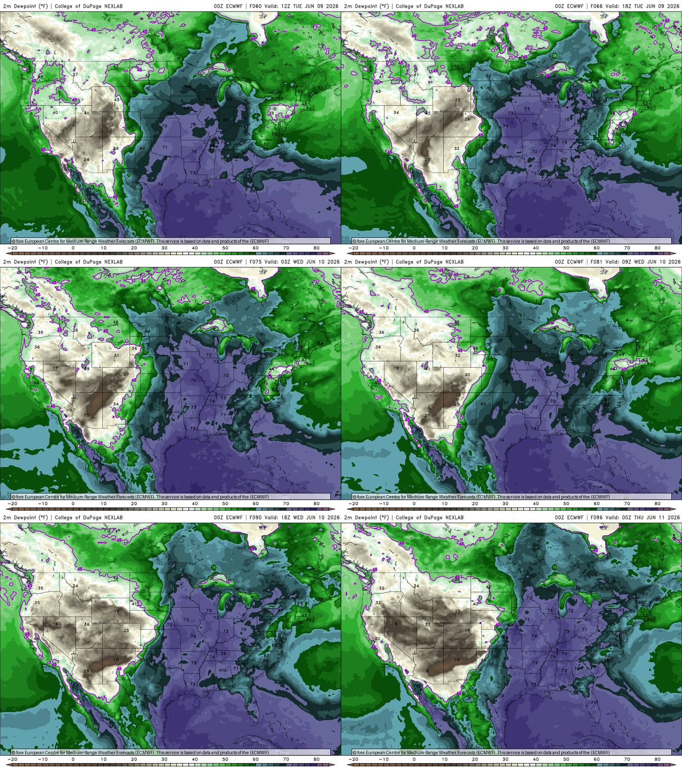
A tropical-like air mass will settle across the Upper Midwest, keeping temperatures in the 80s and 90s while maintaining uncomfortable humidity levels through midweek, with dew points climbing into the 60s and low 70s. This moisture-rich environment will fuel additional rounds of thunderstorms, especially during the evening and overnight hours.
Attention turns to Monday night as another group of thunderstorms may move into Minnesota. An increasingly active pattern will support multiple rounds of storms through midweek, keeping extreme heat in check but maintaining a highly unstable atmosphere.
Strong storms are possible Tuesday evening as activity develops across the Dakotas and moves east, with wind and hail as the primary threats.
Wednesday appears to be the most active day of the week. Very humid air ahead of a strong cold front will create favorable conditions for severe thunderstorms capable of damaging winds, large hail and heavy rainfall.
While details are still being sorted out, Wednesday currently has the highest severe weather potential of the week.
The Storm Prediction Center has already highlighted much of Minnesota in a slight risk, with portions of the Twin Cities metro, southeastern Minnesota and western Wisconsin included in an enhanced risk.

Relief arrives late in the week. Behind Wednesday's cold front, cooler and drier air will settle into Minnesota on Thursday and remain in place through next weekend. Storm chances will drop significantly, while temperatures return to more comfortable levels, with highs mainly in the 70s and lower 80s.


