
From the 90s to severe storms into a cooldown
We have several rounds of strong thunderstorms ahead
Go Deeper.
Create an account or log in to save stories.
Like this?
Thanks for liking this story! We have added it to a list of your favorite stories.


We’ll be hotter and muggier Tuesday and Wednesday. There’s potentially severe weather Wednesday with a risk level of three out of five in parts of the state.
Muggy and stormy ahead
We have a few big regional weather stories to work through this week. The most immediate is the quick rise of 90-degree temperatures around the Twin Cities. We’ve been very close — 89 degrees a few times — but we’ll be hotter and muggier Tuesday and Wednesday.
The next is the rise of potentially severe weather with a risk level of three out of five in parts of the state on Wednesday. Then we tackle the unresolved question: how will all these rounds of rain help our expanding drought across Minnesota?

For the rest of Monday, we’re marginally cooler with a few pops of sunshine — and a few pop-up storms in southwestern Minnesota where the sun does form.
Turn Up Your Support
MPR News helps you turn down the noise and build shared understanding. Turn up your support for this public resource and keep trusted journalism accessible to all.
The temperature trend is pretty toasty in the southwestern-most corner of the state, cooler north, and in the middle 80s in places like Minneapolis, St. Paul and St. Cloud.
Much of the Monday rain has already wrapped up, but a few storms are possible, and they’ll move northeast.
Tuesday is a great day to catch up on outdoor chores like mowing, weeding, or just enjoying the hot day. Almost all of Minnesota is dry and it’s another solid crack at 90 degrees. The “corn sweat” isn’t fully developed. While it’s humid, the peak summer mugginess is yet to arrive.
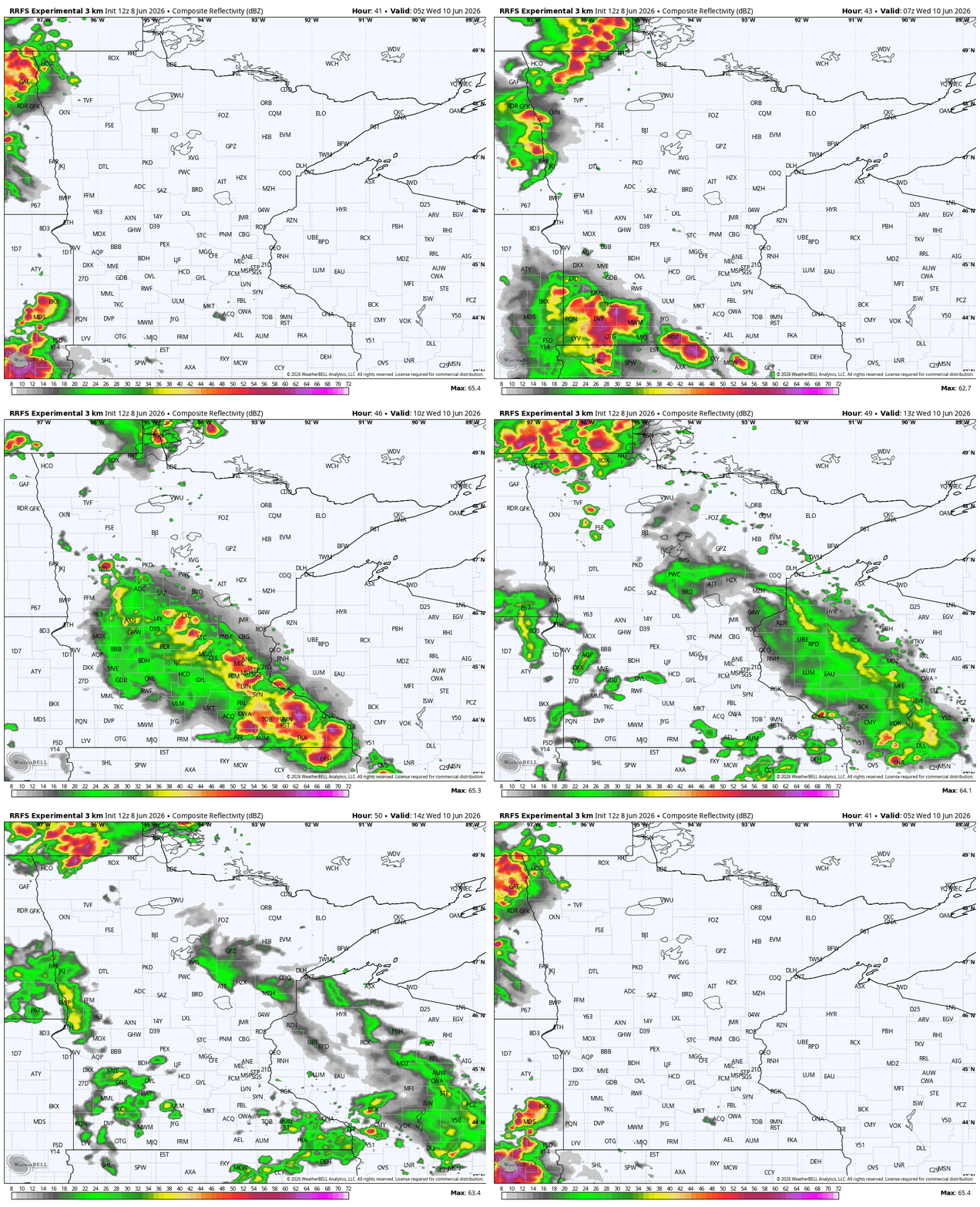

Late Tuesday night, a mesoscale convective system rolls out of North Dakota, clipping the far northern and especially northwestern end of Minnesota. The early Wednesday morning storms could be briefly severe.
Next on our calendar is a morning commute-timed complex of storms steering its way from Nebraska toward the Twin Cities and the Interstate 94 corridor.
This could create some really intense rain, traffic slowdowns, frequent lightning and some spots with wind damage. The primary hail threat remains in the Dakotas.

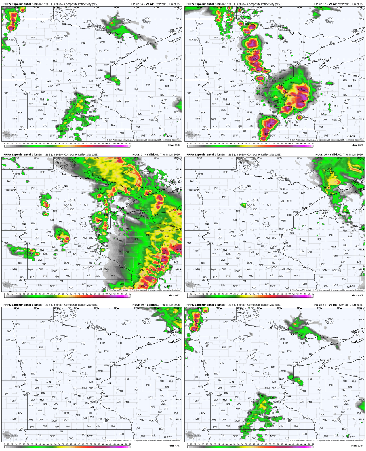
We’ll say the Wednesday afternoon round of storms is the main line for most of the state and there’s the possibility of several reports of straight-line wind damage.
We also cannot rule out some larger hail, along with a stray spin-up type tornado along the squall line. The northeastern motion of these storms could make that difficult to track live on a radar.
Once this blows past, we’ll have a milder and quiet Thursday. There may be a few post-frontal showers popping up in far northern Minnesota, but that’s also the area currently in a drought, that needs rain the most. Friday and Saturday appear cooler, back closer to average.
We have the chance of some more storms curling back up into the Upper Midwest late this coming Sunday into Monday.

