
Hot and humid Tuesday, severe storms possible Wednesday
Cooler to end the week

Go Deeper.
Create an account or log in to save stories.
Like this?
Thanks for liking this story! We have added it to a list of your favorite stories.


It’ll be hot and humid Tuesday and Wednesday. Isolated thunder is possible Tuesday, but most will remain dry. Storms will be possible late Tuesday night, early Wednesday and then again later in the day Wednesday.
Tropical heat and humidity Tuesday and Wednesday with strong to severe storms Wednesday
Make a plan to stay cool Tuesday and Wednesday as we’ll have that combination of both heat and humidity. Dew points will be in the upper 60s and low 70s with afternoon highs in the upper 80s to near 90 degrees in the Twin Cities. Low to mid-90s are possible west. We do have some morning fog and low cloud cover to burn through in eastern Minnesota which may prevent some of us from quite reaching 90-degrees in the eastern part of the state.
There’s also a heat advisory Tuesday afternoon for portions of northeast Minnesota.

An air quality alert is in effect from noon through 9 p.m. Tuesday for portions of central Minnesota and the Twin Cities metro area for ground-level ozone.
Turn Up Your Support
MPR News helps you turn down the noise and build shared understanding. Turn up your support for this public resource and keep trusted journalism accessible to all.
Check the latest air quality conditions, alerts and forecasts here:
While an isolated thunderstorm cannot be ruled out Tuesday, most of us will see partly cloudy skies and dry conditions midday into the afternoon. That will change Tuesday night into Wednesday morning. Storms will develop in the Dakotas and track east. What’s left will reach eastern Minnesota early Wednesday.
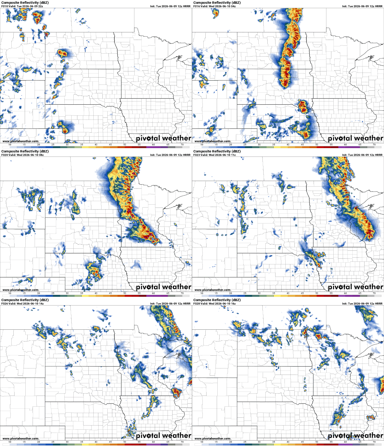
The greatest severe threat will be west — closer to where storms initiate. There’s an enhanced risk (level 3 of 5) and slight risk (level 2 of 5) for severe storms in western Minnesota into early Wednesday.
It’ll be hot and humid again midday Wednesday, which will help to spawn more thunderstorms in the afternoon and evening hours across eastern Minnesota into western Wisconsin. These storms have a strong potential of becoming severe with all hazards possible: tornadoes, large hail and damaging wind gusts. It’s looking increasingly likely in recent model trends that this second round of storms may initiate right on top of the Twin Cities or just south and east. This would then put the greatest severe threat mainly just southeast of the Twin Cities.
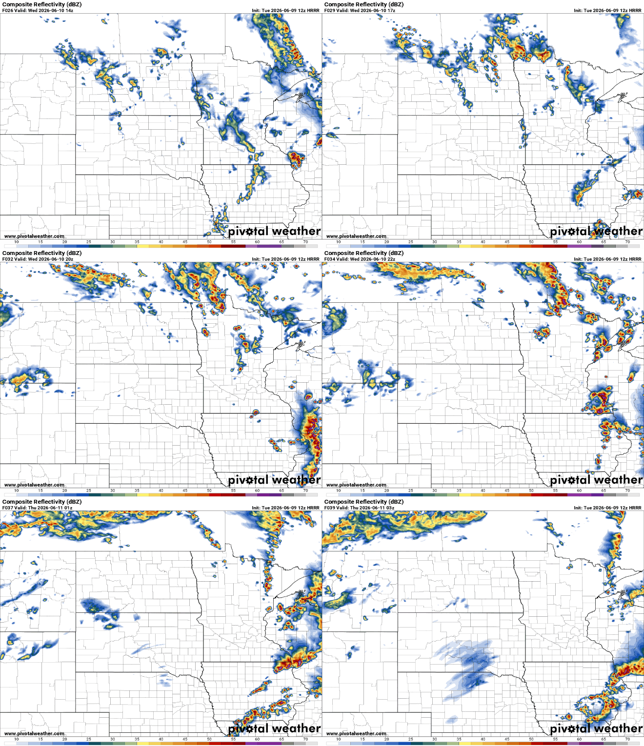
The enhanced risk (level 3 of 5) for severe storms includes the Twin Cities however still into southeast Minnesota and Wisconsin for Wednesday afternoon and evening into the early overnight hours. Make sure to stay aware of the fluid situation and have a way to get weather alerts and warnings.

We’ll see a big drop in dew points Wednesday night into Thursday behind the cool front, making for much more comfortable conditions.
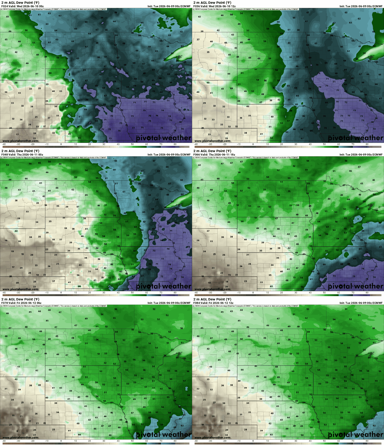
High Thursday will be just around 80 in southern Minnesota to near just 70 degrees north.

Another shot of cool air moves in for the weekend which will drop temperatures even more.

