Breezy and refreshing conditions settle in for the weekend
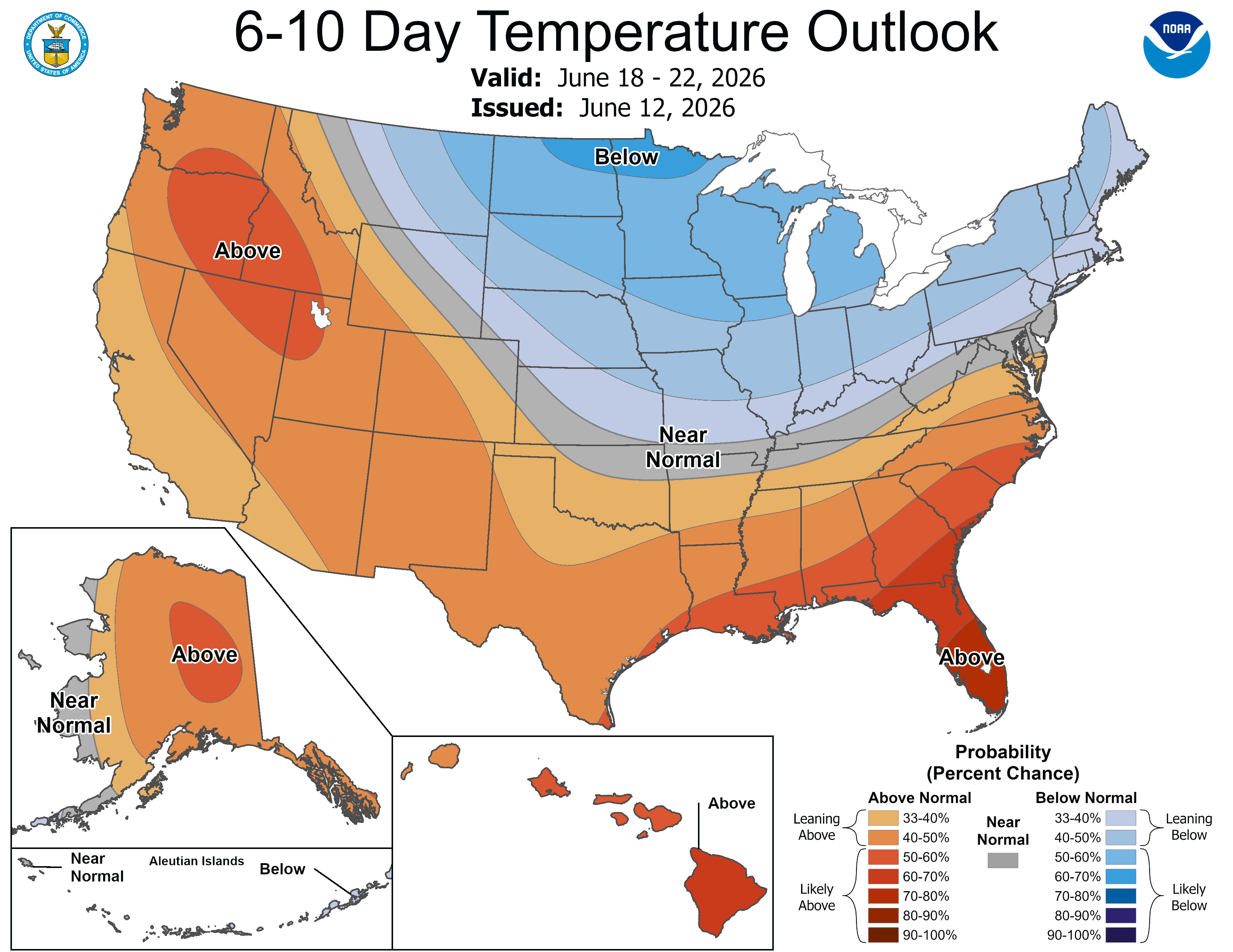
Below-normal temperatures hold on through the week

Go Deeper.
Create an account or log in to save stories.
Like this?
Thanks for liking this story! We have added it to a list of your favorite stories.


After a stretch of warmer weather, a cooler and drier air mass has settled across Minnesota for this weekend. Temperatures will remain below normal through much of next week, while several opportunities for rainfall return to the forecast.
Breezy, refreshing weekend
A cold front continues to push south and east across the region Saturday. While most locations have already seen the front pass through, portions of southern Minnesota may still experience some thundershowers. By Saturday night, the front will be completely east of the area.
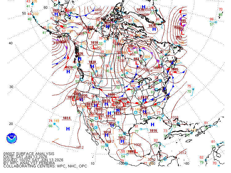
Behind the front, noticeably cooler air will overspread the region. High temperatures Saturday will range from the mid-60s to mid-70s, several degrees below mid-June averages, which are typically in the upper 70s.

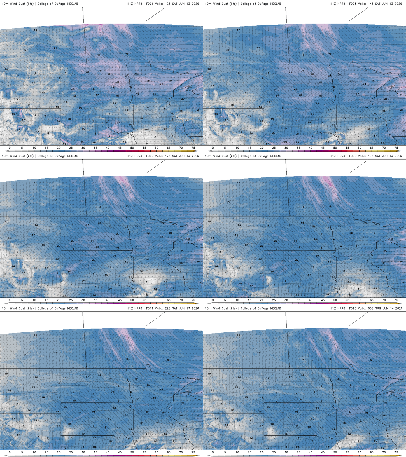
Gusty northwest winds of 10 to 20 mph will add to the cooler feel throughout the day.
Turn Up Your Support
MPR News helps you turn down the noise and build shared understanding. Turn up your support for this public resource and keep trusted journalism accessible to all.
A few precipitation chances will linger early Saturday as the cold front continues to move through the region. Across northeastern Minnesota, moisture will be limited, but a few isolated sprinkles or brief light showers remain possible during the morning hours.
Farther south, closer to the front itself, scattered showers and a few thunderstorms may develop across extreme southern Minnesota, primarily south of the Interstate 90 corridor.
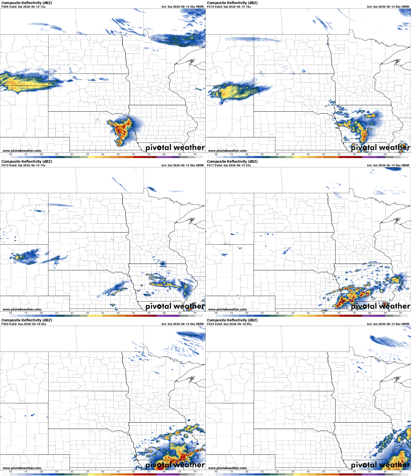
By Saturday evening, the front will have pushed south of the area, allowing dry and cooler conditions to settle in for the remainder of the weekend.
Sundays highs range from the mid-to-upper 60s across northern areas to the lower 70s farther south. Breezy conditions will persist through the remainder of the weekend as northwest winds continue to gust throughout the day.

The quiet weather pattern this weekend will give way to a more active setup next week. The Upper Midwest is expected to remain under northwest flow aloft, allowing several weak disturbances, or shortwaves, to move through the region. While the deep moisture will remain to our south, each of these disturbances may be capable of producing scattered showers, resulting in several opportunities for light rainfall throughout the week.
At this time, widespread or prolonged rainfall does not appear likely, but periodic chances for passing showers will persist.
The persistent northwest flow pattern will also help maintain below-normal temperatures through much of the upcoming week. Highs are expected to remain cooler than average.