
Umbrella weather ahead: Several chances for rain this week
Temperatures more typical of May than mid-June this week

Go Deeper.
Create an account or log in to save stories.
Like this?
Thanks for liking this story! We have added it to a list of your favorite stories.


After a breezy and pleasant weekend, a cooler weather pattern is expected to settle in across the region for much of the upcoming week.
While temperatures will remain comfortable, several opportunities for rainfall are on the horizon with the most widespread and impactful chance arriving during the middle of the week.
Warm Monday with cooler weather, shower chances to follow
Monday looks to be the warmest day of the week with afternoon highs climbing into the lower to upper 70s. That's pretty close to normal for mid-June, but don't get too attached to it. Cooler-than-average temperatures are set to stick around for much of the week.

The first weather maker arrives Monday afternoon. Expect scattered showers to develop across northwestern and central Minnesota before gradually spreading southeast toward the Twin Cities by early evening.
Turn Up Your Support
MPR News helps you turn down the noise and build shared understanding. Turn up your support for this public resource and keep trusted journalism accessible to all.
A few isolated thunderstorms may join the party but severe weather isn't expected.
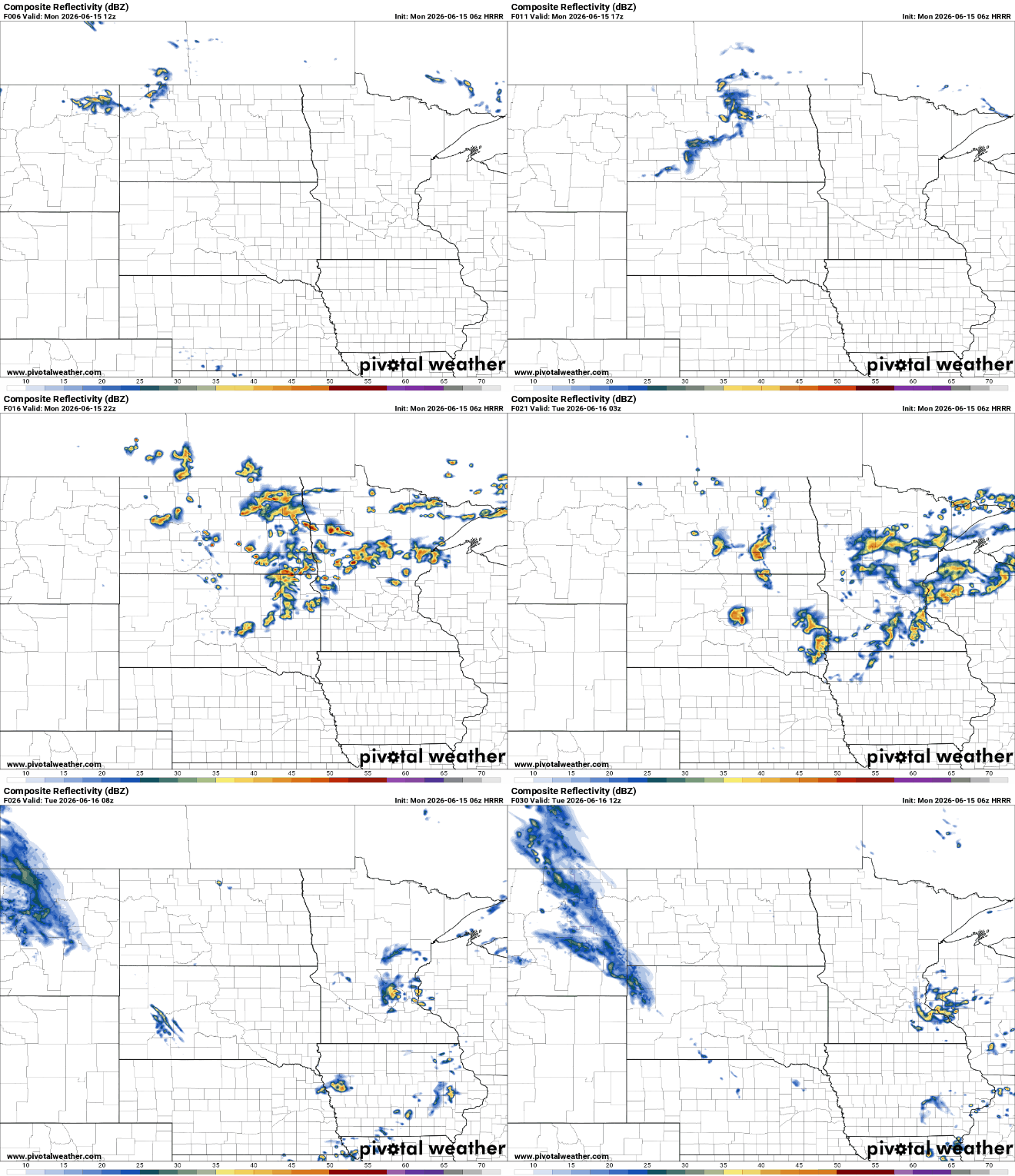
Some showers could linger into Tuesday morning, especially across western Wisconsin, before taking a break during the day on Tuesday.
Tuesday will offer a pleasant break between weather systems, with plenty of sunshine expected across the region. Temperatures will remain on the cool side, ranging from the mid to upper 60s across northern Minnesota to the mid-70s farther south.

Another round of rain is expected to move in Tuesday night and continue into Wednesday. This system looks organized enough to bring widespread rainfall to much of the region, with the best chances generally in central and southern Minnesota.
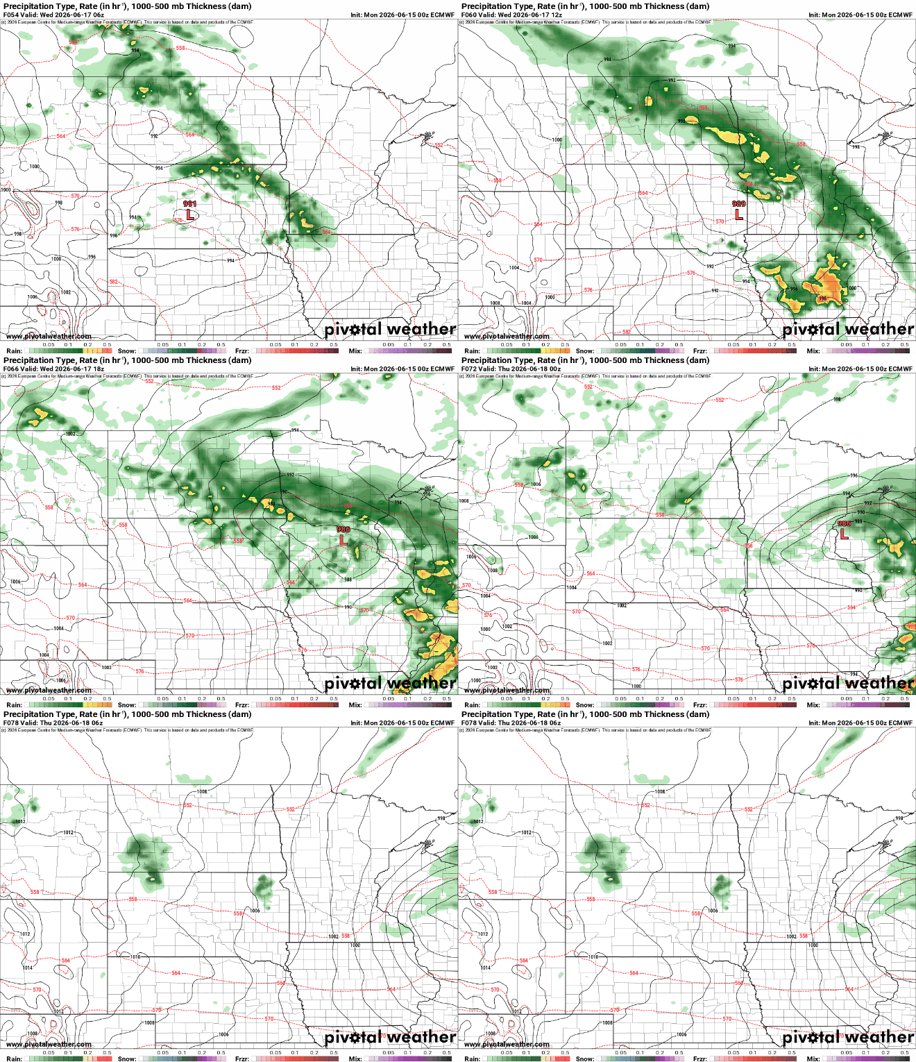
Many locations could pick up one-quarter to one-half inch of rain as the system moves through on Wednesday.
While most of the precipitation is expected to fall as steady rain, a stray thunderstorm can't be completely ruled out. Any thunderstorms that do develop could produce locally higher rainfall totals, leading to isolated areas receiving more than one-half inch.

As for the second half of the week and the upcoming weekend, confidence starts to fade a bit. Forecast models agree that another weather system may pass through around Friday, but the timing and rainfall amounts become much less certain after that.
In other words, don't cancel outdoor plans just yet, but keep an eye on the forecast for updates.

