
Rainy, stormy Wednesday with a mostly dry Thursday
More-seasonable temperatures return next week
Go Deeper.
Create an account or log in to save stories.
Like this?
Thanks for liking this story! We have added it to a list of your favorite stories.


We have an unsettled Wednesday with occasional scattered showers and storms. Thursday will be mainly dry before another disturbance moves in Friday. Temperatures will remain cool.
Rainy, stormy Wednesday; mostly dry Thursday
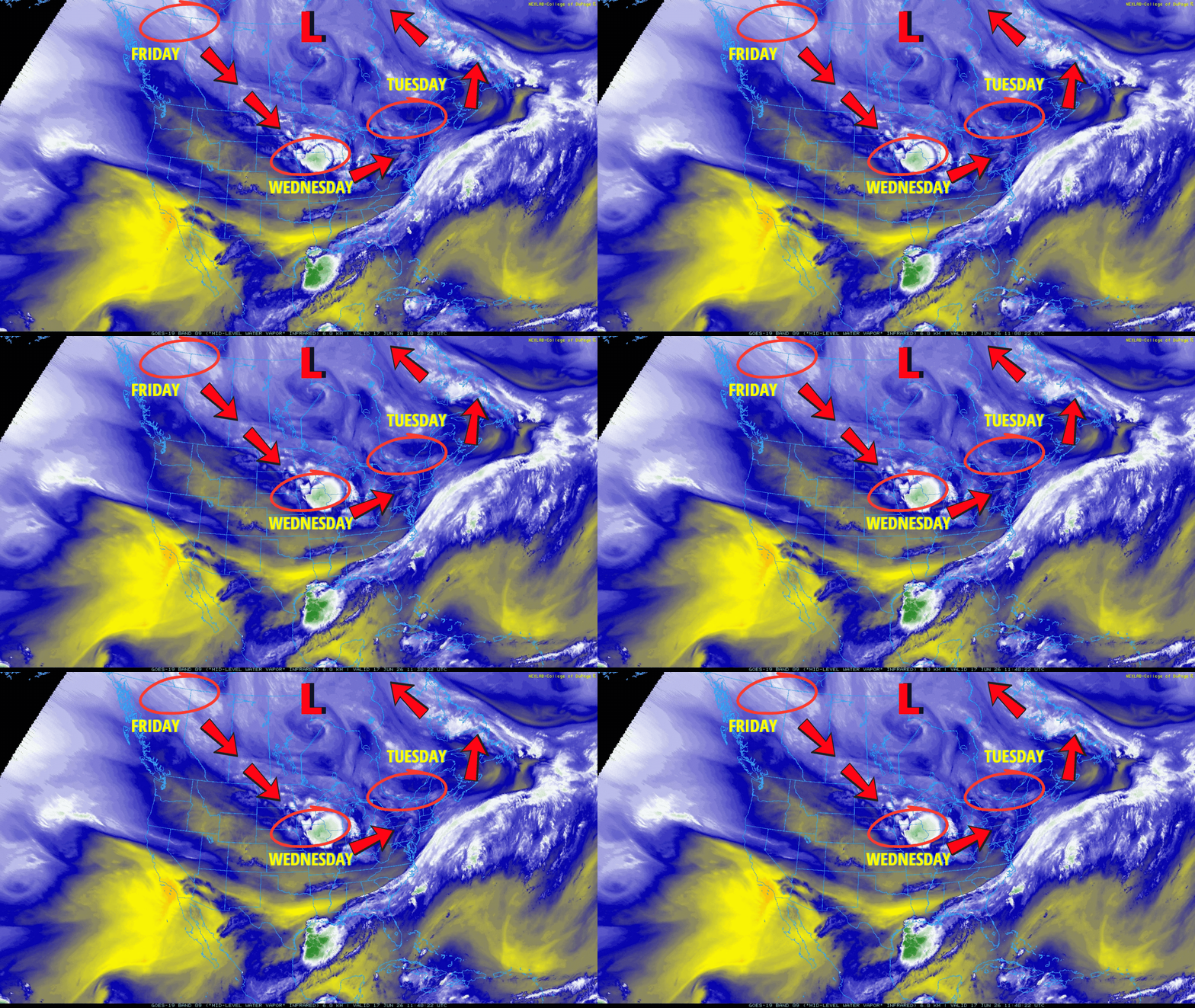
We have another disturbance rotating around an upper-low centered to our north, just south of Hudson Bay. It will make for an unsettled Wednesday with occasional scattered showers and thunderstorms.
There will be some peeks of midday sun in southern Minnesota before more thunderstorms develop.
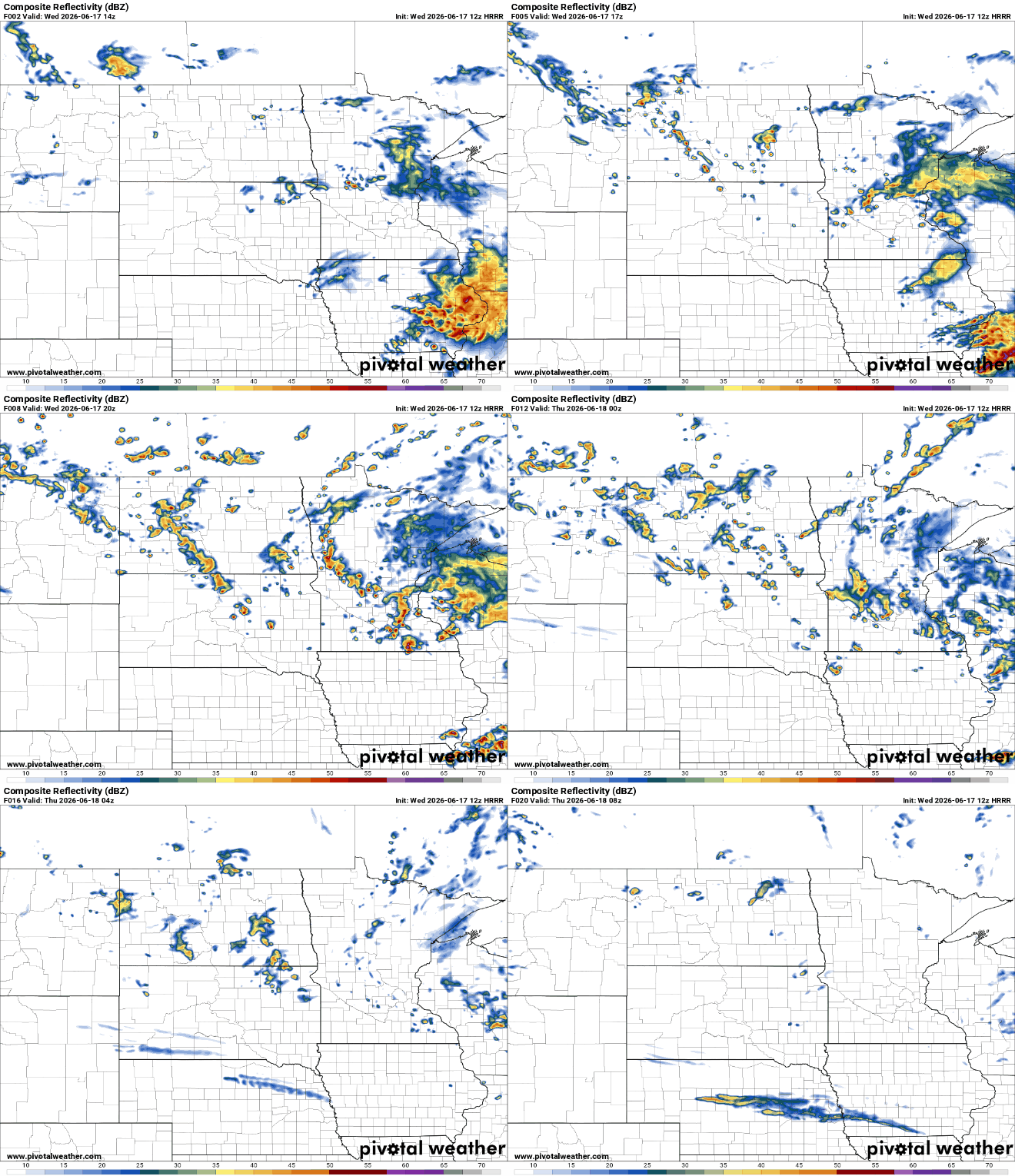
Storms that do pop in southern Minnesota could turn strong or severe in some isolated cases. There’s a slight risk (level 2 of 5) for severe storms for far southern Minnesota.
Turn Up Your Support
MPR News helps you turn down the noise and build shared understanding. Turn up your support for this public resource and keep trusted journalism accessible to all.

Portions of east-central Minnesota into Wisconsin could see up to 1 inch of rainfall with locally higher amounts. While most of the state will see rainfall, the heaviest rains will largely miss most of the drought areas. I’ve circled the main drought regions in the forecast rainfall below:

There’s also a wind advisory for southwestern Minnesota where winds will blow at 15 to 35 mph with gusts up to 50 mph.

Afternoon highs will be mostly in the 70s and 60s due to the clouds and occasional rain.
Thursday should be mostly dry with any lingering shower and clouds moving out in the morning. Temperatures will once again be cooler than normal, ranging from the low to mid-70s south to the 60s north.

Another disturbance swings in for Friday. That will touch off more, at least, spotty showers and storms Friday afternoon and evening.
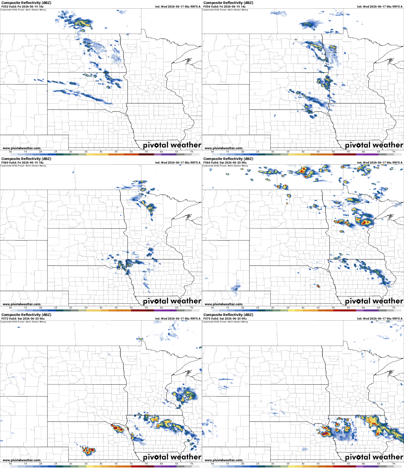
The weekend is looking decent with just isolated chance of showers or thunder and temperatures still slightly below normal, mostly in the 70s.

