Rain to the north Friday, cooler days linger
Unsettled and cool pattern continues early next week
Go Deeper.
Create an account or log in to save stories.
Like this?
Thanks for liking this story! We have added it to a list of your favorite stories.


The rest of Thursday is sunny but still on the cooler side. Another small system, a summery Alberta clipper, comes in for Friday. Rain then largely trends to our southwest on Saturday and Sunday with an active and cooler rain pattern ahead.
Mild Thursday night, rain potential Friday
We have quite the puffy cumulus cloud field across Minnesota. That’s a sign of weak convection with colder air aloft. Temperatures are just a smidgen below normal for this time of the year, but this is a blue-ribbon winner day to get outside and knock some chores out.
Thursday night, we’re pretty mild and typical for this stage of later June.
One thing that is not typical is the mosquito count. According to the local mosquito authorities, the last survey showed about seven times fewer mosquitoes than we’d normally have around this time of the year. That means the weather is even nicer with fewer bugs!
Turn Up Your Support
MPR News helps you turn down the noise and build shared understanding. Turn up your support for this public resource and keep trusted journalism accessible to all.
The overall weather pattern is indicative of Alberta clipper season.

Another clipper rolls in on Friday morning for northwestern Minnesota, including Fargo-Moorhead and Roseau. The best overall chance for thunderstorms Friday is over the northern half of Minnesota, although some general showers could reach the Twin Cities.

This is some much-needed rain in the forecast for the Brainerd and Bemidji areas, which went further into a drought in the newest drought conditions update released on Thursday.
Weekend highs in the 70s
From a high near 70 degrees on Friday, we’ll climb basically 1 or 2 degrees each subsequent day. That means we’re around 71 degrees on Saturday, 72 on Sunday, 73 on Monday, 75 on Tuesday, or very close thereabouts.
Almost all of the state is dry Saturday. Most of the rain Saturday to Monday will be close to or south of Interstate 90. The forecast still looks pretty active for rain on Tuesday through Thursday next week.
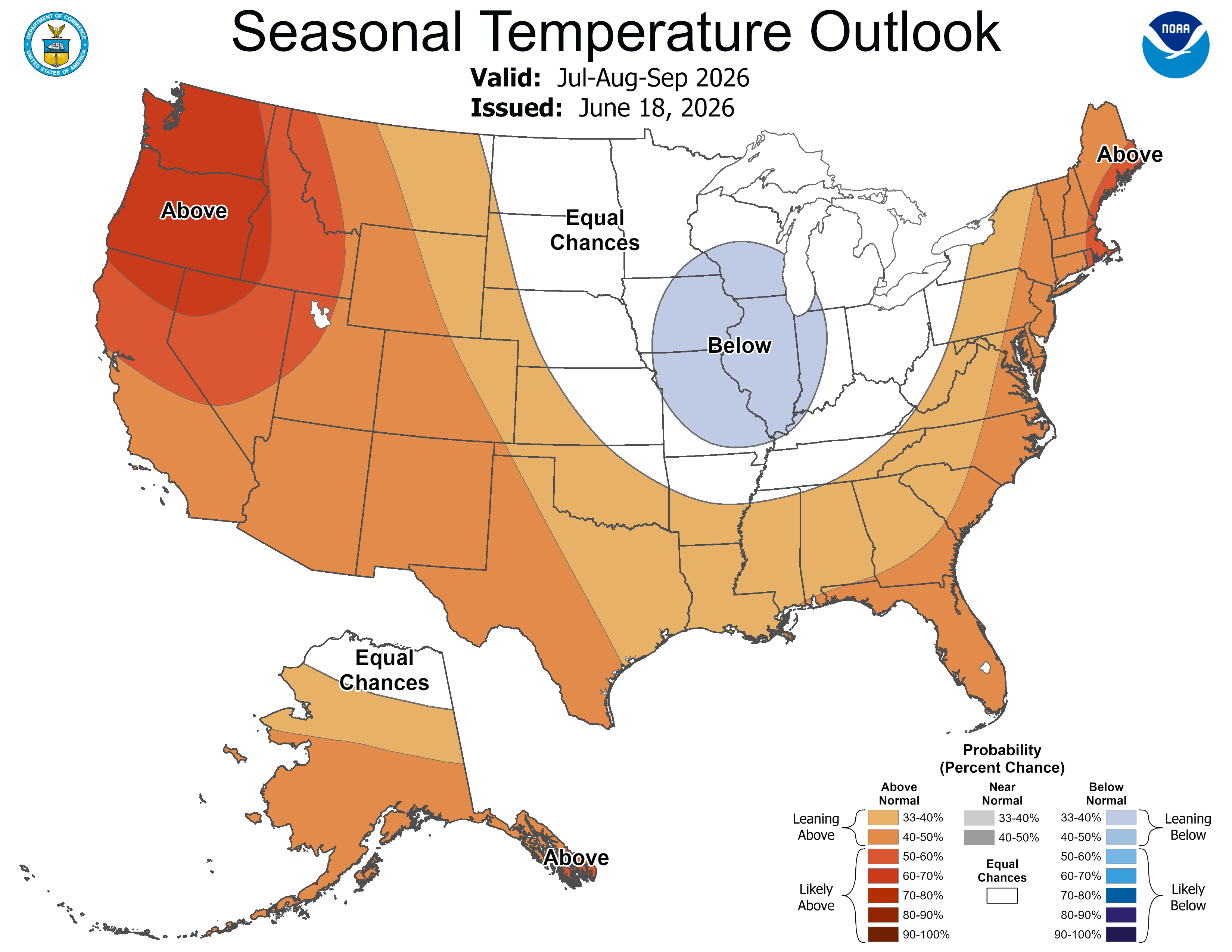
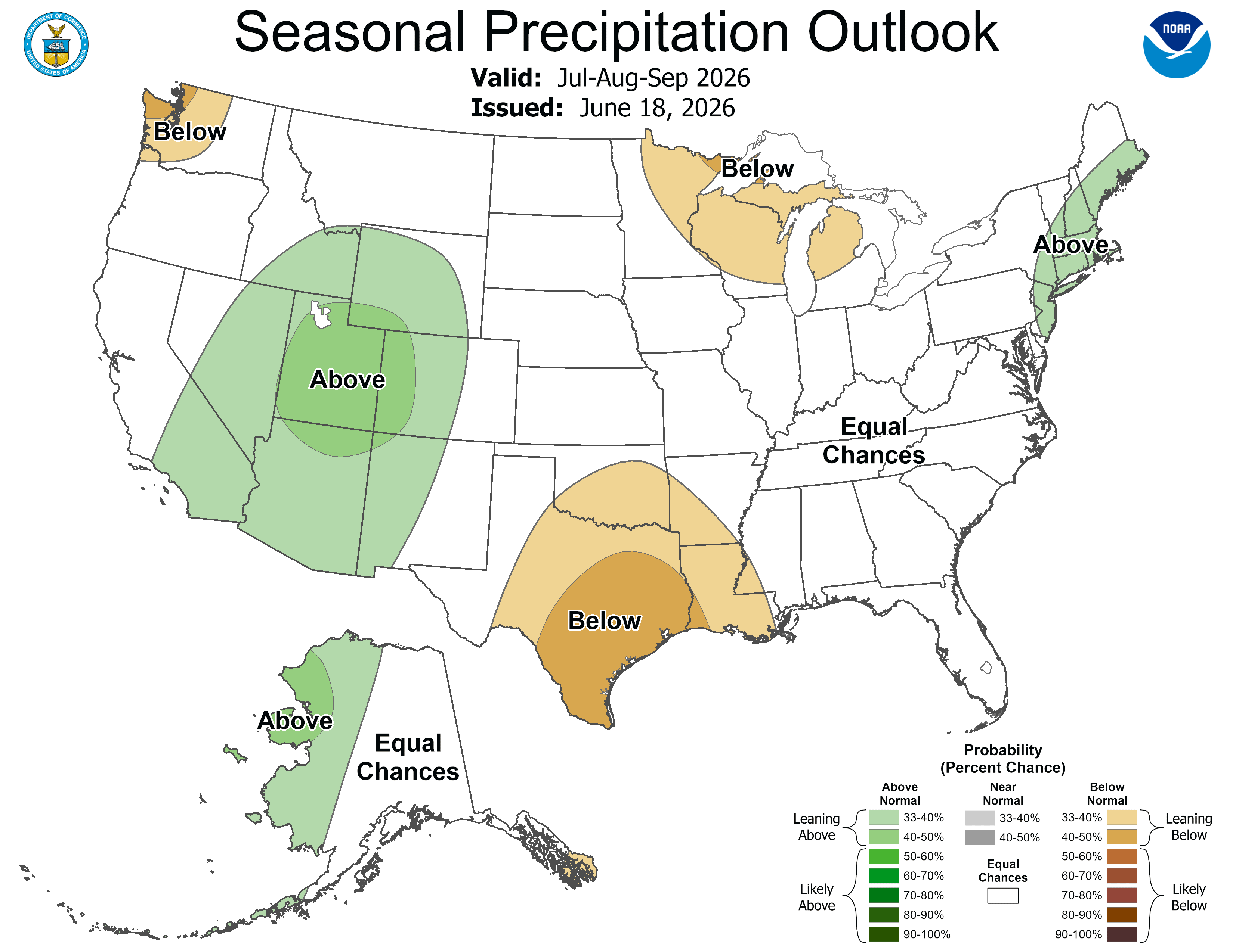
A brand new 90-day outlook was also just released by the National Oceanic and Atmospheric Administration’s Climate Prediction Center. It shows the impact of El Niño from July to September.
We could be a little drier than average in northern Minnesota. Our team thinks this will be another warmer-than-normal summer, despite what the Climate Prediction Center map suggests.