Unsettled Friday, quieter weekend with steady warmth
Go Deeper.
Create an account or log in to save stories.
Like this?
Thanks for liking this story! We have added it to a list of your favorite stories.


The fall-like weather pattern with Clipper after Clipper continues on Friday, with a better chance of a brief soaking rain in the drought-impacted northern part of Minnesota. There’s a small chance of a severe storm from roughly 1:00 p.m. - 7:30 p.m. Friday, going from central Minnesota initially and wrapping up around Red Wing at the end of that stretch.
The storms will not affect everyone in Minnesota, and the rain is generally more even-keeled and longer lived in the morning for northern Minnesota (both of which are great for the level one and level two drought status up in Cass, Itasca, and Koochiching Counties). Once the storms start to develop into a more cellular setup after 1:00, it won’t actually rain as long, but the rain could be more intense. That could cause some midday slowdowns on the roads.
UPDATE: We have received reports via NWS Grand Forks of a tornado near Laporte in Hubbard County, MN. The issue is that this storm was at the extreme edge of both the ND radar and the one in Duluth; effectively the storm was invisible on radar. Because the tornado was called in by a trusted storm chaser, the NWS labeled it as an ‘observed’ or confirmed tornado. We are hunting for pictures or damage reports.
There were also funnels reported over Cass County. This is at the center of a COLD miniature low, so these could have been non-damaging cold air funnels that did not touch the ground.
Turn Up Your Support
MPR News helps you turn down the noise and build shared understanding. Turn up your support for this public resource and keep trusted journalism accessible to all.
Some of these storms are producing hail, however, especially near Onamia. That part could be causing damage.
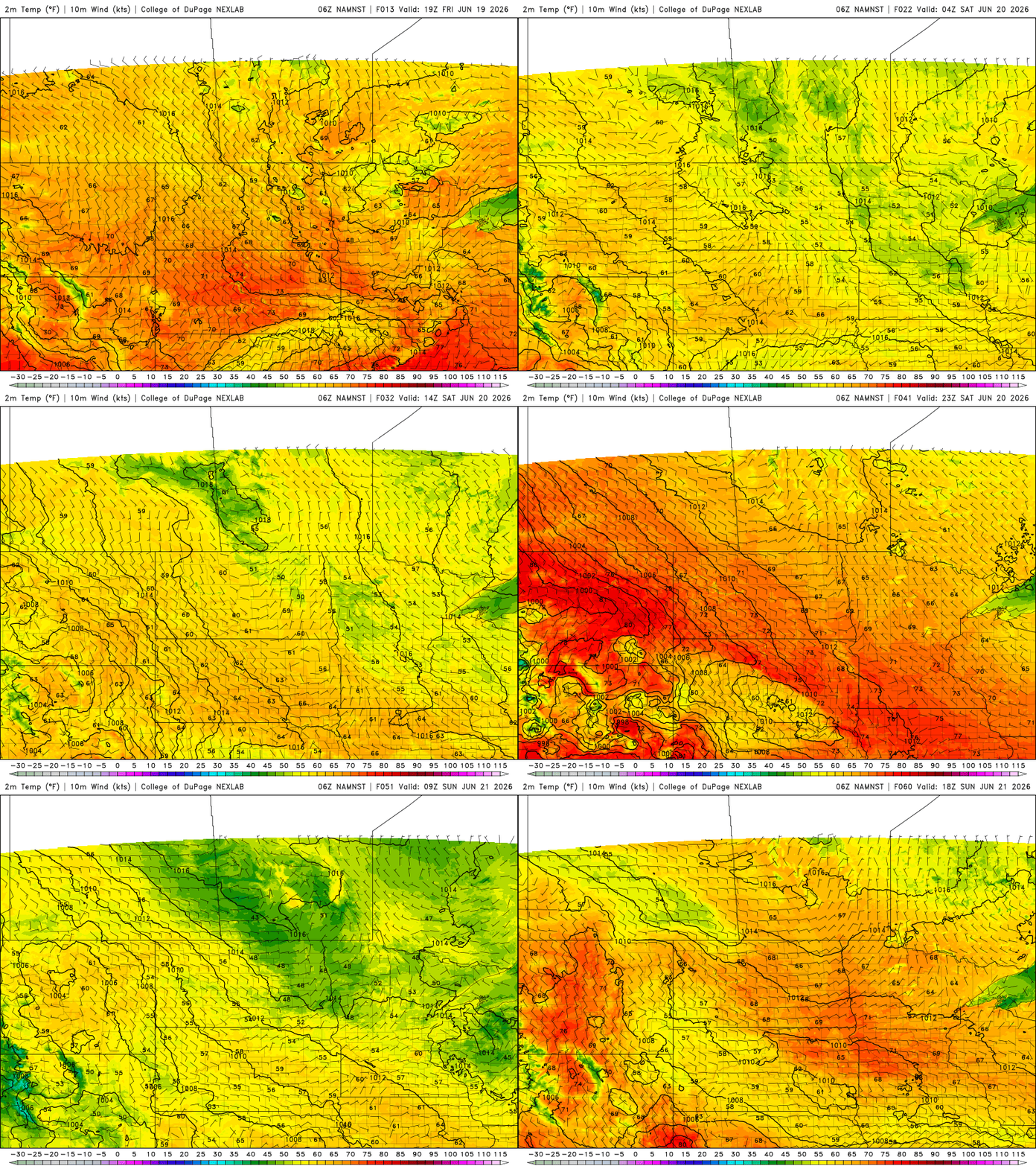
Temperature-wise, we’re not quite as chilly as earlier in the week. Brimson, Tower, the Mesabi Trail area: you all were down into the 30s a few times during the workweek. With the clouds overnight, it’s more like the middle 40s in places. We are climbing effectively one degree each day, but are still below average this week.
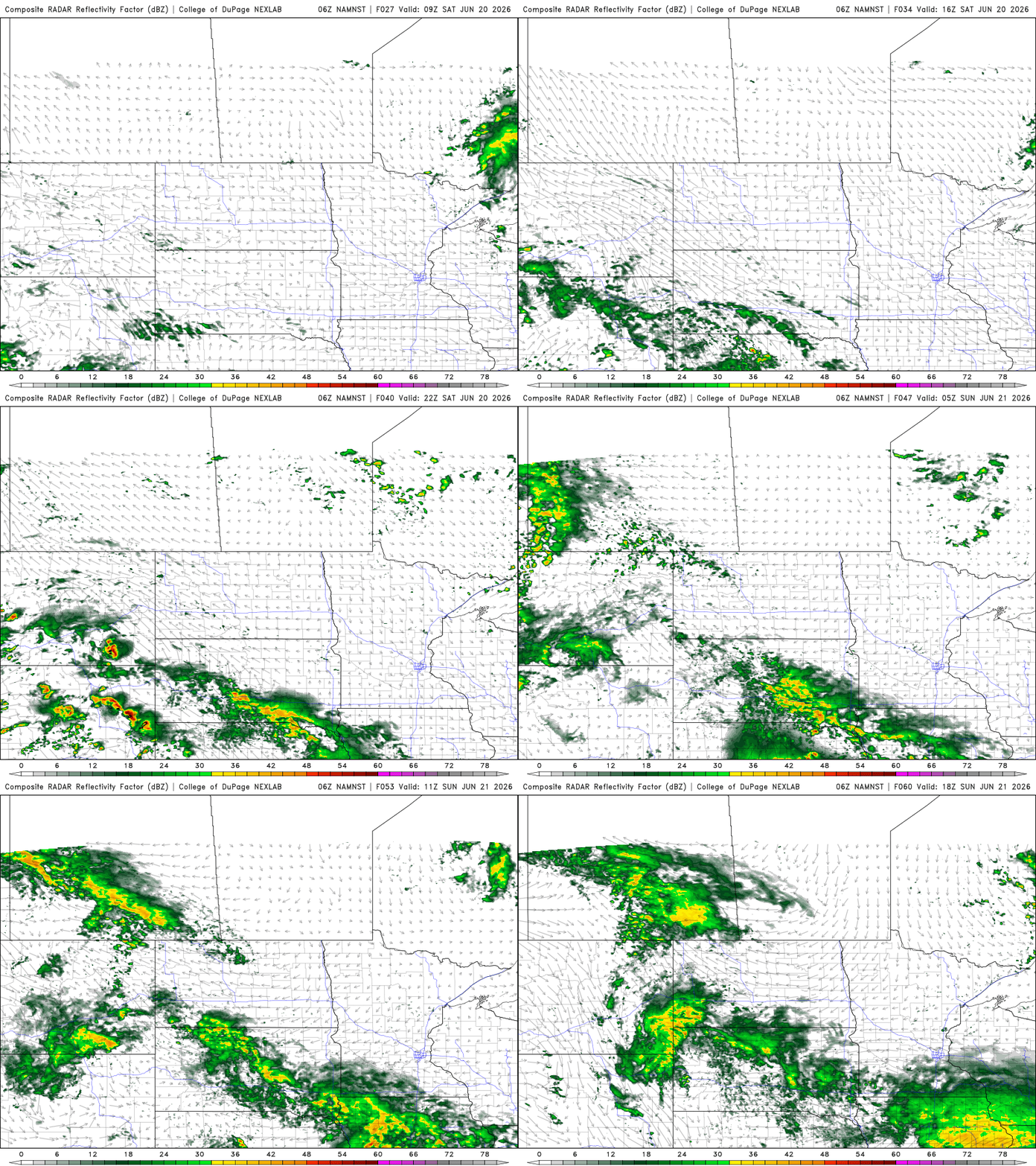
Now we’ve made it to the weekend portion of the forecast! There’s a small chance of Arrowhead rains which we’re adding into the forecast, based off of data Friday morning.
The rain looks to mostly miss the Grandma’s Marathon and half up in Duluth, though it does appear there will be more cloud cover than it initially appeared. The breeze for the races is out of the northwest at 5-10 miles per hour. Gusts flare up a little later, also out of the northwest at 10-20 mph. The rain in Nebraska and Iowa is still there, but doesn’t really extend into Minnesota. On Sunday, a few storms are closing in on Interstate 90. There’s a small chance these showers reach all the way up to the Twin Cities.
Monday is mostly dry but Tuesday brings some soaking rain all across the states. Pack the rain gear before heading into work on Tuesday. Our weather looks a little more settled Wednesday through Thursday which is a little bit of an update.
We’re already in a Climate Prediction Center outlook box for the following weekend, June 26-28. Could have some real downpours *if* things hold together next Sunday.
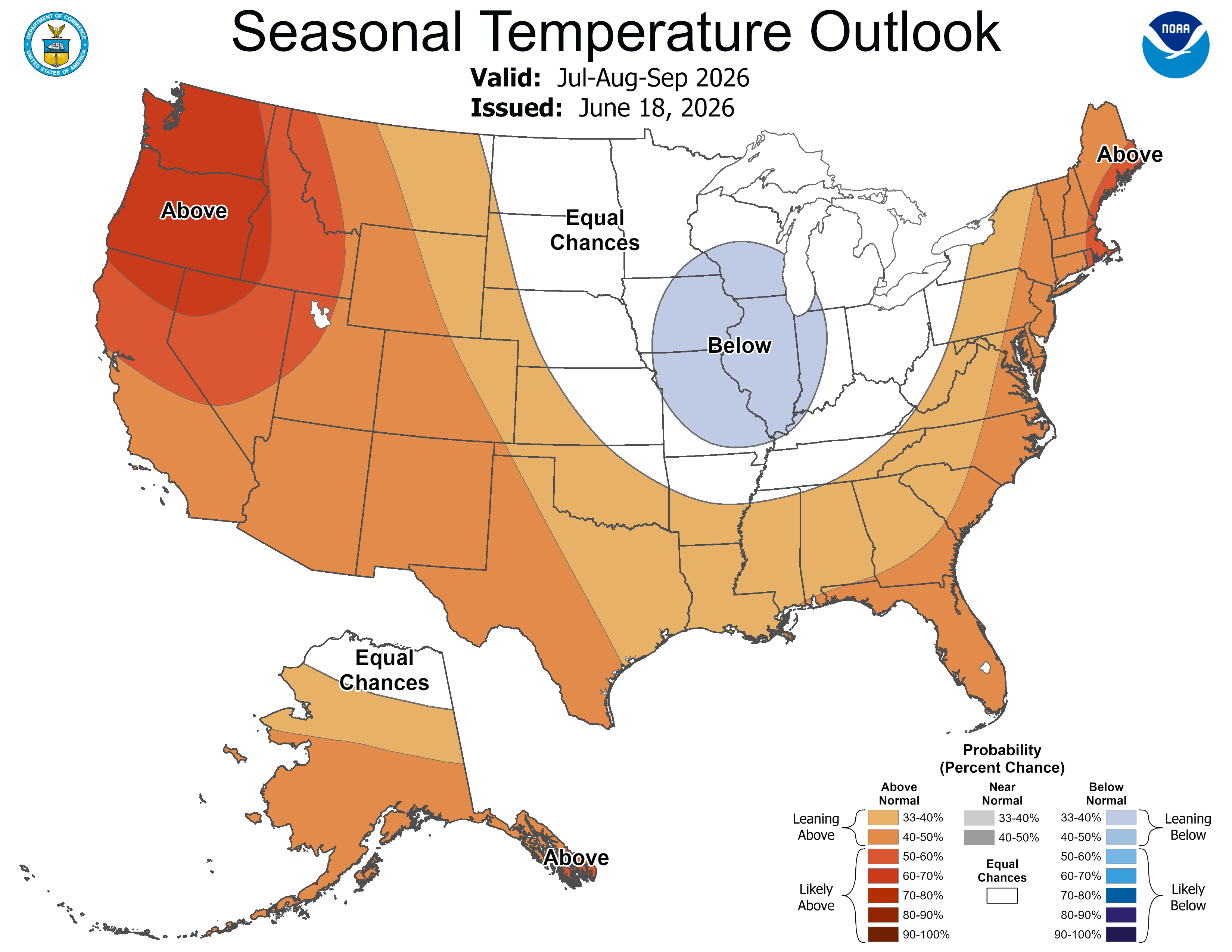
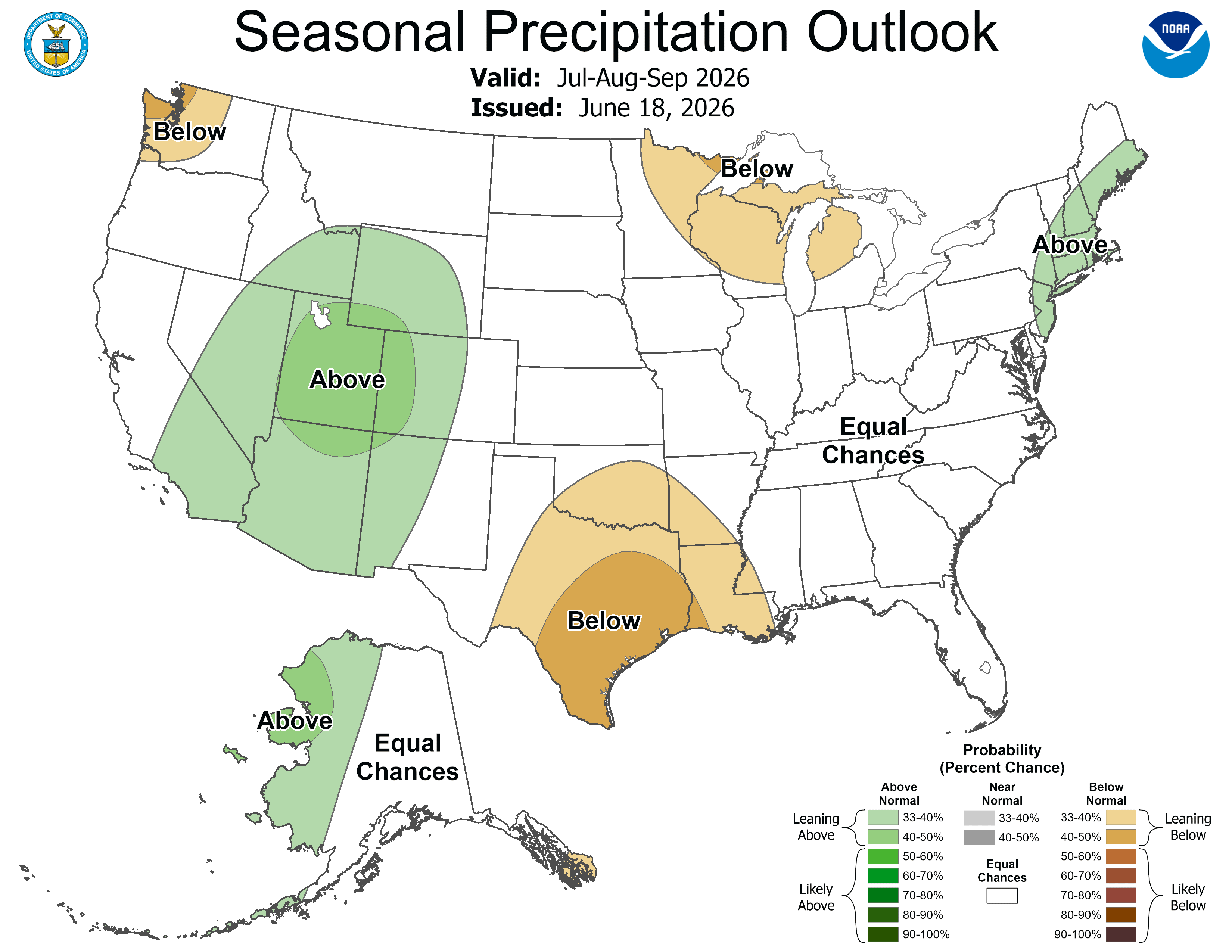
A brand new 90-day outlook was also just released by the National Oceanic and Atmospheric Administration’s Climate Prediction Center. It shows the impact of El Niño from July to September.
We could be a little drier than average in northern Minnesota. Our team thinks this will be another warmer-than-normal summer, despite what the Climate Prediction Center map suggests.