Dry Monday with showers, then storms Tuesday
Temperatures will finally warm up by the weekend
Go Deeper.
Create an account or log in to save stories.
Like this?
Thanks for liking this story! We have added it to a list of your favorite stories.


Monday will be warm and dry. The next chance of showers and storms develops Tuesday with lingering isolated chances midweek. Temperatures finally warm up this weekend.
Dry Monday with showers and storms Tuesday, then warming up
We’ll have a nice, dry Monday with partly cloudy skies. Highs will warm to near 80 degrees in southern Minnesota with 70s for most. Those readings are finally closer to normal.

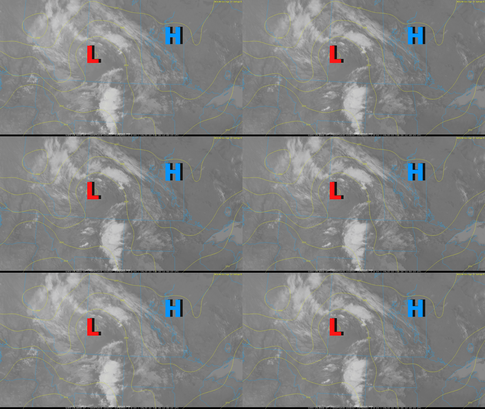
High pressure is in control of Minnesota’s weather today but an upper level low is right behind it which will bring a good chance of rain and thunder for Tuesday.
We’ll see scattered showers and some thunder move into western Minnesota early Tuesday and that will track east with more development of thunderstorms in the afternoon Tuesday into Tuesday night.
Turn Up Your Support
MPR News helps you turn down the noise and build shared understanding. Turn up your support for this public resource and keep trusted journalism accessible to all.
There will be isolated to spotty thunder developing late Wednesday also due to lingering instability.
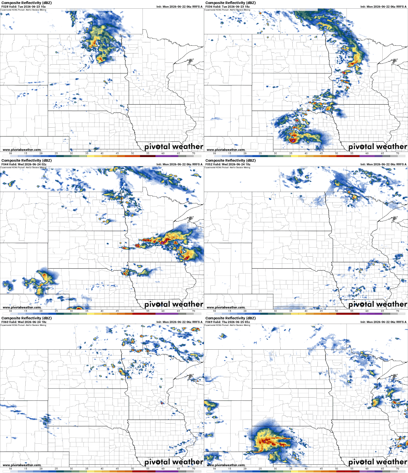
There is a marginal severe risk (level 1 of 5) across central and western Minnesota for some storms Tuesday.

Temperatures will generally be in the 70s — still a bit cooler than normal most of this week — but things are finally heating up by the weekend. We should see 80s return for the first time in a little while. Most forecast models push us to 90 degrees in fact next week.

We’re in for a likely pattern shift. The last 10 to 12 days have been cooler than normal as a series of upper level lows have kept cooler air and unsettled conditions in place on and off.
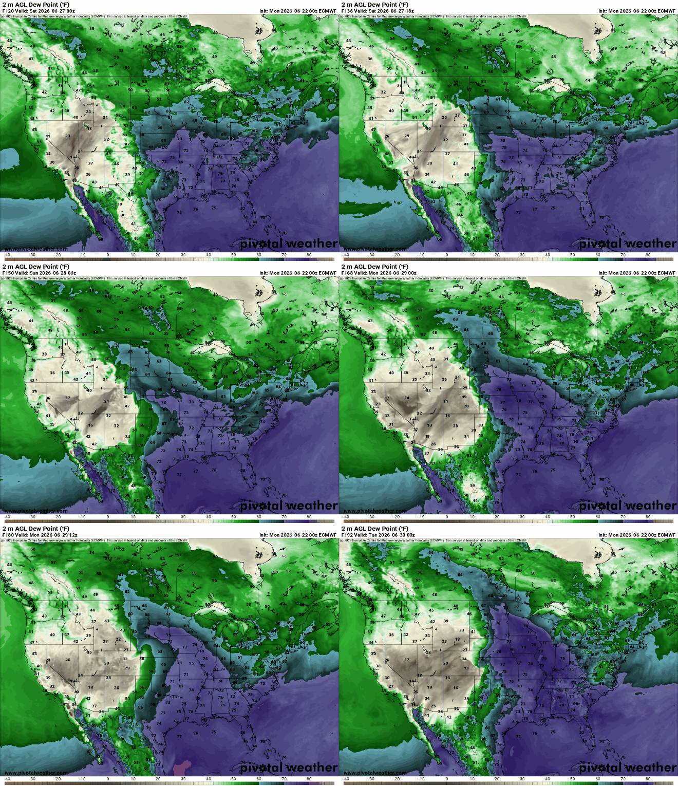
We’ll be flipping that pattern with upper level ridging developing in the central U.S. and upper lows in the west. This will push heat and moisture northward, ahead of it.

As a result, dew points will also increase this upcoming weekend into next week. That combination of increased temperature and moisture means we’ll also see the increased risk of of some thunderstorms.