
Unsettled couple of days ahead followed by a pattern shift
Heat and humidity return by the weekend, next week
Go Deeper.
Create an account or log in to save stories.
Like this?
Thanks for liking this story! We have added it to a list of your favorite stories.


Our latest disturbance is creating some showers and thunder Tuesday and Wednesday. We’ll remain cooler than normal until the weekend with heat, humidity building for next week.
Unsettled couple of days ahead, then a pattern shift
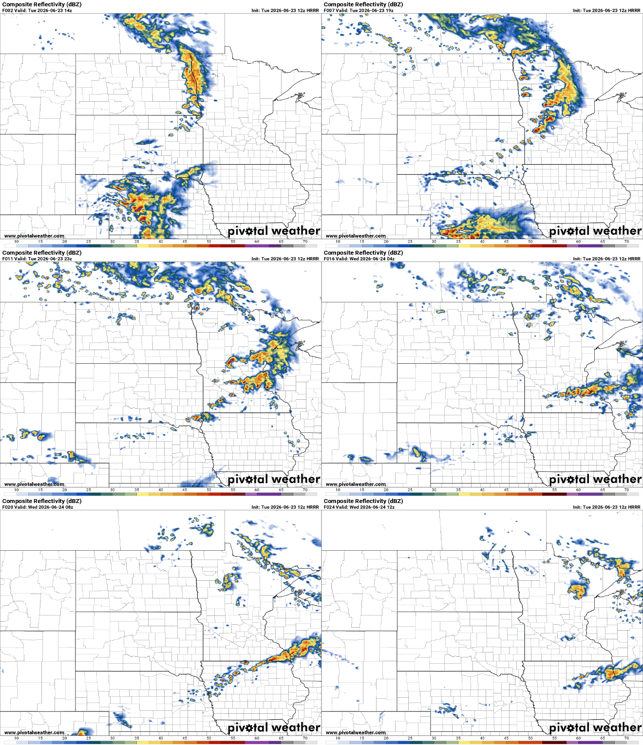
Our latest disturbance is bringing scattered showers and thunderstorms to the region Tuesday. We’ll see some morning activity west and central with redevelopment in the afternoon and evening hours across much of the state.
There’s a marginal (level 1 of 5) severe risk for storms Tuesday. A couple of isolated storms could produce some large hail or brief, damaging wind gusts.

High temperatures between showers and storms will range from the mid-70s south to the 60s northwest.
Turn Up Your Support
MPR News helps you turn down the noise and build shared understanding. Turn up your support for this public resource and keep trusted journalism accessible to all.

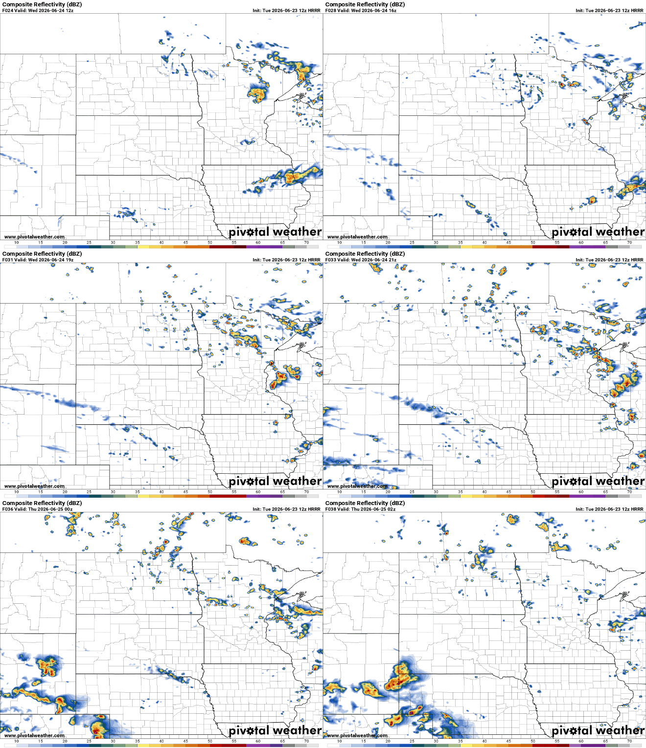
There will be some lingering instability Wednesday and even Thursday due to cool air aloft. That will help generate some pop-up isolated to spotty thunderstorms both afternoons.
After this week, things are returning to more typical midsummer conditions. Temperatures will be back in the 80s this weekend into next week for much of central and southern Minnesota and dew points will creep back up, too.
Next week will be downright steamy with highs near 90 degrees and humid.

The increase in both heat and humidity means an increase in thunderstorm activity, too. We’ll be able to time out storm chances better as the pattern sets up.

