
Seasonal warmth for Saturday before extended heat wave takes hold
Storm threat every day with severe possible

Go Deeper.
Create an account or log in to save stories.
Like this?
Thanks for liking this story! We have added it to a list of your favorite stories.


Summer is making a comeback. After two weeks of unusually cool weather, temperatures rebound to near normal today before a prolonged stretch of heat and humidity begins Sunday.
Return to summer-like temperatures, heat builds starting Sunday
After a two-week stretch of cooler-than-normal temperatures, summer is finally making a comeback. Saturday will feel much more typical for late June, with highs climbing into the upper 70s to low to mid-80s with sunshine to the south, and cloud cover to the north.

Isolated showers and thunderstorms are possible for mainly northwestern Minnesota through the early afternoon. The severe weather chances will remain off to the west in the Dakotas until the overnight hours.
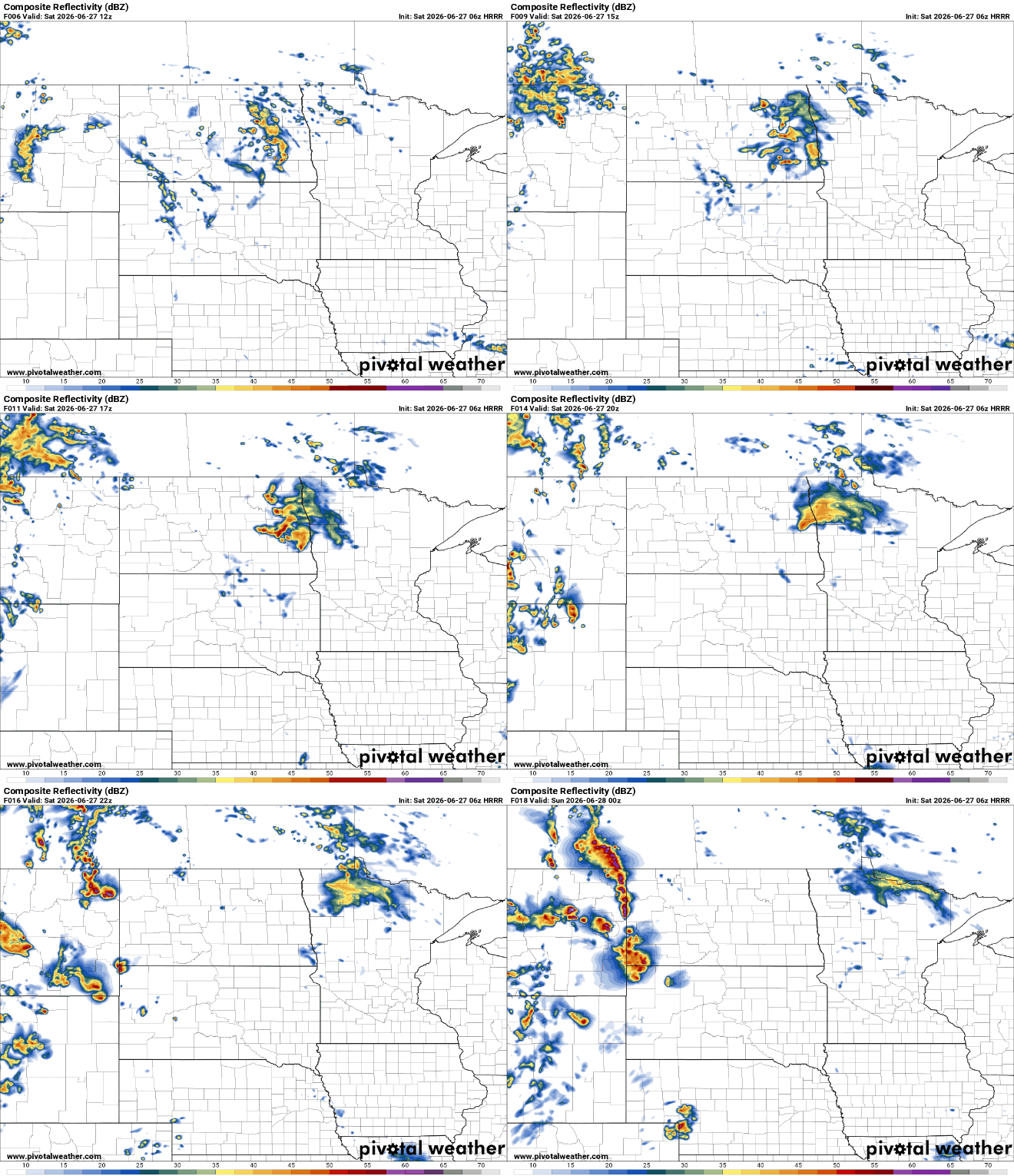
Attention then turns to Saturday night into early Sunday morning as a stronger complex of thunderstorms develops over the Dakotas and moves east. Northern Minnesota will be the primary area to watch overnight, where some storms could remain strong as they drift into the region.
Turn Up Your Support
MPR News helps you turn down the noise and build shared understanding. Turn up your support for this public resource and keep trusted journalism accessible to all.
The Storm Prediction Center has placed much of northwestern and north-central Minnesota under a slight risk for severe thunderstorms. If storms hold together as they move east, the primary threats would include damaging wind gusts, and large hail.

The warmer weather marks the beginning of a major pattern change that will bring a prolonged stretch of heat and humidity starting Sunday and continuing through at least next week.
Sunday will serve as our transition day.
By Sunday afternoon, temperatures will surge into the upper 80s along and south of the Interstate 94 corridor, while southern Minnesota could reach the lower 90s. Humidity will also increase dramatically, with dew points climbing to around 70 degrees.

The hottest day of the stretch appears to be Monday.
High temperatures are expected to reach the middle 90s across much of the region, with parts of western Minnesota approaching the upper 90s. Combined with tropical-level humidity, heat index values will climb well into the dangerous category.

Anyone spending extended time outdoors should be mindful of the risk of heat-related illness and take steps to stay cool and hydrated.

Unfortunately, this won't be a one-day event.
Hot and humid conditions are expected to persist throughout the workweek, with daytime highs hovering around 90 degrees and overnight lows only falling into the upper 60s and lower 70s. The biggest concern is the lack of overnight cooling, which will prevent much relief from the heat and allow heat stress to build with each passing day.
Thunderstorm chances will remain in the forecast every day through next week, although confidence in the exact timing remains low. A strong cap in the atmosphere will likely prevent storms from developing on many afternoons, but if storms are able to break through, the environment will support severe weather. Any thunderstorms that develop have the potential of damaging winds, large hail, heavy rainfall, and possible flooding.
Enjoy Saturday's comfortable summer weather because a prolonged stretch of dangerous heat, high humidity, and occasional strong thunderstorms is set to dominate the forecast through next week.

