
Dangerous heat peaks Monday; heat index could reach 110 degrees
Conditional threat for severe weather and heavy rainfall

Go Deeper.
Create an account or log in to save stories.
Like this?
Thanks for liking this story! We have added it to a list of your favorite stories.


Dangerous heat is expected to blanket much of the Upper Midwest Monday afternoon, with heat index values climbing as high as 110 degrees. Extreme heat warnings and heat advisories are in effect as one of the hottest days of the summer arrives.
Dangerous heat arrives Monday
Monday will be the hottest and most dangerous day of the week as dangerous heat and oppressive humidity settle into the region. Extreme heat warnings and heat advisories are in effect for much of the area, and anyone spending time outdoors should take precautions.

Monday morning dew points in the 70s point to a steamy afternoon ahead.

Afternoon temperatures will climb into the low and middle 90s under plenty of sunshine, but the bigger story will be the humidity.
Turn Up Your Support
MPR News helps you turn down the noise and build shared understanding. Turn up your support for this public resource and keep trusted journalism accessible to all.

Dew points in the middle to upper 70s will combine with the heat to produce heat index values between 100 and 110 degrees Monday afternoon and early evening. These conditions can quickly lead to heat exhaustion or heat stroke if proper precautions are not taken.
Adding to the concern will be the lack of cooling in our overnight temperatures, only further raising the heat stress on our bodies.
The atmosphere will also become extremely unstable during the afternoon as the intense heat and humidity build.
A strong cap in the atmosphere should prevent thunderstorms from developing through much of the day, but that cap begins to weaken later Monday evening as a cold front approaches from the west.
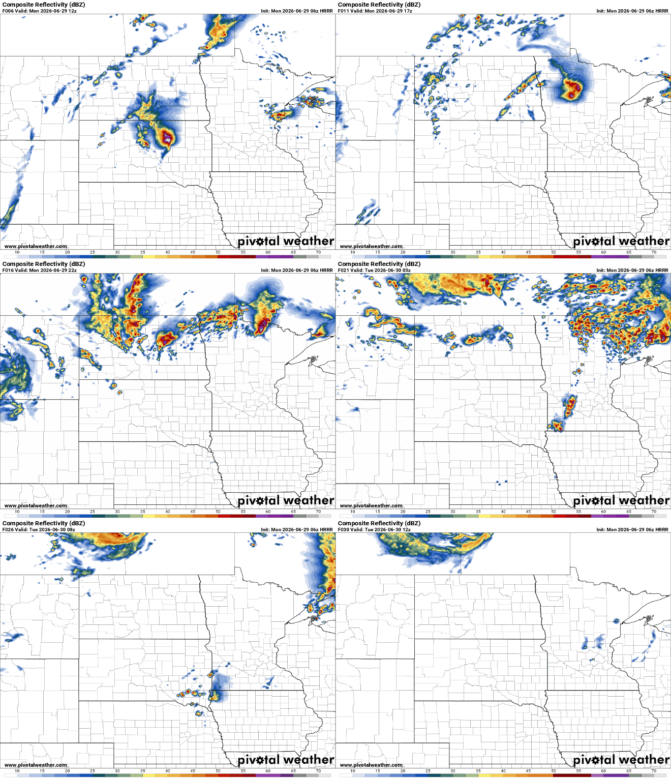
Thunderstorm chances remain relatively low, around 20 to 30 percent, but if storms are able to develop, they could quickly become severe. Damaging winds would be the primary threat, although torrential rainfall and frequent lightning are also possible.
According to the National Oceanic and Atmospheric Administration’s Storm Prediction Center, there is a slight severe weather risk from the for a majority of the state, and an enhanced risk for the Moorhead and Detroit Lakes area.

While Monday's heat will be the peak of this stretch, the hot and humid pattern is expected to continue through much of the week.
High temperatures will remain well above normal and afternoon heat index values will continue to reach the 90s with some locations approaching 100 degrees. Periodic chances for thunderstorms will also continue as weak disturbances move through the Upper Midwest.
The bottom line is simple: Today is a day to respect the heat. Limit time outdoors during the hottest part of the afternoon, stay hydrated, and have multiple ways to receive weather alerts if thunderstorms develop later Monday night.

