
Minnesota weather: Damaging winds and dangerous humidity
Go Deeper.
Create an account or log in to save stories.
Like this?
Thanks for liking this story! We have added it to a list of your favorite stories.


Record-breaking humidity, damaging straight-line winds, intense and dangerous heat, we’ve felt it all in Minnesota, and we’re only into Monday. There are also going to be more storms later Monday night.
The mesoscale convective vortex packed a wallop on Monday morning into the afternoon. Nearly 10,000 power customers were in the dark, feeling sweltering heat, once the wake low passed by on early Monday afternoon.
The water carnival tent was blown across the highway in Bemidji and many other folks had cleanup to do. There is another wave of severe weather potential — plus the attendant wake low — in northwestern Minnesota this afternoon.
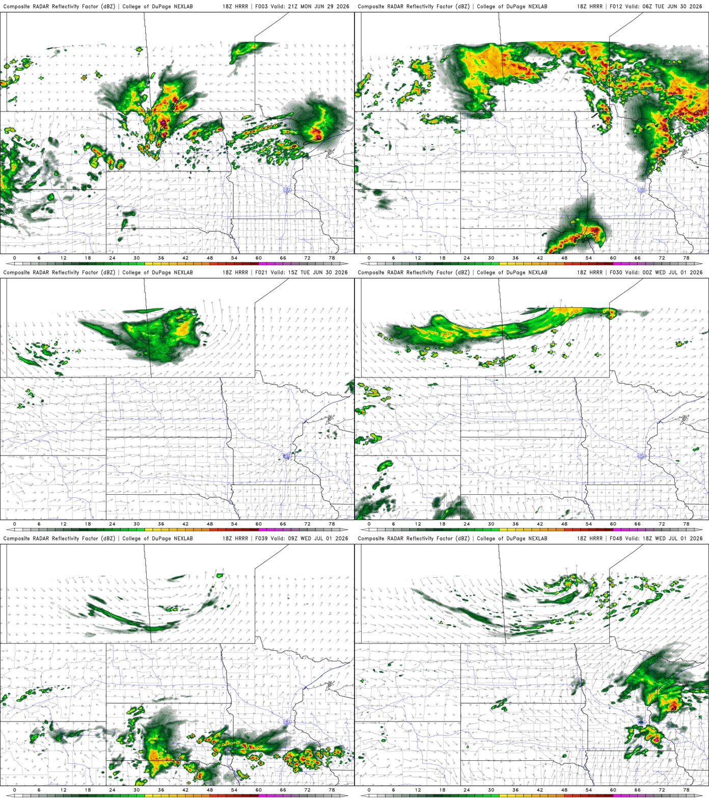
The primary late line comes out of the Dakotas starting at 8 p.m. This is really more for the northern two-thirds of Minnesota and could potentially pass just north of the Twin Cities.
Turn Up Your Support
MPR News helps you turn down the noise and build shared understanding. Turn up your support for this public resource and keep trusted journalism accessible to all.
The National Weather Service has restored its Sioux Falls radar back to service because high winds prevented maintenance from finishing. That will help MPR’s folks track the storms in Sioux Falls and southwest Minnesota.
The storms are in central Minnesota closer to 10 p.m. and in the Arrowhead closer to midnight. These are largely at our eastern state lines around 1a.m. If the cities get the high winds, it will likely be right around midnight.


Some parts of central Minnesota — where humidity and dew points remain among the highest parts of the state — could have brief fog overnight. Otherwise it will be exceedingly soupy.
When we have dew points this high, temperatures do not cool as fast nor as much. Tuesday will overall be a much more tranquil ‘active’ weather day. There will likely be a few smaller showers and a stray thunderstorm between about 6 a.m. and 8 a.m. right over the heart of the metro.
This is a really small complex of rain but the timing and populated area could slow down traffic. The rest of the day is just plain hot and humid, with better sunshine. If there was ever a day for the waterpark or town pool, Tuesday is that day.

We continue the extreme heat warning through Wednesday so, suffice it to say, it will continue to be very hot and humid. Storms bubble up in southwestern Minnesota around dawn Wednesday, this time reaching the Twin Cities, Mankato, St. Peter and Shakopee before noon.
These will bring some isolated risks for damaging winds and a ton of rain potential. This moves along the I-35 corridor and into Wisconsin by the early part of the afternoon (as of this writing). We probably wont hit 90 degrees in southeastern Minnesota but in the north of the state, Wednesday will be another scorcher of a day.
Thursday should be even more dry as the heat dome rebuilds and hangs north a few miles. We’re very close to 90 degrees across much of the state. There may be a brief storm between St. Cloud, Duluth and Minneapolis, but this only shows up on a few weather maps. The active on-and-off pattern for storms is back on Friday, rolling west to east through central parts of Minnesota.
Through the day Saturday, we are still close to 90 degrees for high temperatures all across the state. Sunday could top out in the middle 80s, if the rain pictured on many computer models actually forms. We’re still pretty far out and in a chaotic pattern, so that’s really no lock, in the forecast.
Next week does not look quite as hot but there are still going to be plenty of above-average days to talk about on Morning Edition and All Things Considered.

