
Storm chances, heat and humidity continue
Temps will cool slightly by Sunday

Go Deeper.
Create an account or log in to save stories.
Like this?
Thanks for liking this story! We have added it to a list of your favorite stories.


The heat and humidity continue but it won’t be quite as humid Tuesday. Temps will cool slightly by early next week and we’ll have some additional storm chances.
Continued hot with additional storm chances
It’s been a stormy 24 hours.
Numerous severe wind gusts were reported in northern and southern Minnesota. There were also a couple of funnel clouds and one confirmed tornado in Flom, in northwestern Minnesota. Jackson, along Interstate 90, had a 73 mph wind gust at 2:55 a.m. early Tuesday morning.

Clouds are quickly clearing this morning. More spotty storms will pop in southeastern Minnesota and Wisconsin Tuesday afternoon and evening near and ahead of a weak cool front.
Turn Up Your Support
MPR News helps you turn down the noise and build shared understanding. Turn up your support for this public resource and keep trusted journalism accessible to all.
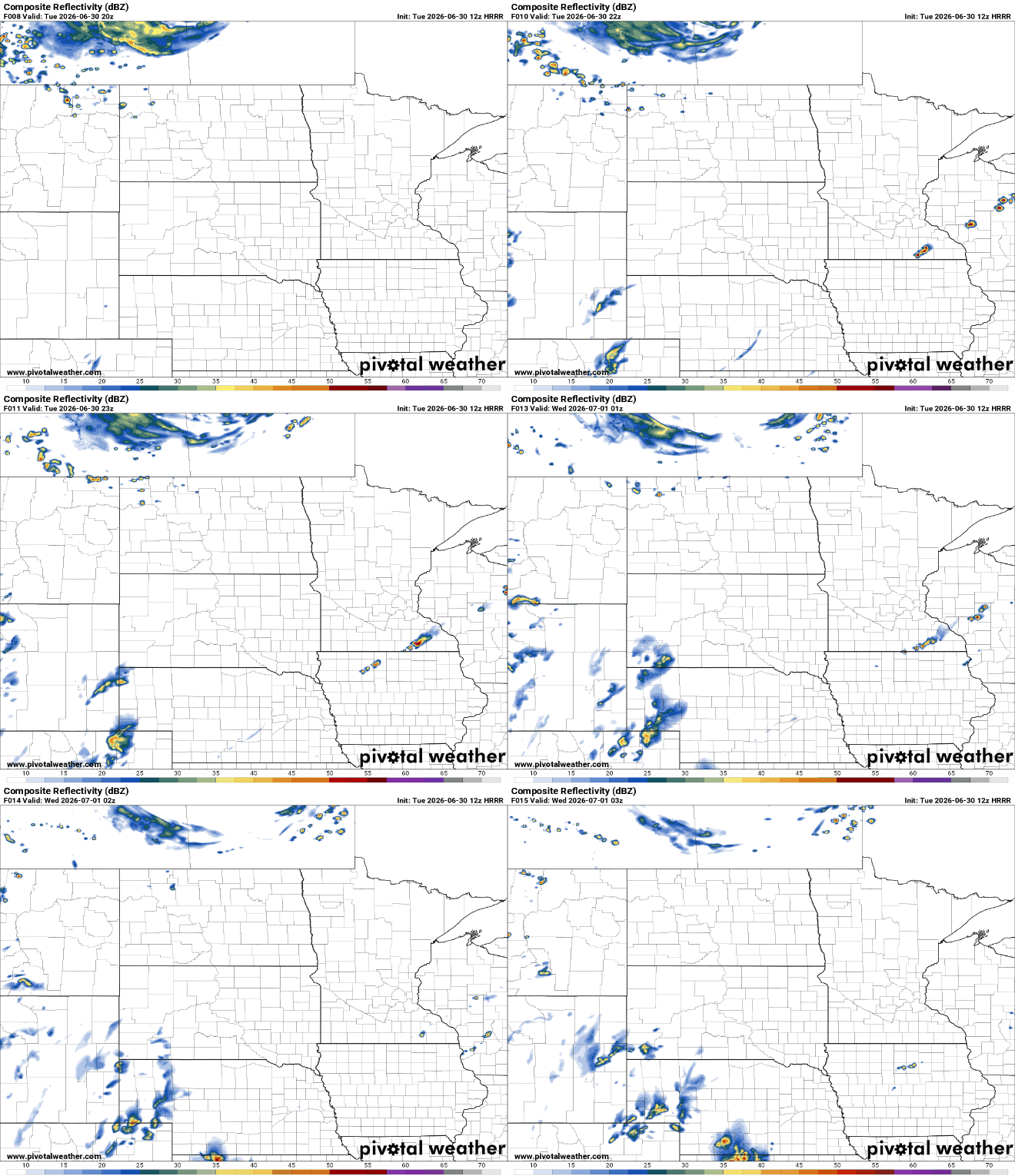
There’s a slight risk (level 2 of 5) for severe storms in northern Wisconsin with a marginal risk (level 1 of 5) for much of central and southern Minnesota Tuesday into Tuesday night.

There’s a heat advisory Tuesday for the Twin Cities and much of southeastern Minnesota with an extreme heat warning in far southeastern Minnesota.
Heat index values will exceed 100 degrees in far southeastern Minnesota and be in the 95 to 100-degree range in the Twin Cities.
Highs Tuesday will be back in the 90s for much of southern Minnesota, making for another hot day for most.

A weak cool front will wash out over the state, dropping the dew points so it won’t be as steamy as Monday. Southeastern Minnesota and Wisconsin will keep dew points in the low 70s while western Minnesota will see them drop into the much more comfortable 50s.
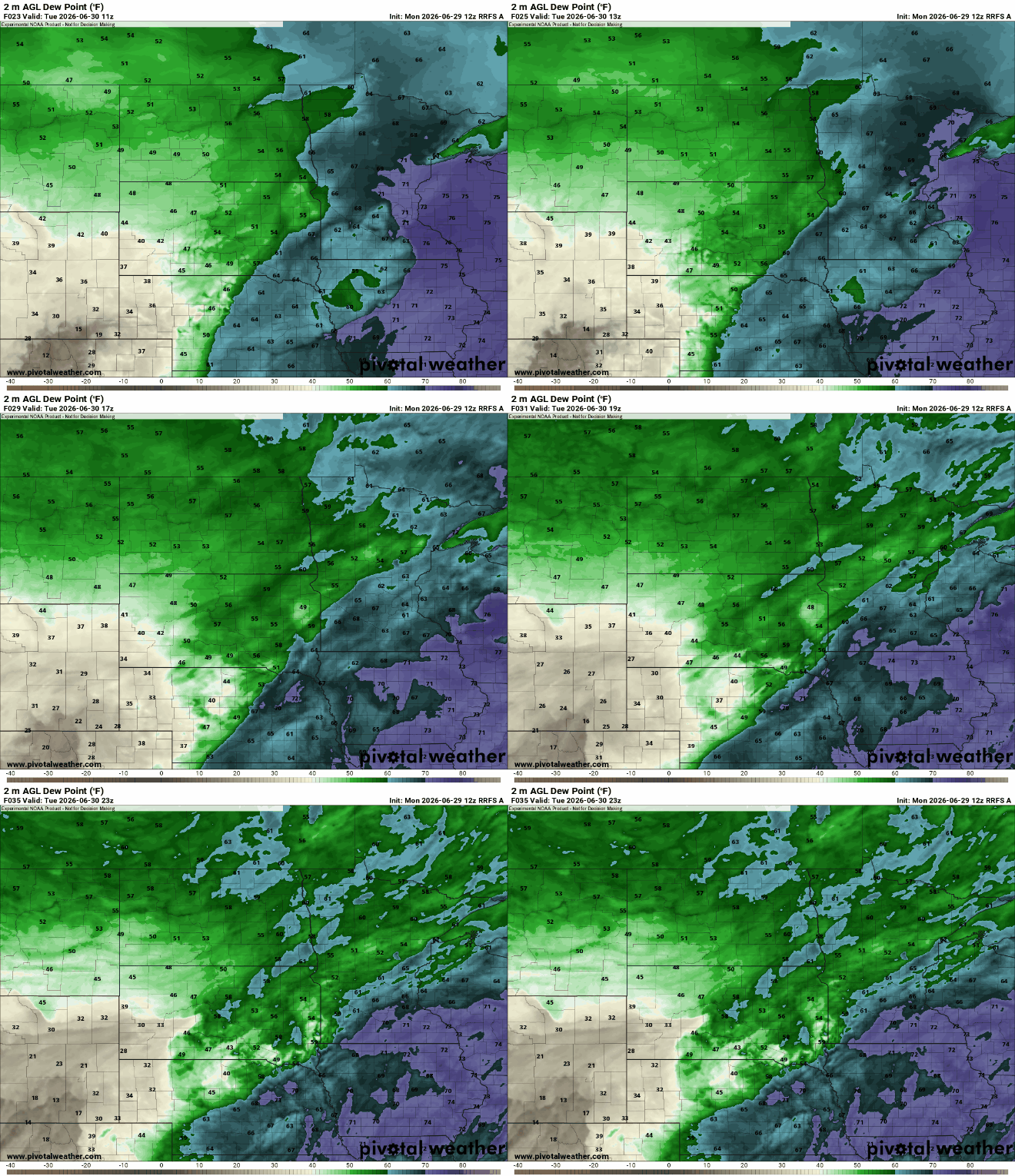
That will make for a heat index that won’t as impressive for most Tuesday afternoon but still well into the 90s.

Our next best chance of storms will be Wednesday and Thursday night. Expect some scattered storms Wednesday morning and again later in the day. More widespread scattered storms are possible Thursday night.
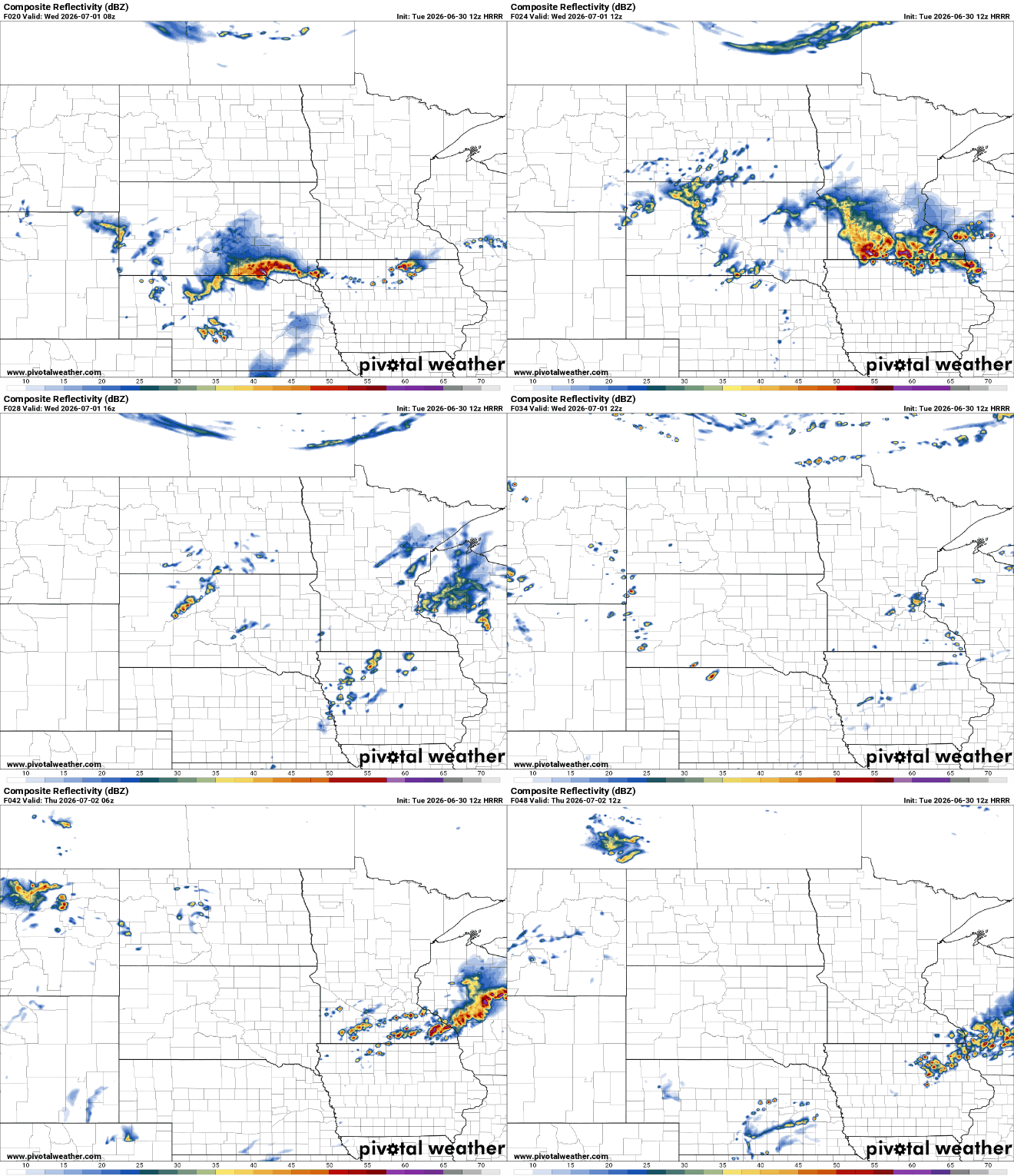
There will be additional severe weather chances as well. There’s a slight risk (level 2 of 5) for severe storms both Wednesday and Thursday across portions of southern Minnesota.

We’ll have at least isolated to spotty chances of thunder really each of the next several days. A cool front will move through Saturday night dropping temps and dew points slightly for Sunday.

