Minnesota weather: Storm risk upgraded on Wednesday

Go Deeper.
Create an account or log in to save stories.
Like this?
Thanks for liking this story! We have added it to a list of your favorite stories.


Every day the forecast features heat, with storms skipping a day, from Monday to Wednesday to Friday to Sunday. Next up, we get some thunder at the southern end of Minnesota.
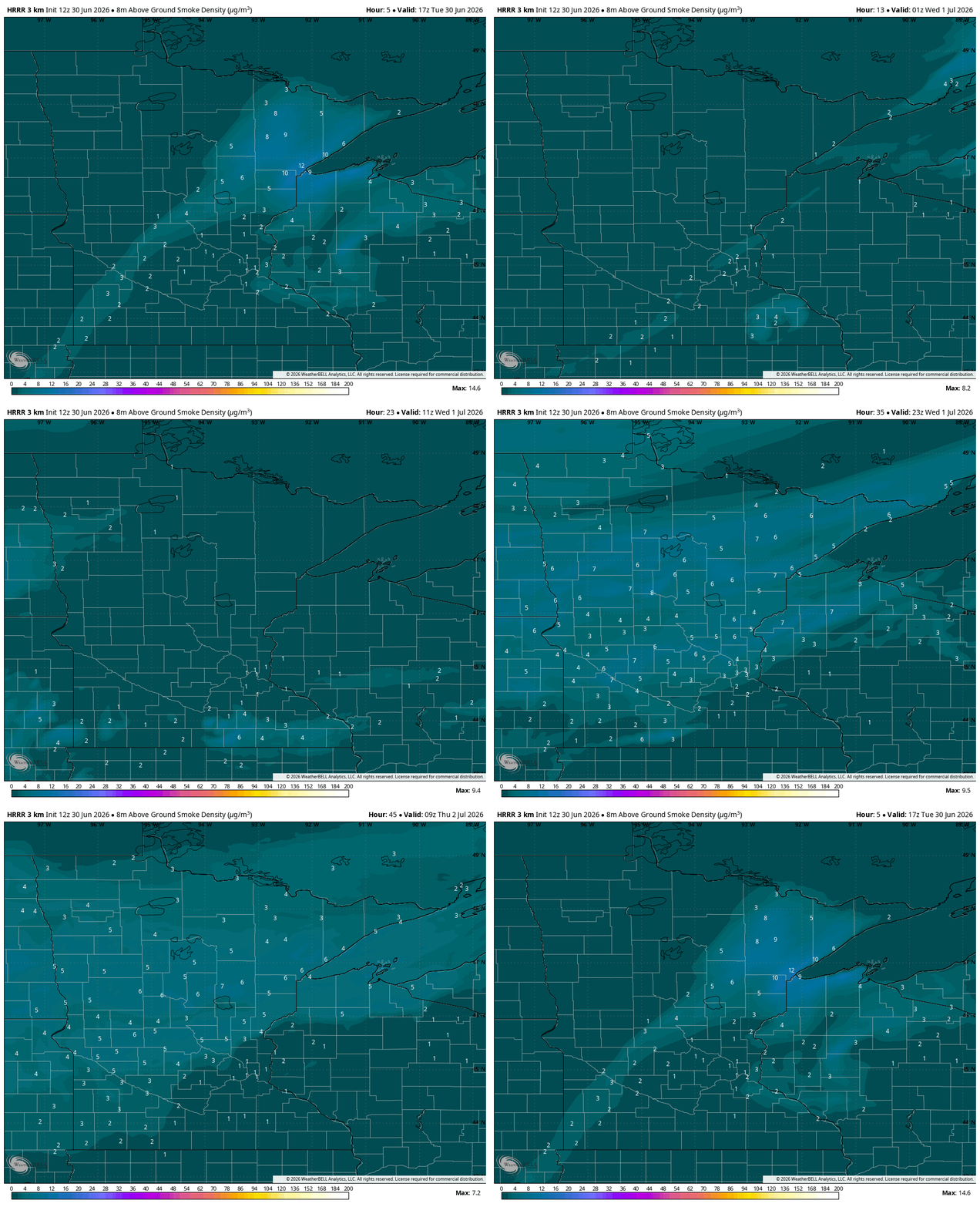
We could also pick up some more haze by Wednesday, combined from diffuse Saharan Desert dust and wildfire smoke from both Colorado and Alaska. Three parts of the world are converging on Minnesota this week.


Once again, we are pushing 90 degrees. The weather in the Twin Cities feels substantially less muggy, but dew points are still elevated from what we’d typically expect for the final day of June.
There should be a second wave of thunderstorms Tuesday in parts of southeastern Minnesota, including Rochester and La Crescent. Enjoy the sunshine if you can do it coolly; the UV and sunburn index are really high Tuesday.
Turn Up Your Support
MPR News helps you turn down the noise and build shared understanding. Turn up your support for this public resource and keep trusted journalism accessible to all.
Severe storm potential Wednesday
Let’s move to Wednesday, when rain returns. This begins midmorning in the southwestern corner of Minnesota.
This is a really compelling severe weather day, as much of far-southern Minnesota was upgraded toward the rougher storms risk a level three out of five (enhanced) for severe weather.
The most likely time is 9 a.m. to 11 a.m. for the Twin Cities, Rochester and Albert Lea, though there will be storms hanging around the Interstate 90 corridor much of the day.
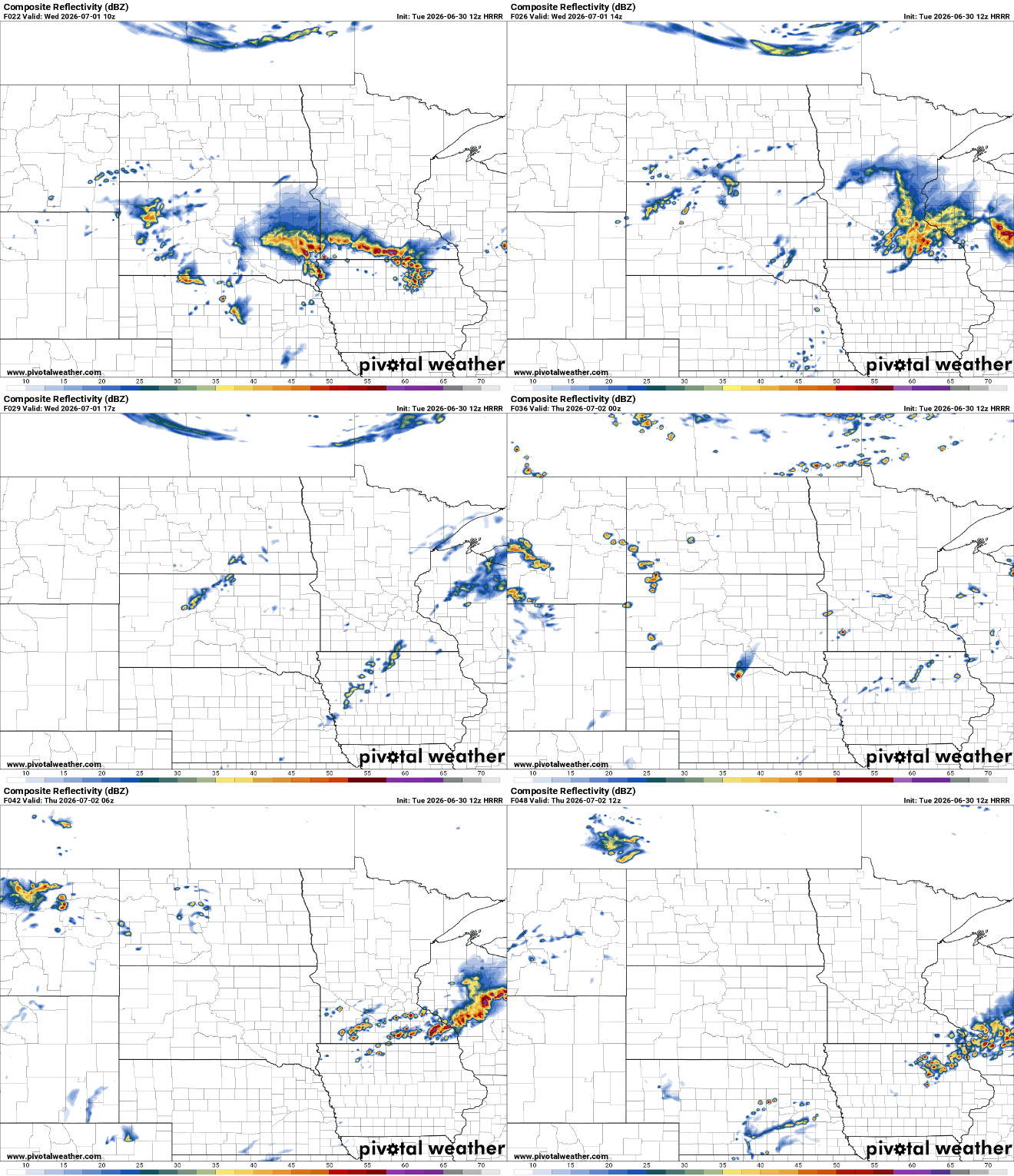
In the northern two-thirds of Minnesota, you might wonder, “What the heck is Ben talking about? It’s totally sunny.” Indeed, this stormy day will only impact a small portion of Minnesota. That said, some storms could be on the stronger-to-severe side, especially sitting at the Minnesota-Iowa border.
There may be some storms closer to dinner time — and in the same areas — and then a third round that comes for the cities closer to 10 p.m. Wednesday. Some places will get no rain at all while others could have up to three rounds of big storms!
Thursday is still toasty but otherwise pretty similar to the sunshine and heat of Thursday.
Below are reports to the National Weather Service of significant wind and hail damage from local storms on Monday into Monday night.
Northern Minnesota
Zim: Trees down on power lines, power out
Nisswa: trees down
Herbster: wind damage
Melrude: wind damage
Jacobson: huge pine branch thrown into ground like javelin
Jacobson: road blocked by trees down
Southern Minnesota
St James: Trained Spotter reported multiple 8-10 inch diameter trees blown down or snapped in half
Alexandria: trees down
Cambridge: 20-inch diameter tree branch fell on a mobile home.
Luxembourg: huge birch tree down
Kenyon: funnel cloud seen
Northwestern Minnesota
Flom: brief tornado touchdowns
Ulen: trees down
Moorhead: 3-inch hail