
Stormy Wednesday night; July Fourth looks rainy
Enhanced risk of severe storms across much of southern Minnesota

Go Deeper.
Create an account or log in to save stories.
Like this?
Thanks for liking this story! We have added it to a list of your favorite stories.


Expect several more quick-hit thunderstorms in the days ahead. None of these storm complexes will affect all parts of the state. Temperatures will stay above average.
At least a few thunderstorms are likely on the Fourth of July.
Stormy Wednesday night
Storm after storm after storm. The heat ridge is precariously balanced along the Minnesota-Iowa border with an upper-low feature just north of the Boundary Waters. That’s tamped down the heat a little after Monday’s record-setting heat index and brought rain despite the cap that looked to win the overall weather battle.
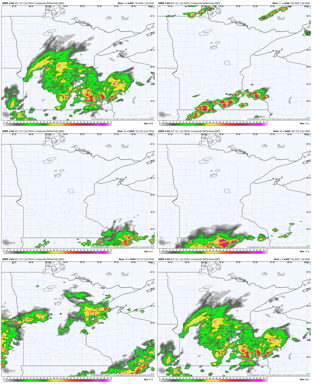
Wednesday night’s thunderstorm threat stretches across southern Minnesota — Worthington, Albert Lea, Rochester and into La Crosse, Wis. — and up to the Twin Cities. There’s an enhanced risk (level 3 out of 5) for severe storms in those areas, which means there’s potential for high winds, large hail and possible tornadoes.
Turn Up Your Support
MPR News helps you turn down the noise and build shared understanding. Turn up your support for this public resource and keep trusted journalism accessible to all.
Storms start to bubble up just north of the Minnesota-Iowa border around 5:30 p.m. By 7 p.m. they’re really getting going right over Interstate 90, which is likely to slow down traffic and the late evening commute.
Storms approach the Twin Cities between 8 p.m. and 9 p.m. From there, the storms migrate into Wisconsin to our east. Sunshine and warmth topping out in the middle 80s in many spots will add instability, helping the later storms to materialize.


Thursday night storms possible
Thursday was looking much quieter. We now expect some evening storms to flare back up after 5 p.m.
The first evening round Thursday should run from Marshall in southwestern Minnesota to the Twin Cities in a west to east line.
Another, more powerful line runs from Bemidji to Brainerd to the Duluth area a little closer to midnight. That could pack some damaging winds and smaller hail to go along with lightning and downpours.
This “ring of fire” weather pattern will sit over Minnesota through at least the end of this weekend. That means storms will continue to be off-and-on for Friday, but it’s not an all day deal anywhere.


July Fourth storms
The forecast is the most hectic on Saturday, the Fourth of July. The weather maps are going back and forth, trading rainy jab with dry hooks and lightning uppercuts.
As of right now, it seems safest to plan for rain. There are likely to be at least a few thunderstorms given the hot and humid pattern.
Sunday does seem to be a bit drier but we’re even closer to 90 degrees.
Could the “ring of fire” pattern finally buckle? Could we see some aid to the widespread drought? We’ll find out more on both angles on Thursday. Stay tuned.


