
More chances of storms but a dry break early next week
Overall the pattern remains warm and muggy into next week

Go Deeper.
Create an account or log in to save stories.
Like this?
Thanks for liking this story! We have added it to a list of your favorite stories.


Morning shower and thunderstorm activity will fizzle with decreasing clouds for midday. More storms will be possible tonight and Saturday but overall a dry break Sunday into Tuesday.
More chances of storms but a dry break early next week
Areas of showers and thunderstorms will move through and diminish this morning giving way to decreasing clouds and some midday and afternoon sunshine, making for a nice lull in thunderstorm activity. Some pop-up, spotty storms are possible again later in the afternoon and evening, especially in northern Minnesota.
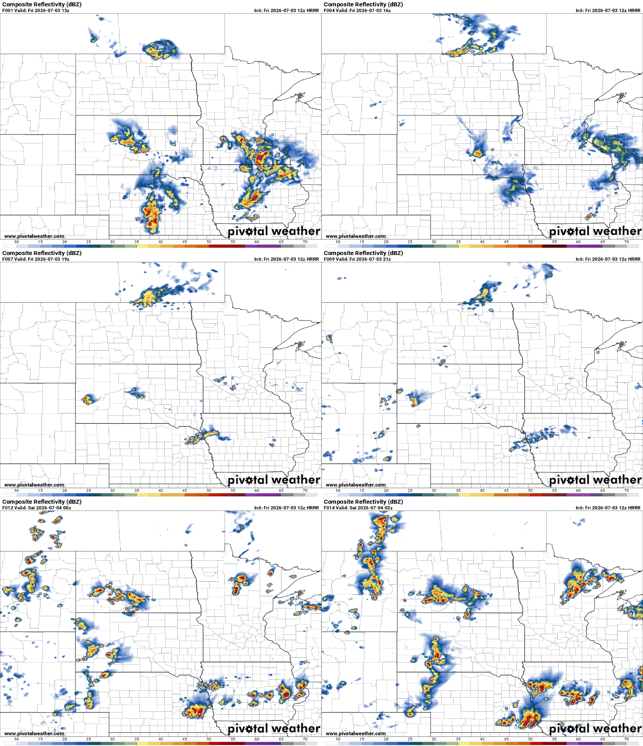
A flood watch continues for southeast Minnesota until 1 p.m. Friday due to extreme rainfall over the last couple of days and more rain on the way Friday.

Portions of southeast Minnesota saw 5 to 8 inches of rainfall over the past few days in total. In particular, Caledonia in Houston county saw a whopping 8.09 inches of rain since Tuesday.
Turn Up Your Support
MPR News helps you turn down the noise and build shared understanding. Turn up your support for this public resource and keep trusted journalism accessible to all.

Afternoon highs will be in the 80s for most of the state with muggy dew points mostly in the 60s and occasionally low 70s. It will be cooler near Lake Superior, mainly in the 70s.

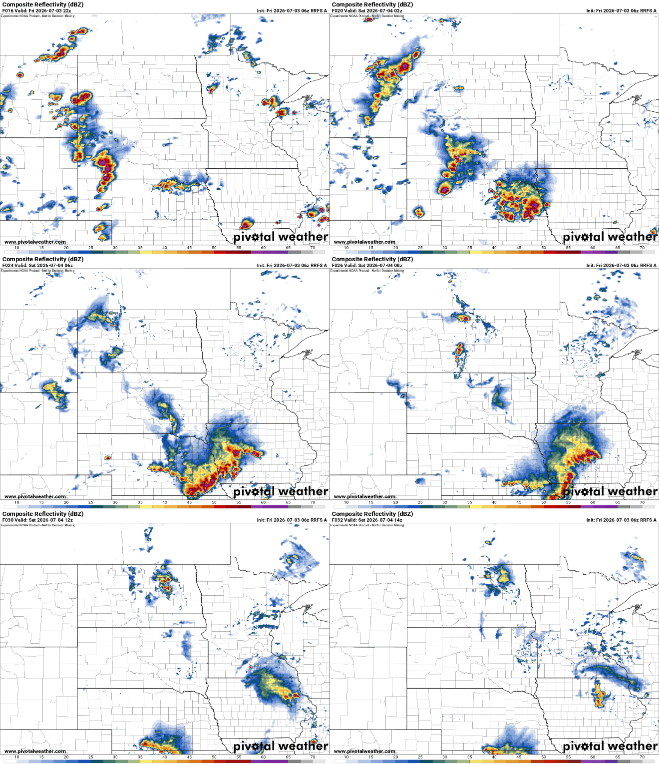
Morning activity will help keep the afternoon mainly quiet but more storms will be possible tonight. We’ll see potential clusters of storms develop west and track east overnight into the early morning hours Saturday. Some forecast models have this next round of storms Friday night occurring more south of Minnesota:
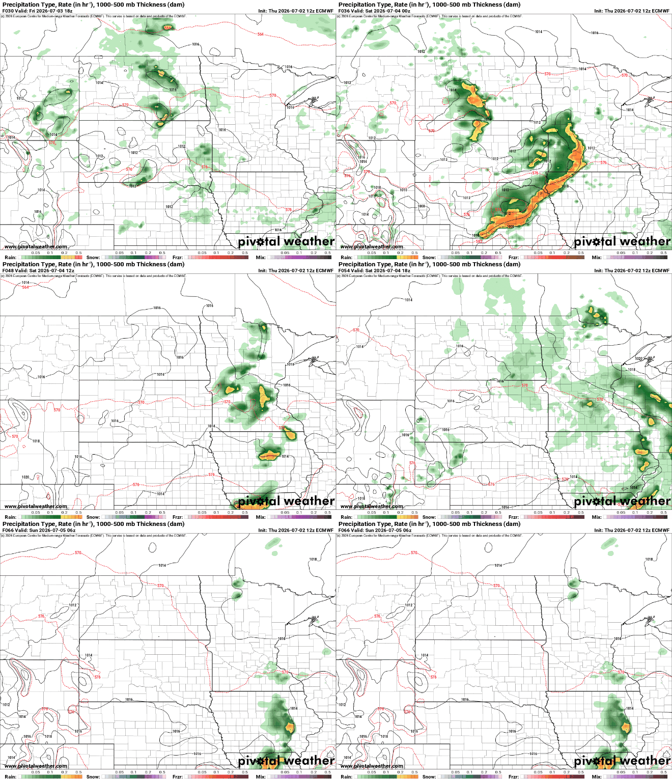
Forecast models differ widely however. This has been a very difficult and volatile pattern to forecast the last few days. The European model, for example, has a different scenario playing out with evening storms late Friday into Friday night occurring on a more northerly track which would bring them into southern Minnesota:
There’s a slight risk (level 2 of 5) for any storms that do develop Friday into Friday night. Damaging wind gusts and large hail could be possible.
Saturday will yield hit and miss showers and thunderstorms along with a mix of clouds and sun. If the northerly track prevails, we’ll see some showers early. If we miss those Friday night storms, we’ll see more sun which will then create spotty storms later in the afternoon and evening. Most of those storms should dissipate by fireworks time, however.
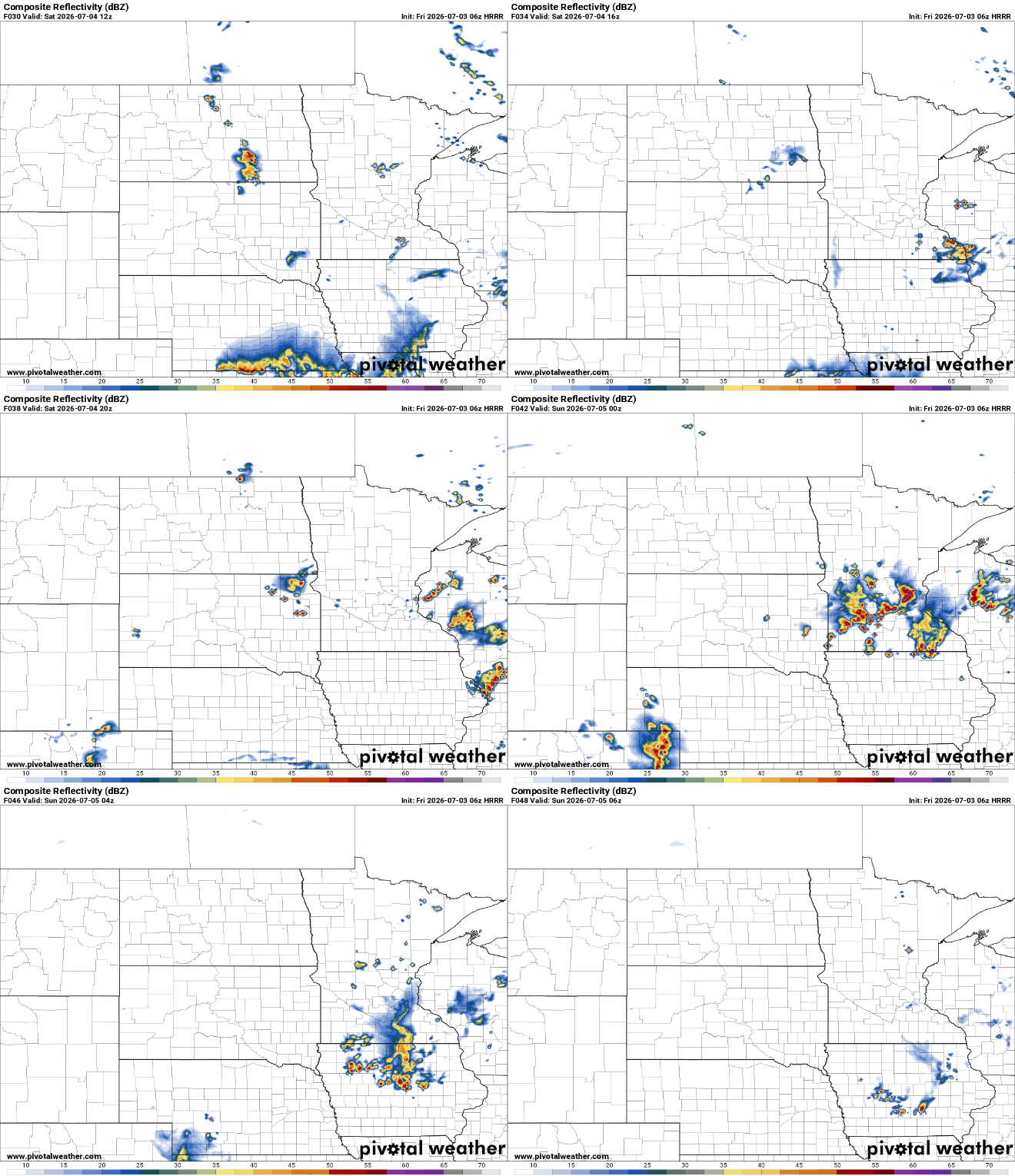
Highs Saturday will range from the low to mid 80s south to upper 70s north, pretty typical for the Fourth of July. While there will be at least few storms around for fireworks time Saturday evening, it will not be a widespread soaking.

The good news is that we’re in for a few days of mainly dry, quieter weather. Dew points will drop just enough to stabilize the atmosphere across much of Minnesota making Sunday through Tuesday mainly dry.
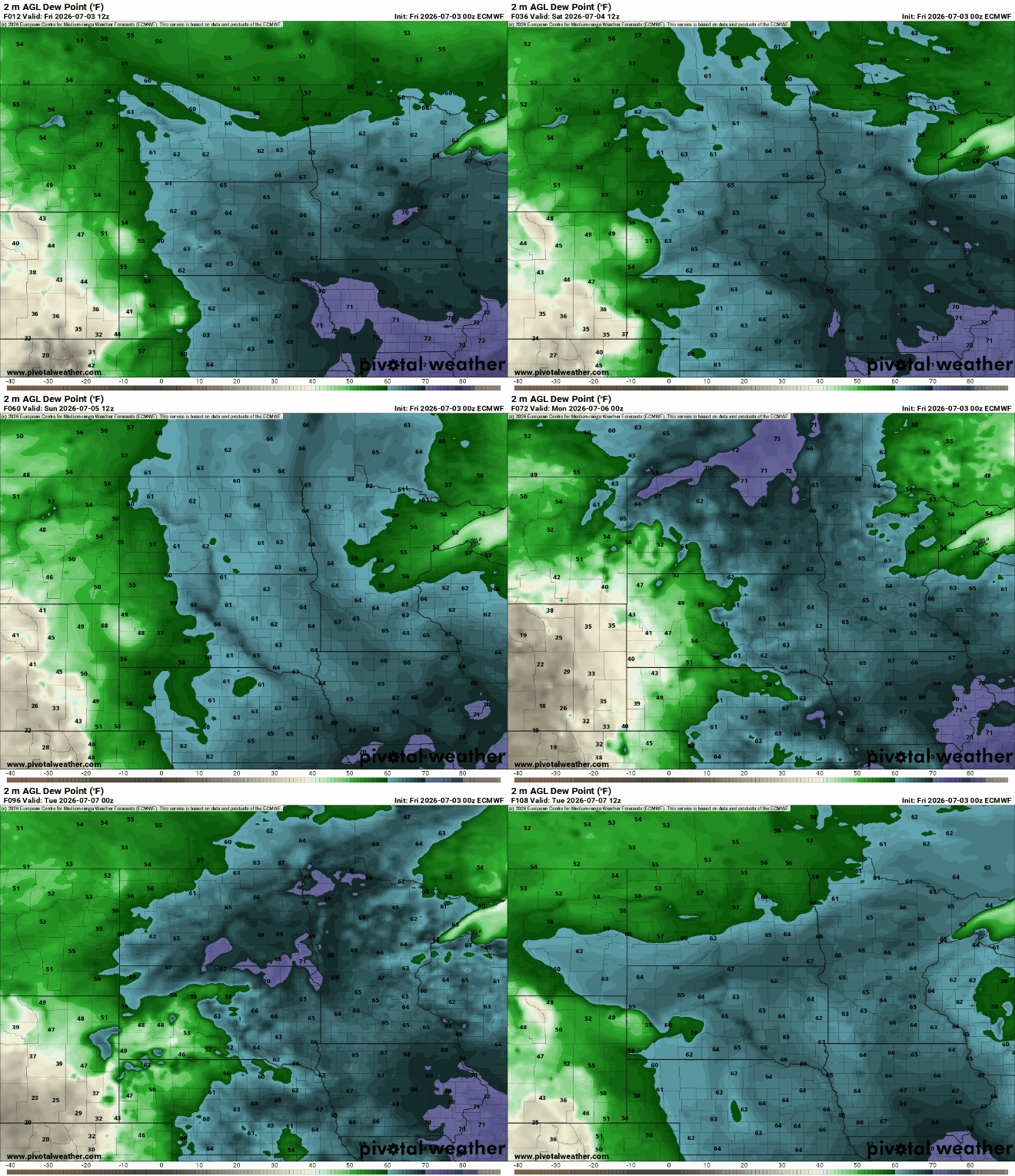
It will still be a little muggy however with dew points in the low to mid 60s, versus near 70-degree. It will also be slightly cooler with highs mainly in the mid 80s for early next week, near seasonable averages.

