
Week ahead starts off quiet with storm chances increasing by Tuesday
Strong storms possible with heavy rainfall

Go Deeper.
Create an account or log in to save stories.
Like this?
Thanks for liking this story! We have added it to a list of your favorite stories.


Our week is off to a quiet start, but storm chances will increase by Tuesday, bringing the potential for heavy rainfall and a few strong to severe thunderstorms. Temperatures will remain close to seasonal averages through much of the week before a possible warm-up arrives next weekend.
More rain chances return after a dry start to the week
After a wet and stormy Fourth of July weekend, Sunday gave us a preview of what's in store to begin the new week. Mostly sunny skies and light winds will help temperatures climb into the middle and upper 80s on Monday, just a few degrees above average for early July.

By late Monday afternoon and evening, thunderstorms are expected to develop across the Dakotas along an approaching cold front.
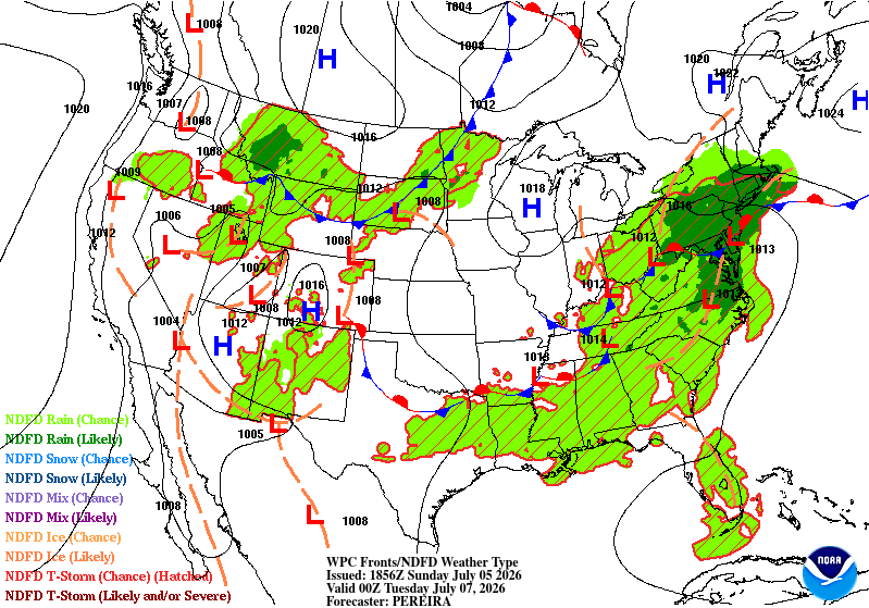
While these storms will attempt to move into Minnesota overnight, they are expected to weaken as they move further southeast, mainly affecting northern and portions of central Minnesota.
Turn Up Your Support
MPR News helps you turn down the noise and build shared understanding. Turn up your support for this public resource and keep trusted journalism accessible to all.
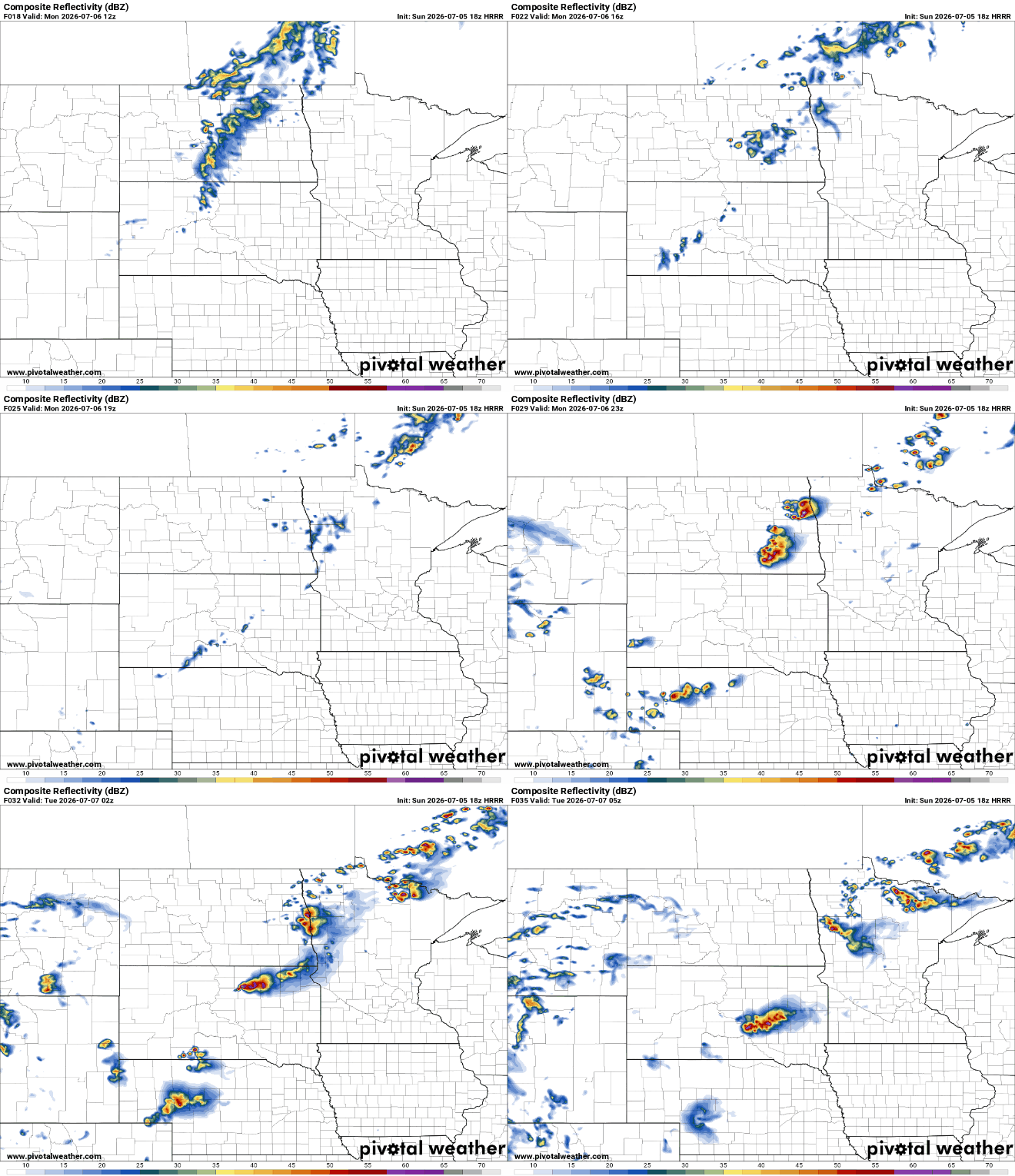
Our attention will be focused on Tuesday, with the potential for heavy rainfall, some models are showing accumulation ranging from 1 to 2 plus inches.

In addition to the heavy rain threat, there is also a slight risk for a stronger complex of thunderstorms capable of producing damaging winds and large hail.

As we get closer to Tuesday, forecast confidence will continue to improve, giving us a much clearer picture of the timing, location, and overall severity of any storms that develop.
Once our midweek storm system exits, the forecast settles down considerably. Thursday through Saturday look dry with seasonable temperatures and lower humidity, providing a welcome break from the active weather. High temperatures should remain near normal for early July, with only small chances for isolated showers.

